Short ride today with ~1300ft net feet of climb. Got a chance to walk through historic center of Santa Fe.
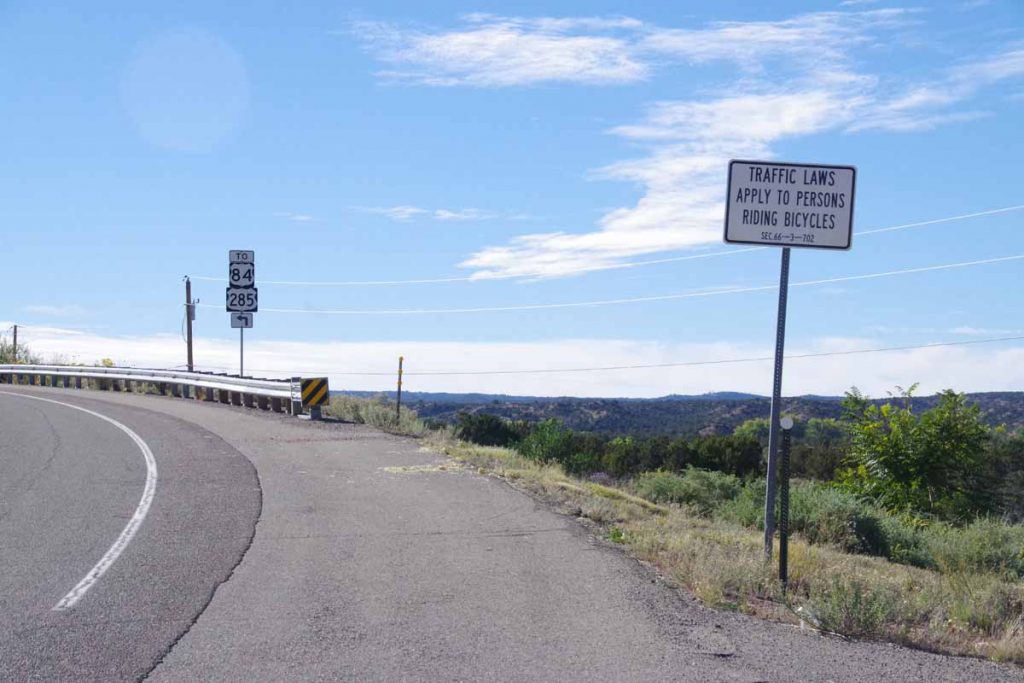
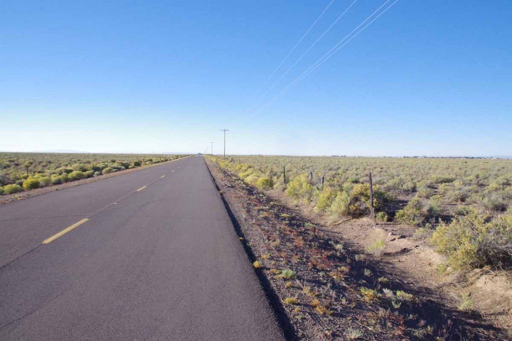
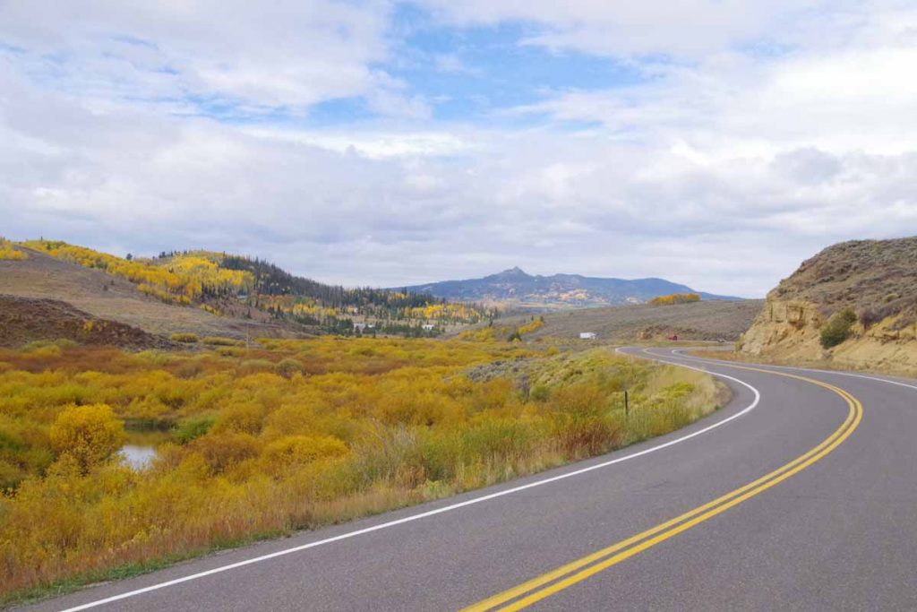
Last night I carefully wrote out directions coming from Google Maps. The first 18 miles I was parallel to US285 but was only on the highway for two miles. Photo above was looking back on the highway.
A good portion of the road was through Pajoaque Indian reservation. There were several casinos and also at least ten signs like the one above. First one I saw, I thought “good, nice to have a reminder”. However, when I kept seeing them, I then wondered what else might be going on here, e.g. local riders making rides through the reservation? I did pass a bored police officer at one intersection and made double sure to come to absolute complete stop at the stop sign.
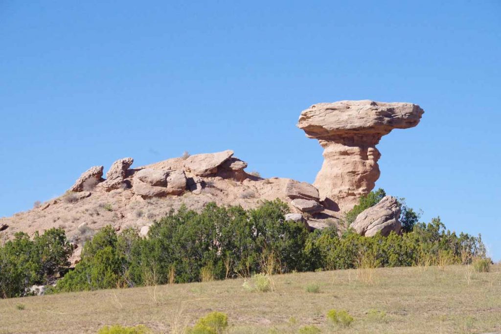
I passed Camel Rock.
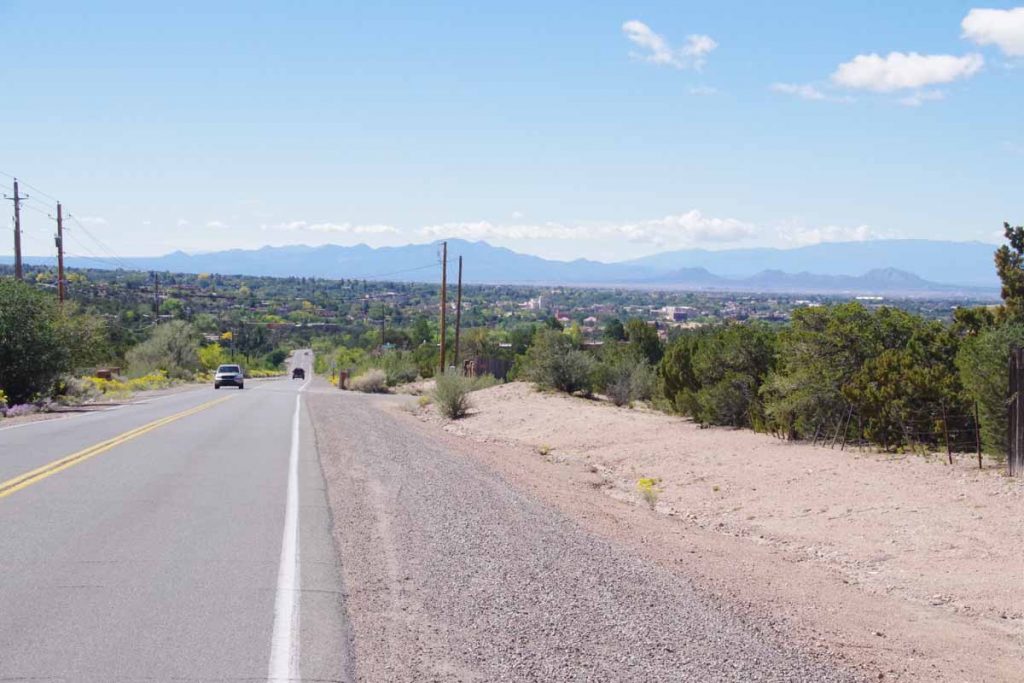
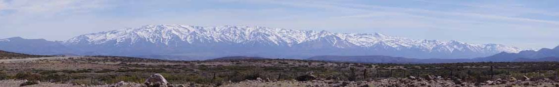
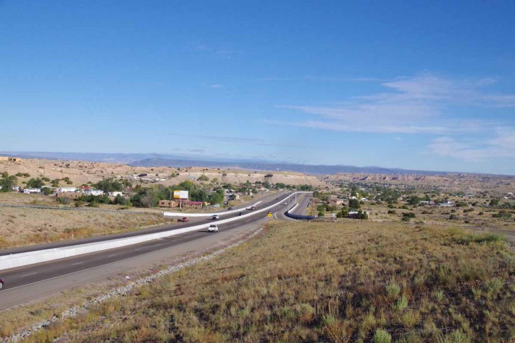
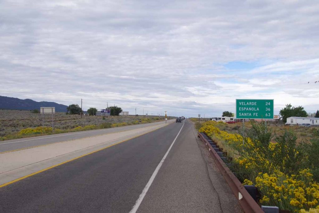
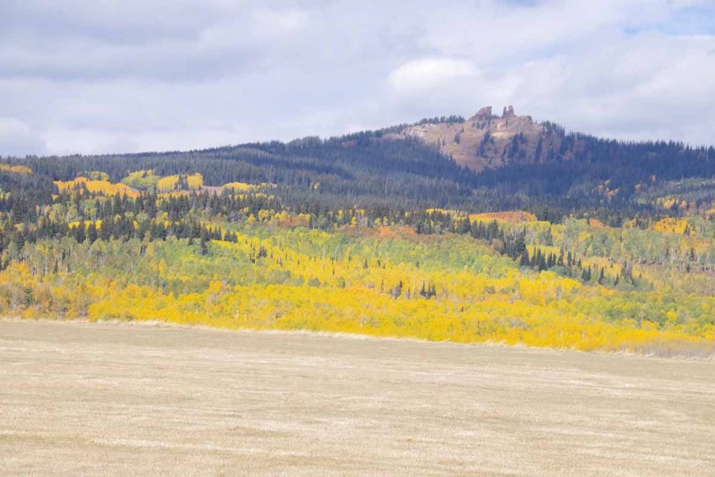
At 18 miles the road left US 285 and I followed NM 591. It went through some upscale neighborhoods. I also stopped briefly at a cafe for a snack. After that continued to climb up to top of divide. Photo above was shortly after the top, when I could see down into the city.
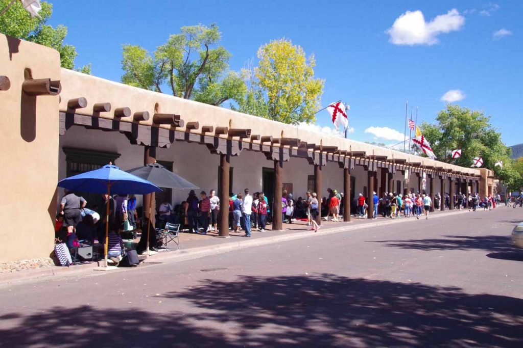
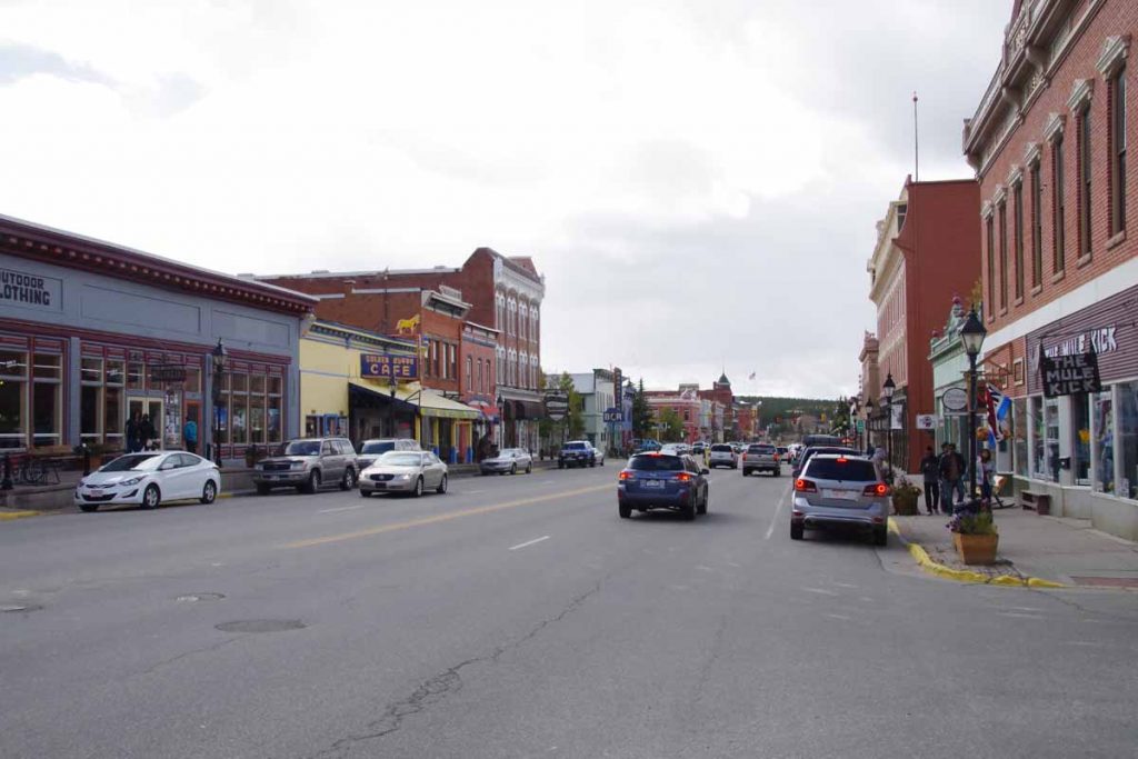
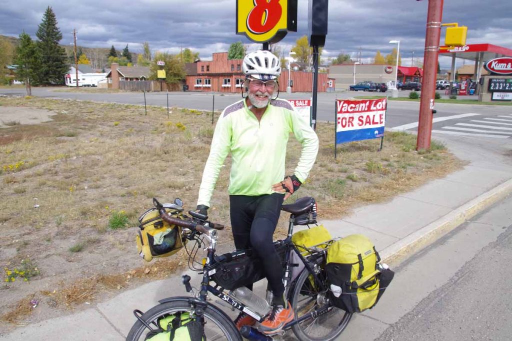
After finding place to stay, I walked down to the historic plaza shown above. Lots of artsy shops, restaurants as well as tourists visiting.
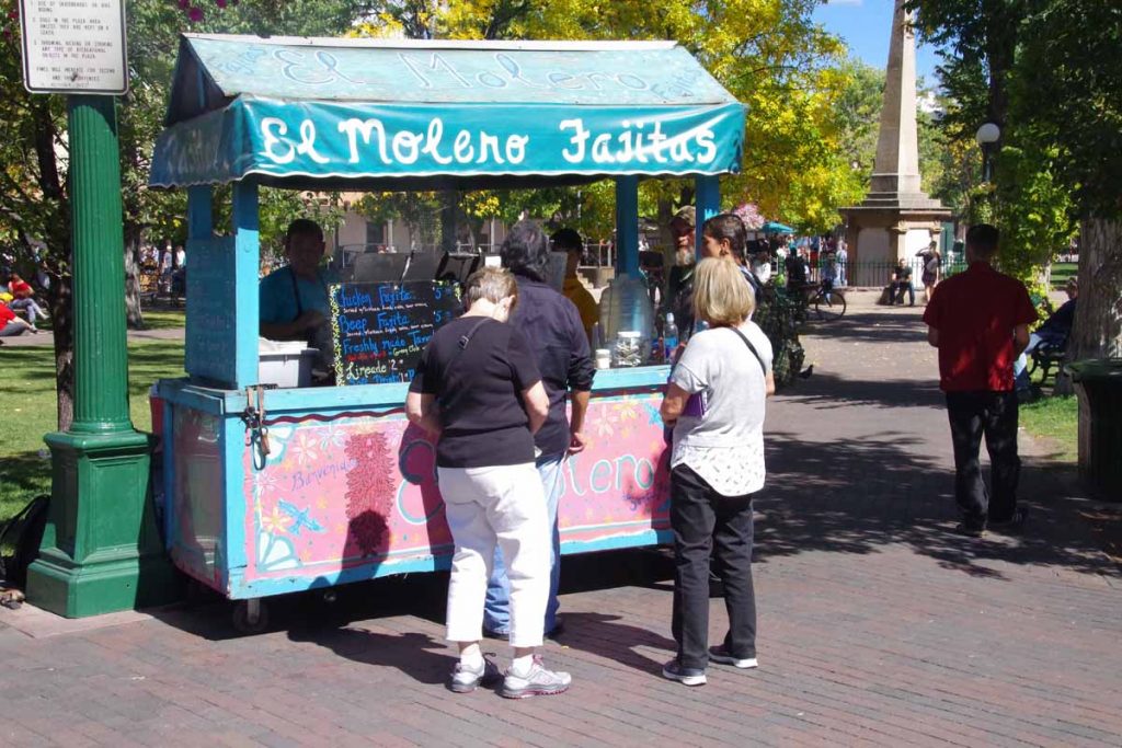
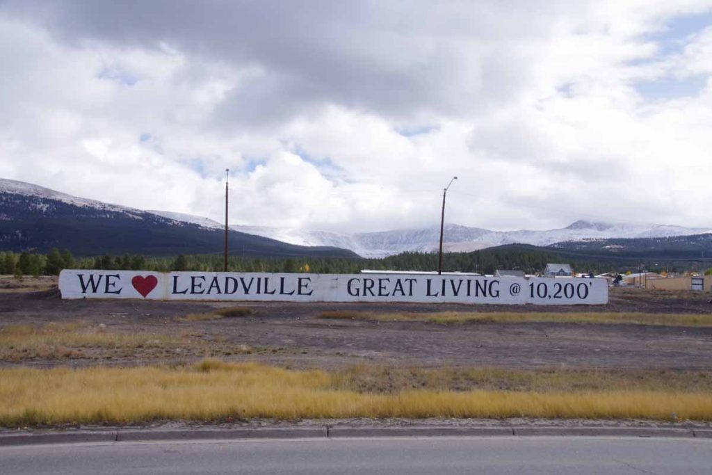
Above is the palace of governors with many vendors. Overall, a not too difficult ride into a touristy city. My count is this makes 27 US state capitals that I’ve ridden a bicycle. I’ve cycled in all 50 states, but not the capital city in the other 23.
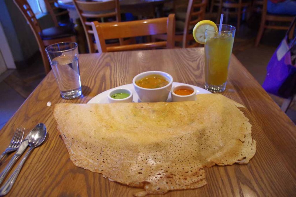
For dinner, I found the “Paper Dosa” restaurant and had a masala dosa (above). Tasty and thanks Mohan for the suggestion. May seem strange to have south Indian in Santa Fe, though I’ve been eating Mexican food most other nights, mostly at hole-in-the-wall restaurants in towns I’ve come through.
Monthly Archives: September 2016
Española
Easier ride today with three different parts. Surprised with how much traffic there was on the road.
Started out from Taos with a decent shoulder riding along the edge of a wide valley.
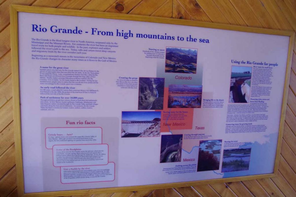
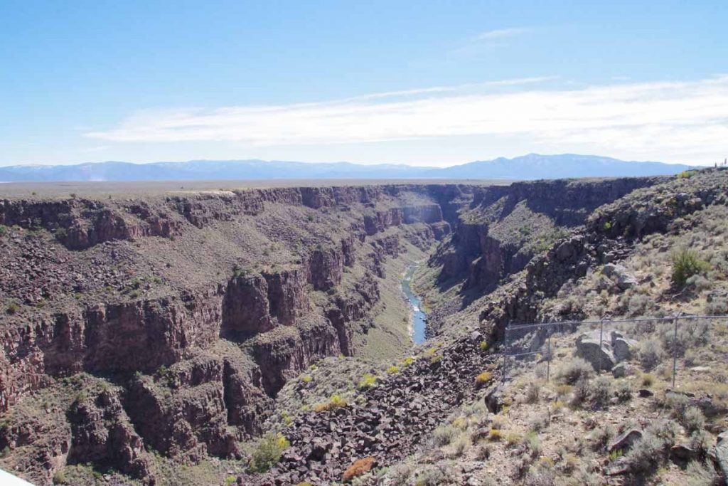
Once I left congestion of the town, I could see across wide open spaces. At 11 miles, the road went over a low rise and then descended ~750ft in the next two miles. At bottom was the Rio Grande Gorge Visitor center. They had a nice overview topographic that showed my last two days riding. The Rio Grande River goes through a gorge of ~82 miles long. It is now part of Rio Grande del Norte National Monument established in 2013. I had seen some of the signs, but the visitor center helped put it all together.
The next third of the ride went through a part of the gorge.
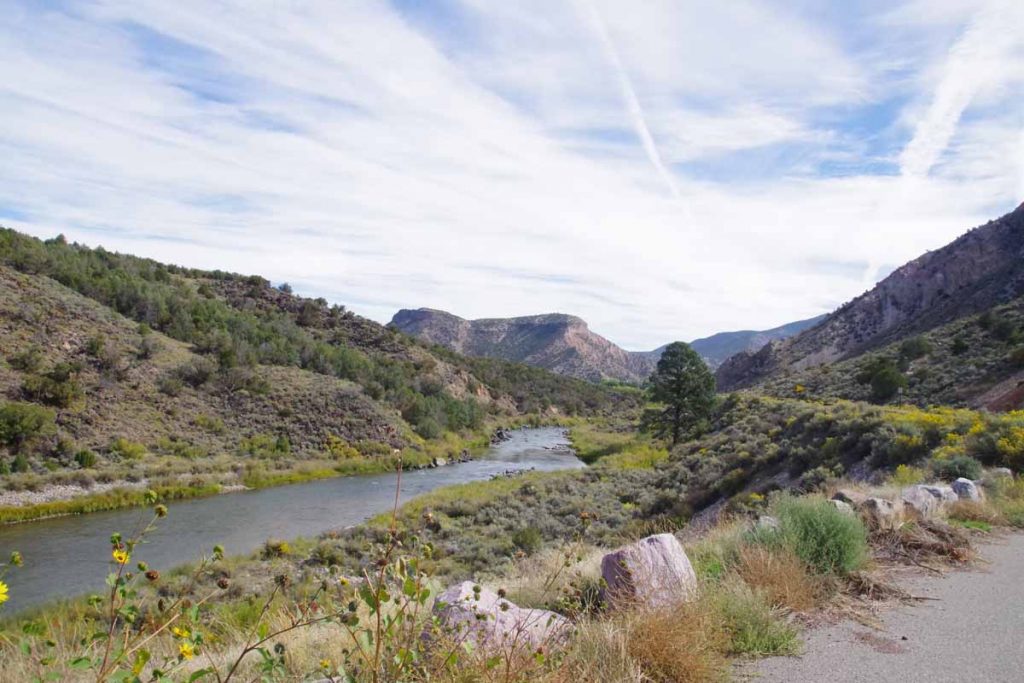
It was pretty though the road was narrow and the shoulder was rough. That would have been OK, except I was surprised at how much traffic seemed to be on this road. At Velarde the valley opened up and suddenly the road became two lanes each direction.
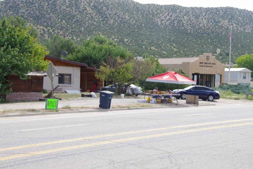
Here were folks selling apples along the way.
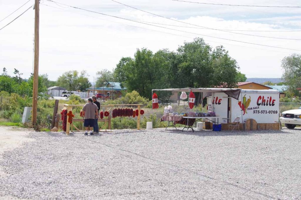
Short while later also possible to buy chiles.
I rode down to intersection with US 285 before finishing for the day. This will let me take a shorter ride tomorrow into Santa Fe, as well as do some additional looking on the best route to take into and through this city.
Taos, Land of Enchantment
Crossed into New Mexico today.
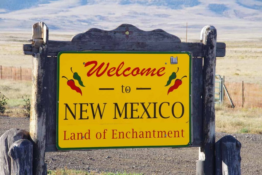
After five miles, came to the border with requisite CO and NM signs.
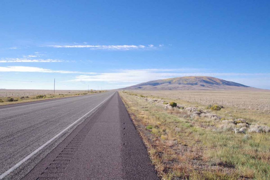
In the background was San Antonio Mountain. The route gradually climbed over to left of the mountain and then along. Several signs for “Elk Crossing” and “Winter Wildlife viewing area”, but otherwise not much. Shortly pass San Antonio Mountain was a weigh station and then the shoulder went away. Fortunately, light traffic most rest of the day.
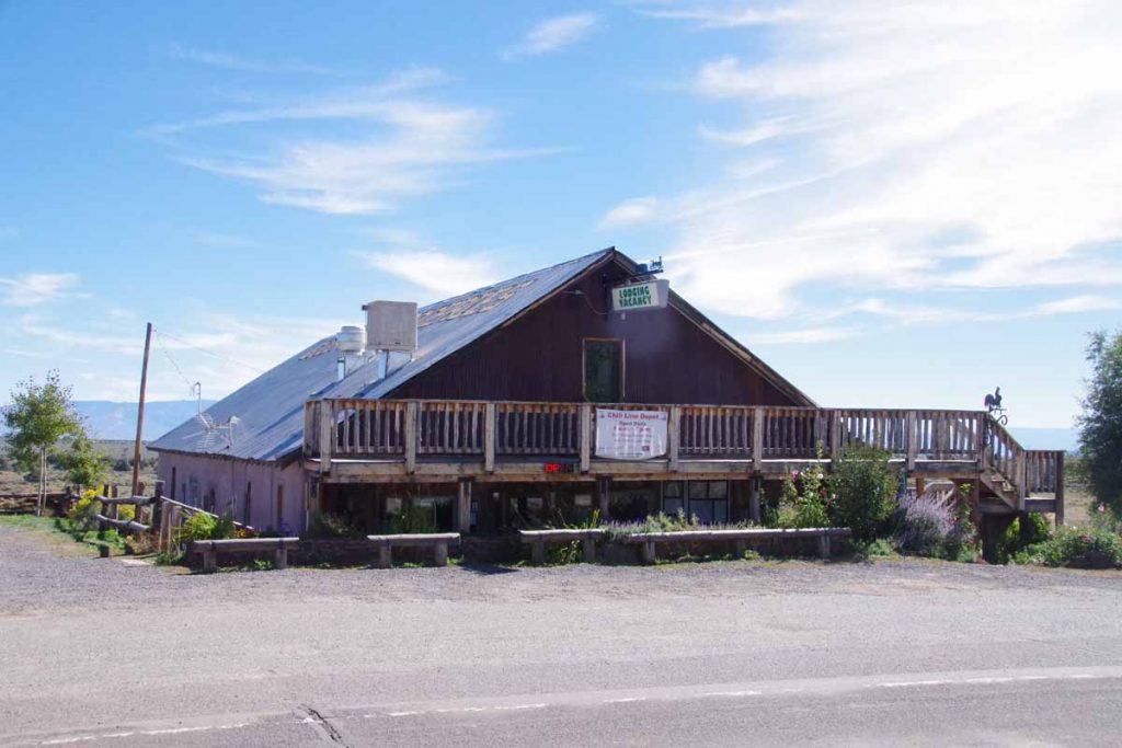
At 30 miles was Chile Line Depot and chance to get a late breakfast.
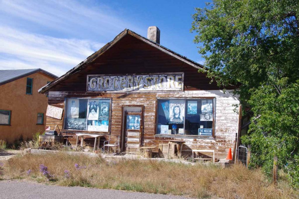
The place across the street claimed to be a store, but I’m skeptical. After Tres Piedras, two route choices either continue on US285 or go east via Taos. Trip reports I’d read seemed to suggest more traffic and intermittent shoulders on 285 and more lodging choices in Taos, so headed east.
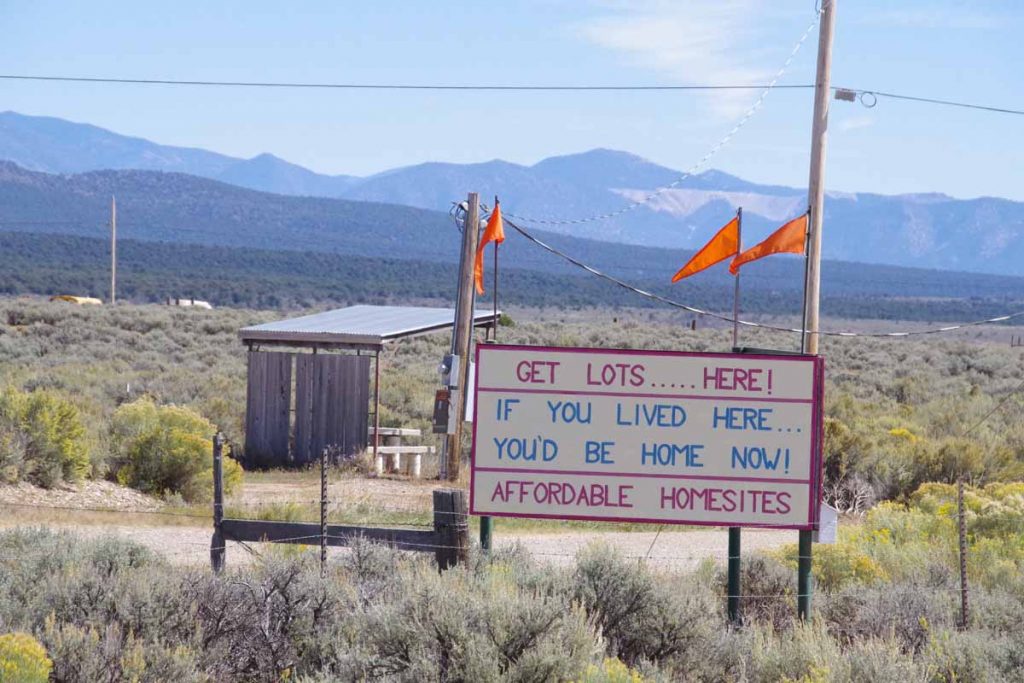
“If you lived here, you’d be home now!”
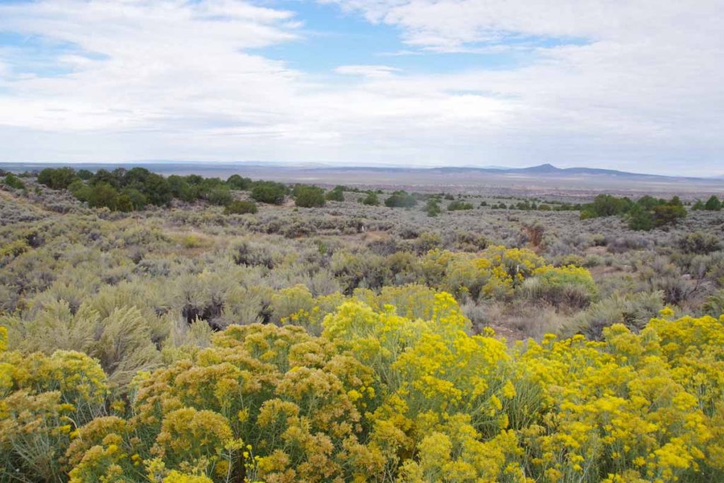
A few home sites but also many wide open spaces. A lot of this land seems to be either BLM or Forest Service managed.
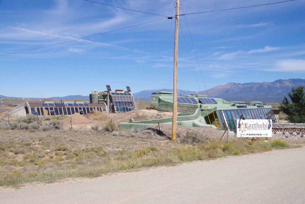
At some point I started seeing a number of funky looking homes. The company was earthship.com and they had a display home. However, when I saw the $7 admission fee, I wasn’t quite curious enough.
Shortly after the road crossed the Rio Grande river. The river itself was contained in this small gorge.
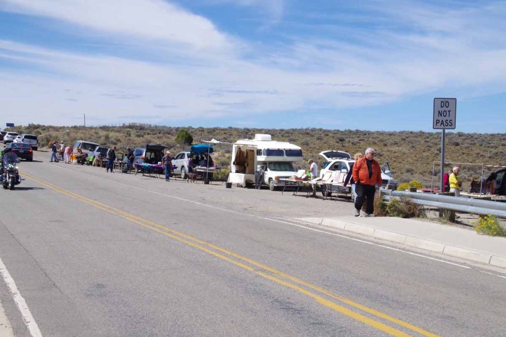
There were vendors selling art type stuff.
After this, a bit of a grind to cycle into the wind and very slowly uphill. I crossed over Taos and found a place to stay on the other side. I saw some of the turnoffs to the Taos Pueblo, but didn’t follow them this time. Overall, get sense of a touristy and slightly artsy community. Nice to get a few miles in New Mexico.
Antonito
Two days mostly in the San Luis Valley brought me to Antonito, just five miles north of the New Mexico Border.
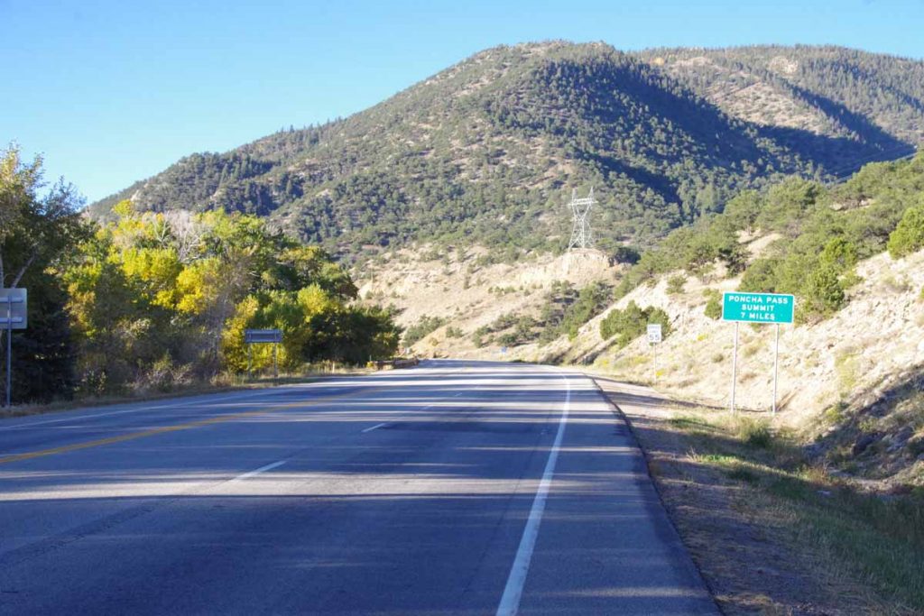
First order of business was to climb over Poncha Pass, approximately 2000ft spread over 11 miles. Some gentle climbing to Poncha Springs where I took the photo above. It looks like the “bike shuttle” likely takes tourists to either Poncha Pass (9010 ft) or Monarch Pass (11318 ft) where they can then glide back down. I went up the more conventional way which had one or two short stretches of 6% and the rest was 5% or less.
It was cool climbing though quite a bit warmer than Fremont Pass.
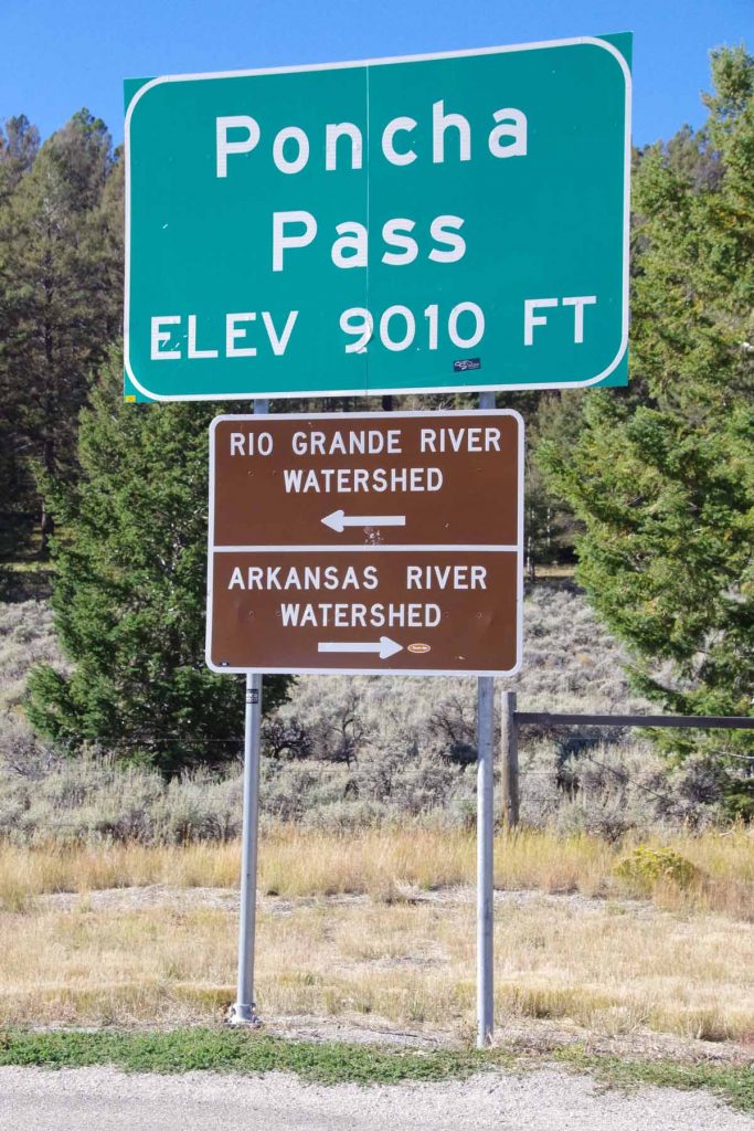
Sign at the top. In my riding through Colorado I’ve now crossed through the headwaters of four large rivers:
- Crossed the North Platte River just after Rawlins. The North Platte starts up in North Park basin where I rode past Walden.
- Once I crossed Muddy Pass, I came into the Colorado River basin. I crossed the Colorado River just past Kremmling. The headwaters were a little further east above Grand Lake.
- Once I crossed Fremont Pass, I was in the Arkansas River headwaters and crossed the Arkansas River several times as I followed the river downhill to Salida.
- Once I crossed Poncha Pass, I came into the Rio Grande River basin. The headwaters are in the San Luis Valley. I crossed the Rio Grande River just before Alamosa.
No other big river basins left, though eventually I’ll need to cross back from the Rio Grande Basin to the Colorado River Basin.
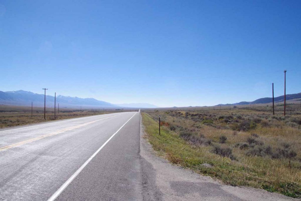
The San Luis Valley is a high-altitude basin of approximately 8000 square miles (122 miles x 74 miles – slightly larger than area of Massachusetts and half the size of the Netherlands). It is flat, open and without trees. Fortunately these two had little wind. I had some gentle descent into the valley and then pretty flat after that.
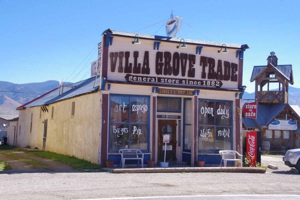
At 25 miles was Villa Grove. An unexpected treat to find this store/cafe. Stopped and had a delicious piece of chocolate pie.
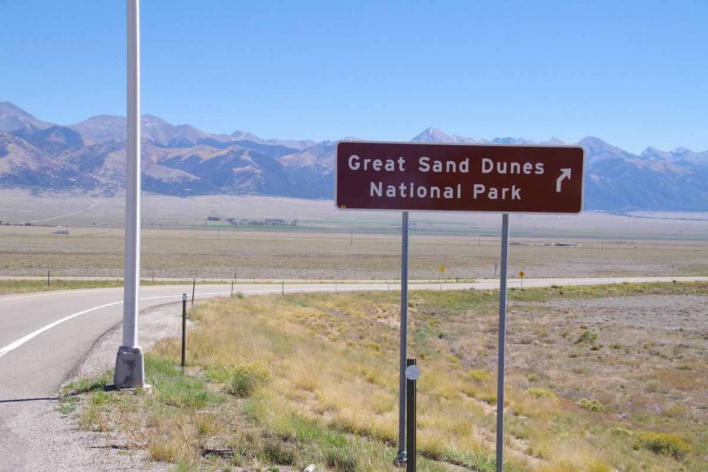
Five miles later was turnoff to CO 17, the smaller road to the Great Sand Dunes. Less traffic and much narrower shoulders.
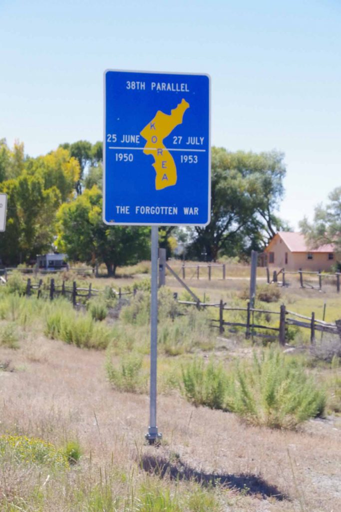
At the town of Moffat, I crossed the 38th Parallel. Here they also had a sign pointing out this was same parallel as original dividing line in Korea. Town is an overstatement as only business establishments consisted of a post office and a small artsy gallery that also served espresso coffee.
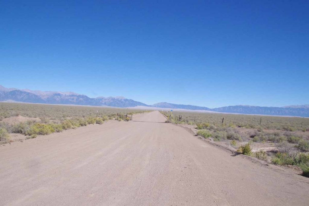
After Moffat another 16 miles south and then I turned to a gravel road. The Great Sand Dunes are in the distance. It was washboard road, but fortunately only 2.7 miles and I was at the Great Sand Dunes Pool and RV Park.
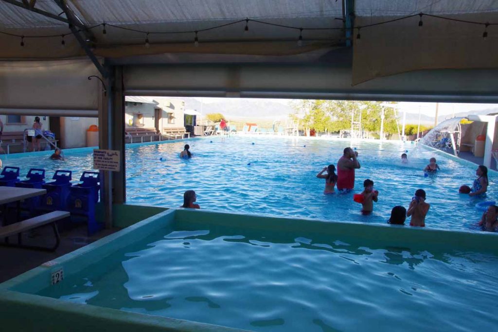
There was a nice swimming pool here as well as a small grill. I had dinner and then went for a swim and soak. In the evening I watched the presidential debate on a TV at the bar.
Next morning skies were clear blue again and back cycling through San Luis Valley. The town of Hooper is off in right side of this image. Again, town is an overstatement as nothing was open.
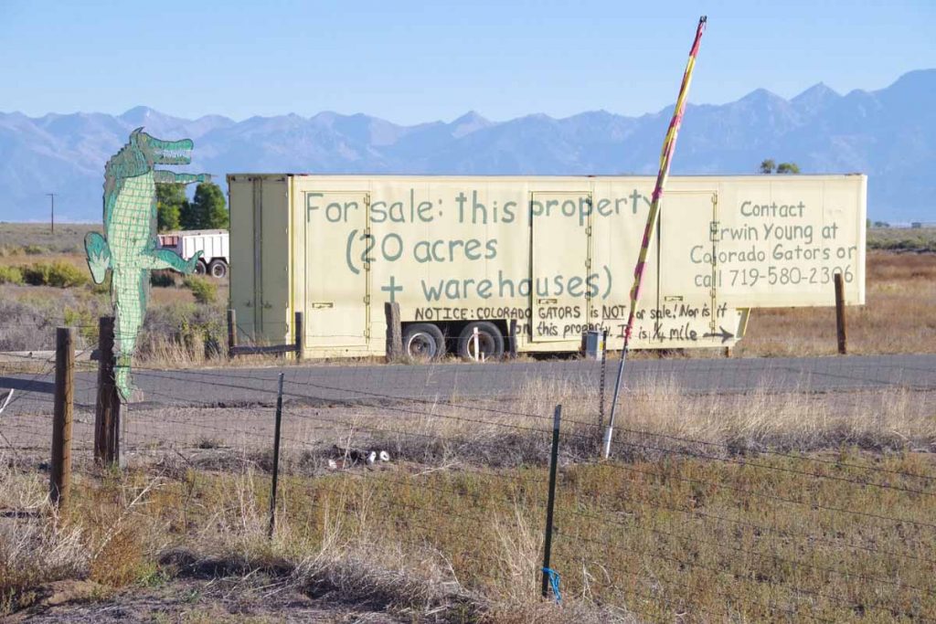
Not much further was an alligator farm. Once can even buy the land next door.
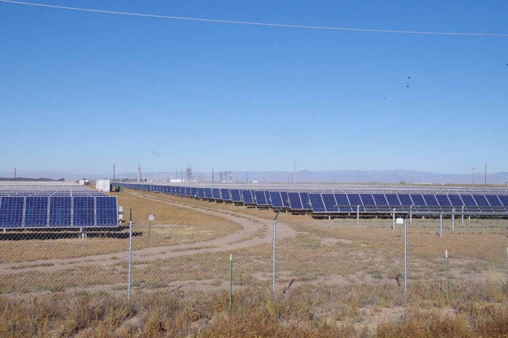
A little before Mosca, was this 30 MW Solar Array. Wikipedia says it was largest installation in the world at time it was completed (2012). Those panels rotate to catch the sun.
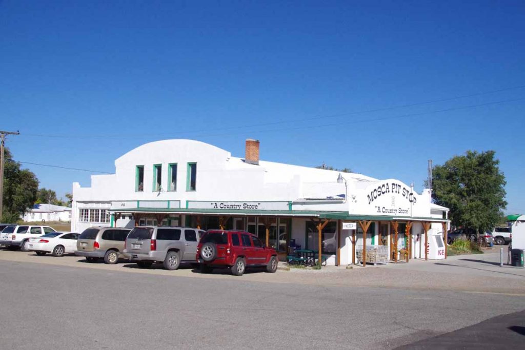
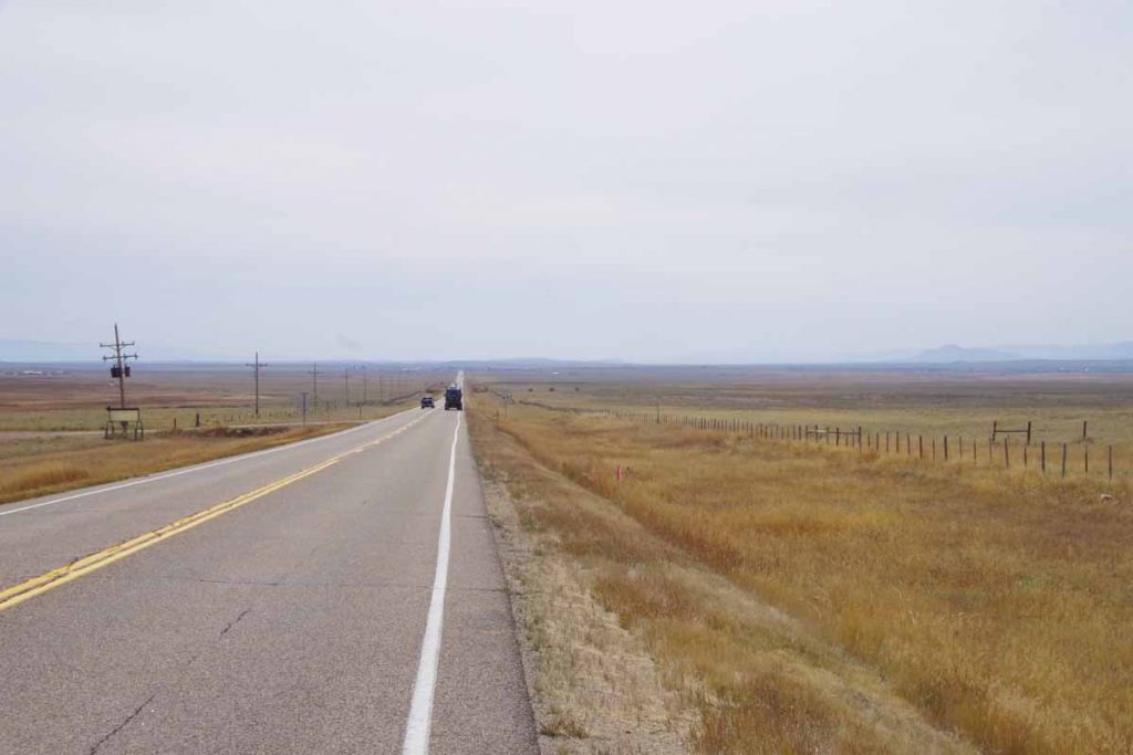
Seven miles past Hooper, Mosca had a store/gas station and chance to get breakfast. After that another 15 miles and I was through Alamosa, the big town for the day.
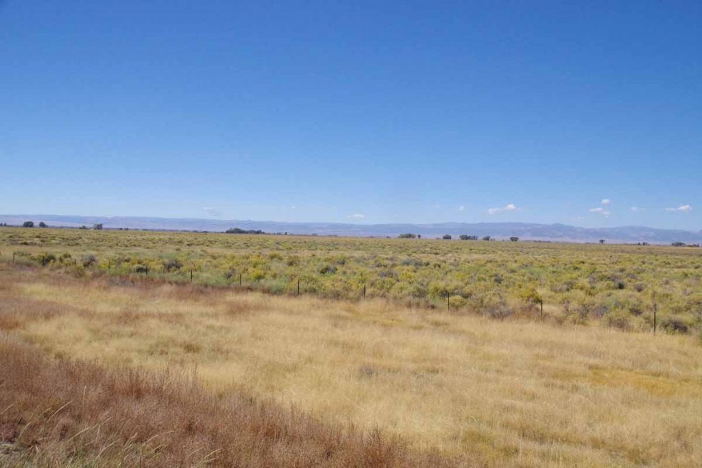
After Alamosa, the route followed the railroad. US285 had nice wide shoulders. There was the slightest incline as I climbed ~300ft in 29 miles to reach Anonito.
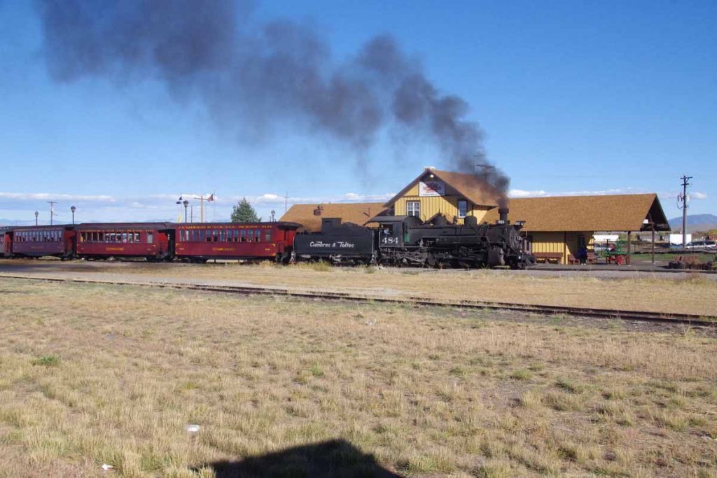
Antonito has a narrow gauge tourist railroad.
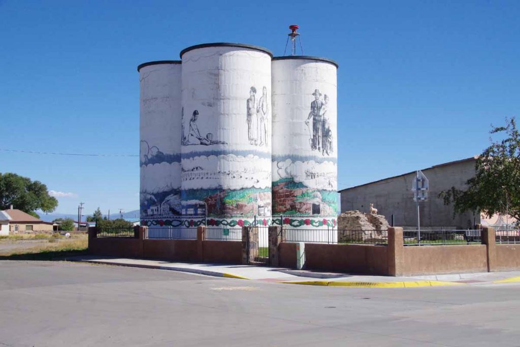
It also has some interesting artwork and paintings. Otherwise a small downtown with grocery and one or two restaurants. Overall two nice and not extremely difficult days of riding to come here.
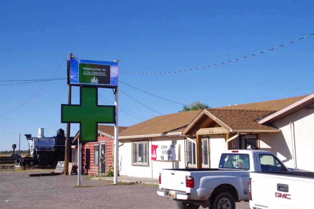
It also has at least three cannabis shops. There might be more of these shops than restaurants in town.
Salida
Downhill, little wind and warmer. Big contrast today from yesterday as I followed the Arkansas Valley downhill from Leadville to Salida. While it was a route I’ve done multiple times, I still enjoy coming down past the Sawatch range and the 14ers.
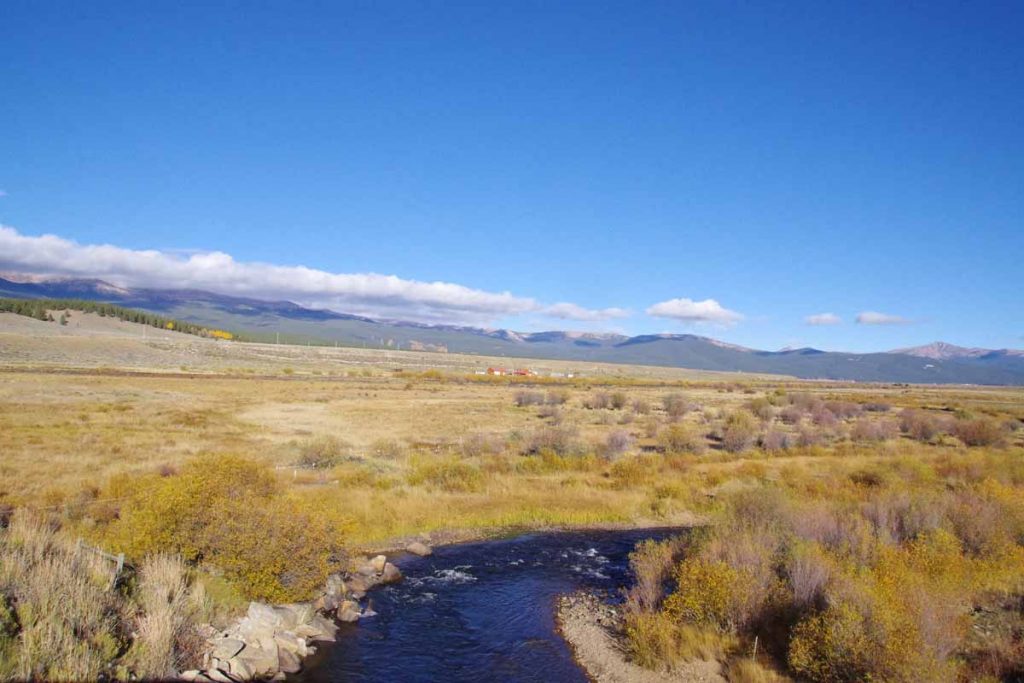
It was barely below freezing starting out. I had a nice descent from Leadville but that also meant less pedaling to keep warm. In photo above, I crossed the Arkansas River. Still pretty small here. The valley opened up, but fortunately not much wind either direction.
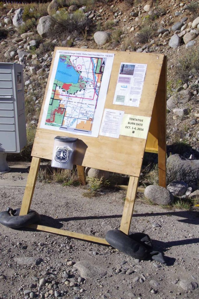
At 14 miles was a turnoff to CO 82 for Twin Lakes as well as the road that goes over Independence Pass. The sign indicated there was a scheduled burn to get rid of extra fuel. After this the road went through more of a small canyon and past the town of Granite.
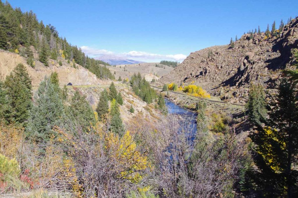
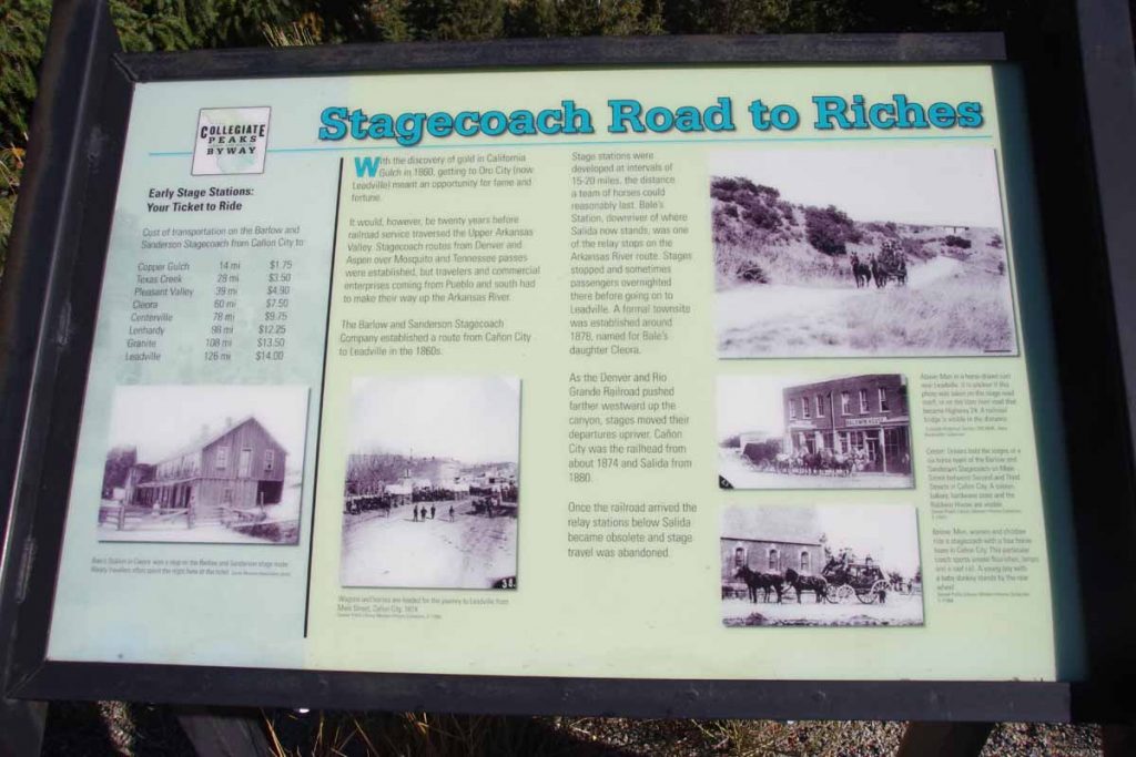
Picture above shows both the canyon, railroad and remains of a stagecoach road. The stagecoach route was created when Leadville had its gold and silver rush.
After this through the town of Buena Vista. The main street was narrowed due to construction, but traffic otherwise well-behaved. A short refuel stop before going on the road.
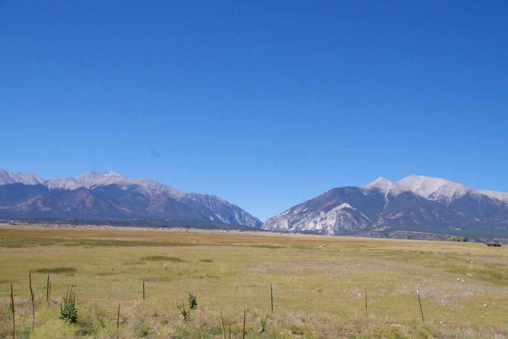
Photo above is Mount Princeton and Antero. Looking back at my photos, many of them were of the different 14ers as I came past, though there is also some similarity.
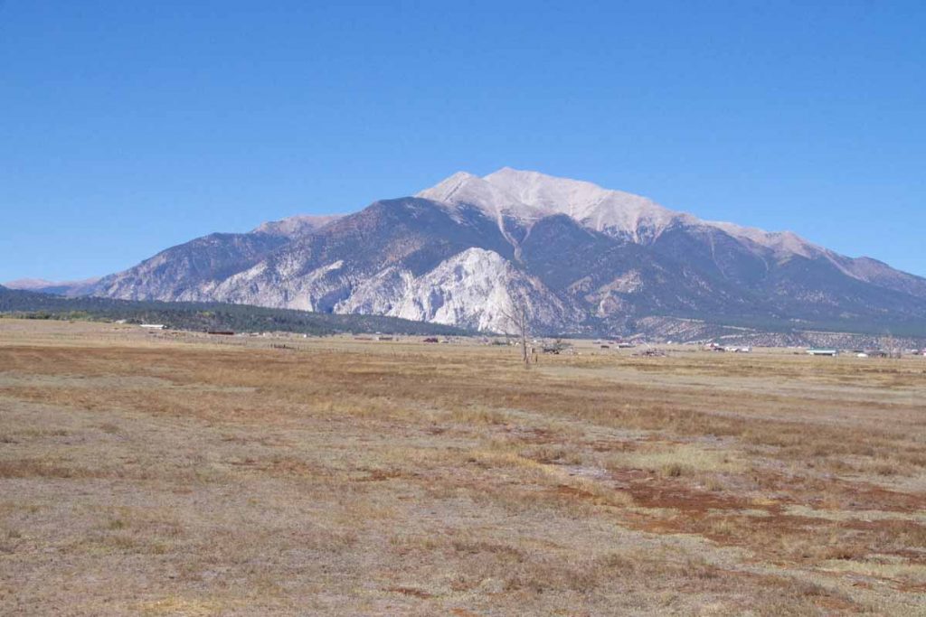
Mount Princeton is interesting because of the white “chalk”, which is actually coloration of the granite coming from mineral springs.
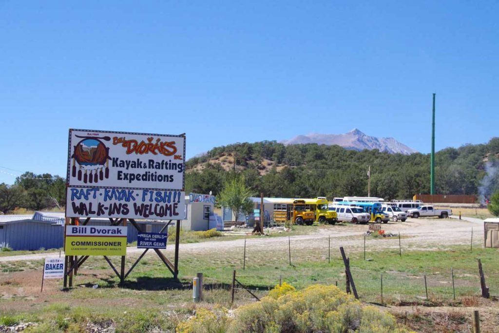
Rafting is a huge business during the summer. Places along the road seem to mostly be closed for the season.
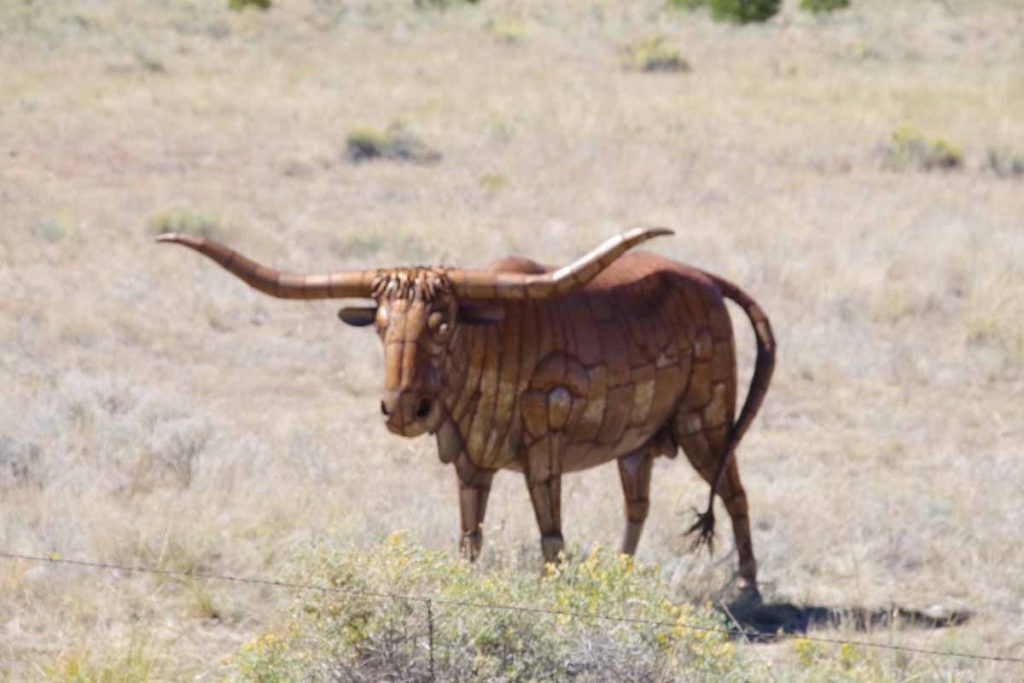
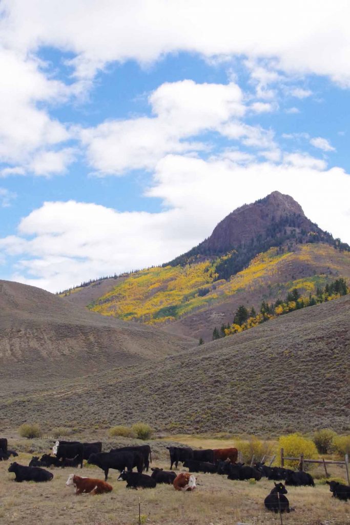
Past some ranches and cattle as well as this fake bull.
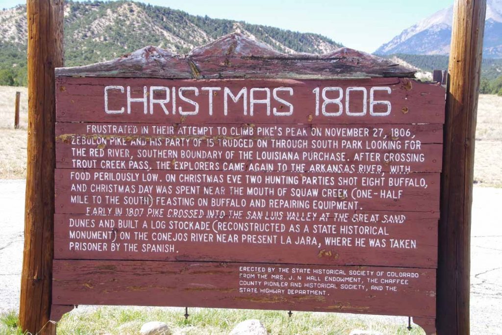
Sign about the early Pike expedition through the area.
At 49 miles the road split and I took the high road to Poncha Springs. It went over a small ridge and back up to 7600ft before I turned back onto US 50 and descended back to Salida. Overall nice to have an easier ride today. Otherwise get ready for another pass (Poncha Pass) tomorrow.
Leadville, Fremont Pass
A chilly ride over Fremont Pass to Leadville.
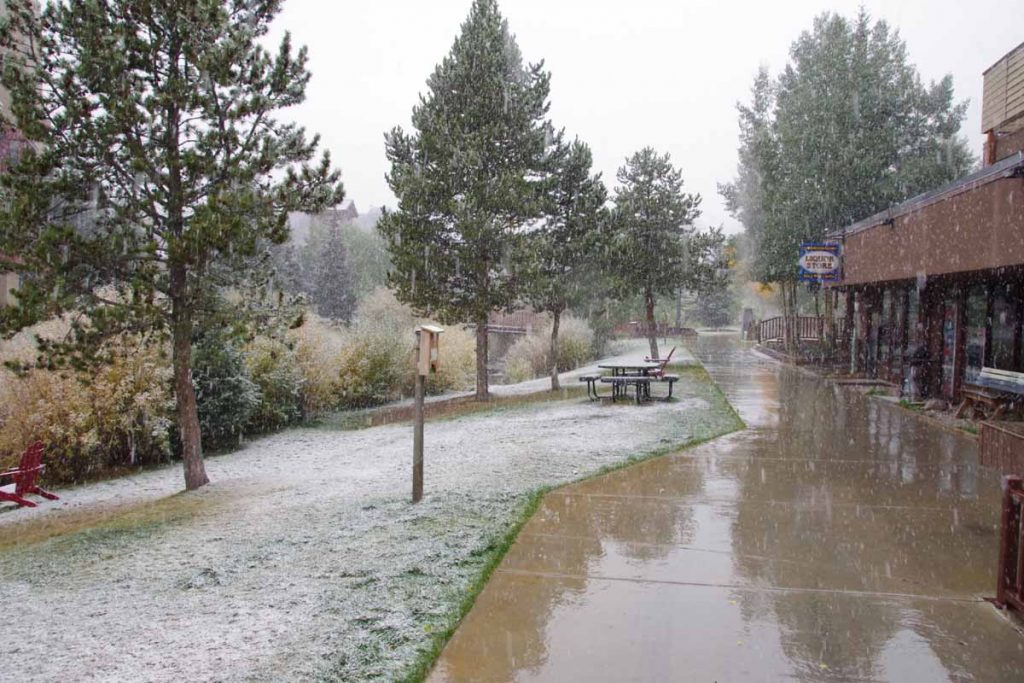
Yesterday was a quiet rest day in Copper Mountain. It is “mud season” after the summer resort season and not yet ready for ski season. In the afternoon a cold front came through with wind as well as snow flurries. As you can see above, it didn’t really accumulate much and mostly made things wet.
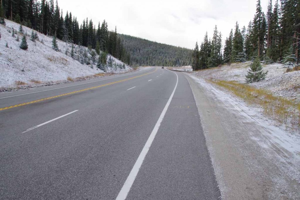
It was cold the next morning and I waited until the sun got a chance to get up. The lowest temperatures my cycle computer showed for the ride was -5C (23F), just a bit on the chilly side for the gear I have with me. At least the storm had passed through and no wind.
After 0.5 miles I reached the junction with CO 91 and climbing began almost immediately. Fortunately a fairly gentle ~3% type grade until the 4.5 mile mark where there was a two mile hill with grades closer to 6%. The climbing took enough effort that I kept warm.
There were road markings left on the road, on photo above you can barely see “Ali” a bit ahead. This was the last part of a sequence on the road: “Float like a butterfly” (0.25 mile gap), “Sting like a bee” (0.25 mile gap), “R.I.P. Ali”. One of the markings indicated it was from RTR (Ride the Rockies). This past summer, the RTR route did the “Copper triangle” from Copper Mountain to Leadville to Vail and back to Copper Mountain. It is also a popular ride other times as well. In any case, nice to have some of the hazards marked and interesting these markings are still there three months after RTR.
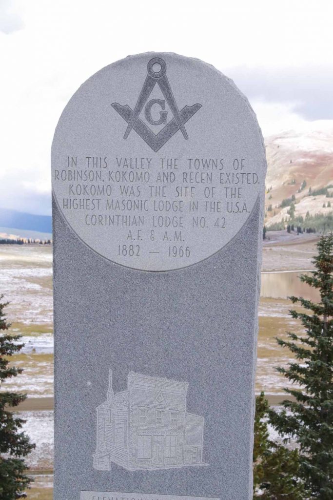
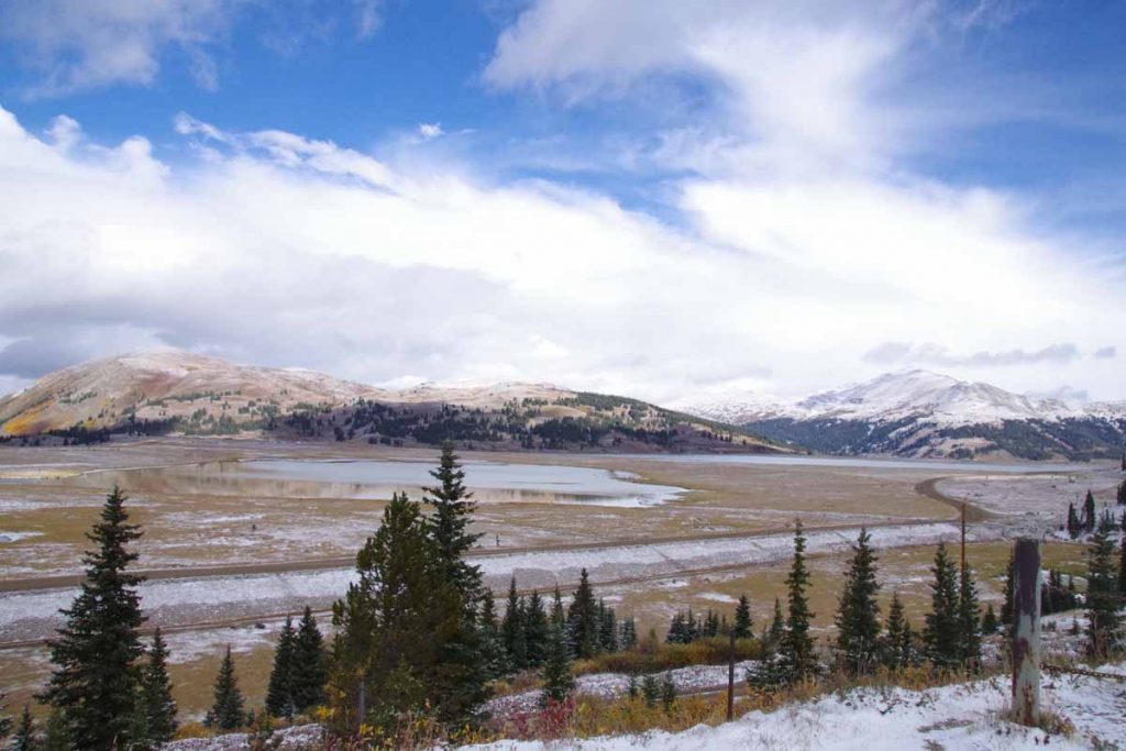
After seven miles the road flattened with a majority of the climbing completed. One could look over the large tailing ponds, not frozen yet. The marker above marked the former towns that had been flooded over by tailings and mine debris.
Here is a photo taken right next to the monument.
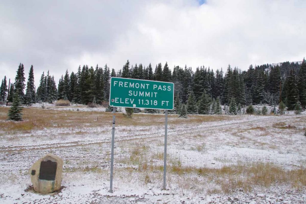
Not long after this, the last little bit of climbing brought me to summit of Fremont Pass. The marker on left tells that this was also a boundary of the 1803 Louisiana Purchase.
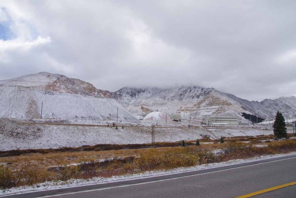
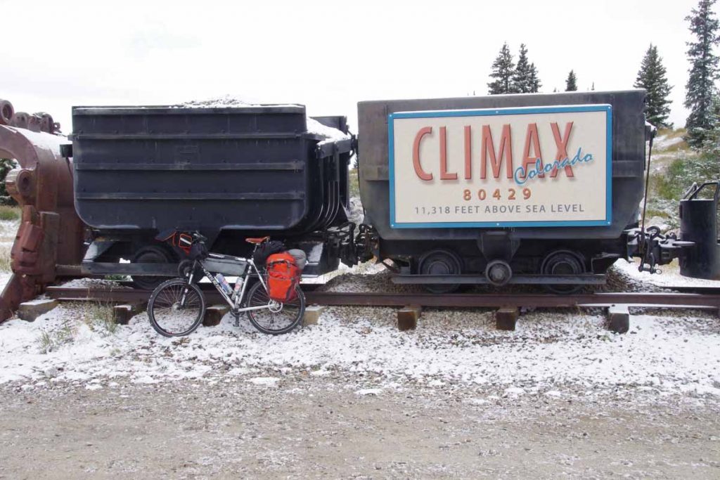
Just before reaching the summit, I could see the Climax Molybdenum Mine. At its peak output, this mine supplied 3/4s of the worlds molybdenum. It was shut down in 1995 and recently reopened in 2012.
There was a little display here about mining.
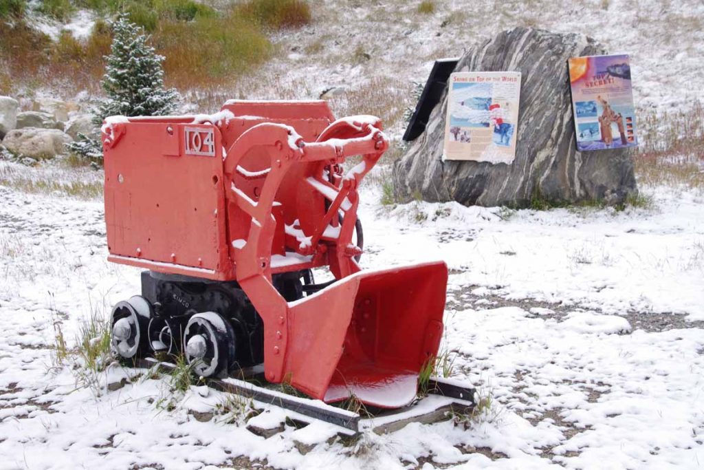
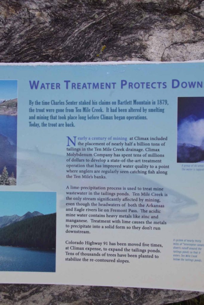
Included was a description of the tailings (half a billion tons!) that helped bury little towns below.
From the top of Fremont Pass, the temperature was now up to -1C (30F) and warmed a bit from there. However, there was also a cold west wind and I was no longer climbing, so felt colder on the way down than the way up.
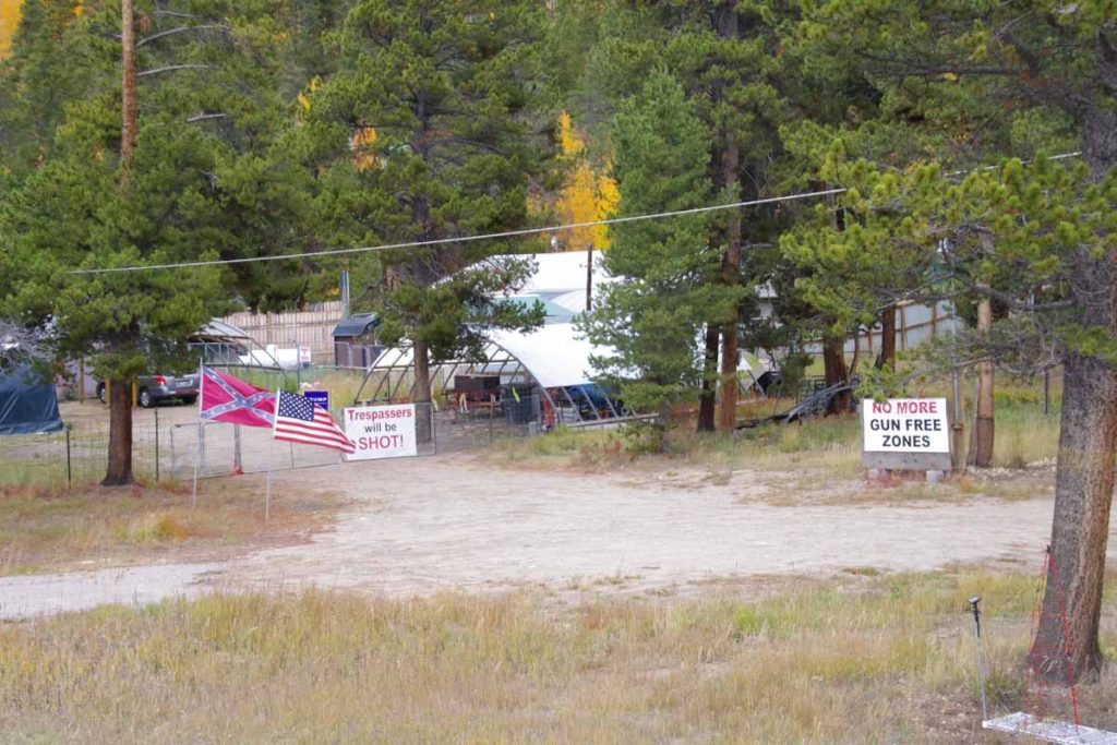
On the way down, this place seemed to broadcast his political views, complete with confederate flag and Trump sign.
Without too much trouble I found my way to Leadville and had lunch in the old downtown.
After that found a place to stay not much further. It was a short ride and never did warm up much – but also nice to see some Fremont Pass again.
Copper Mountain
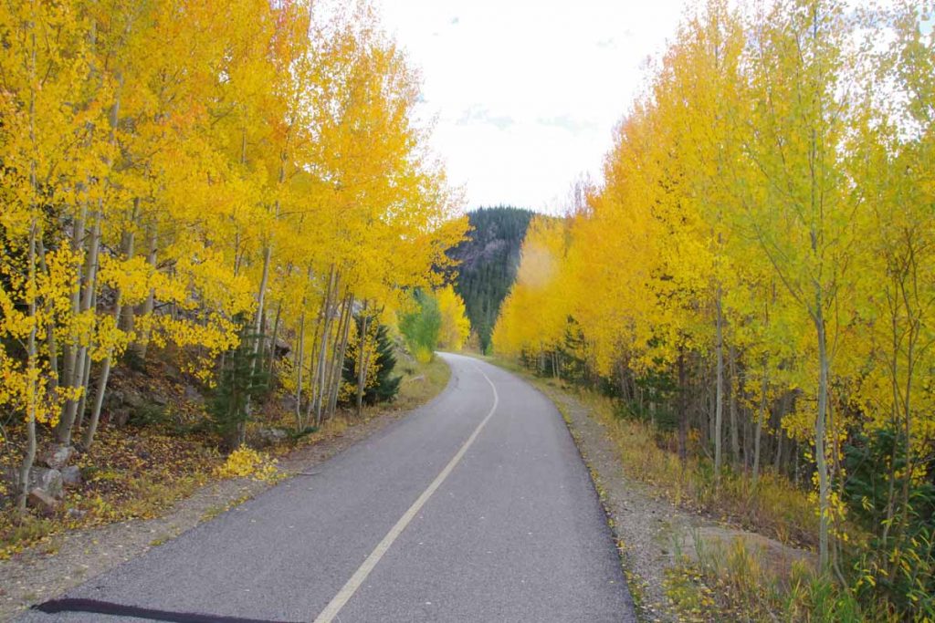
Leaf season is here. Lots of yellow aspen trees and some leaf peepers stopping along the road.
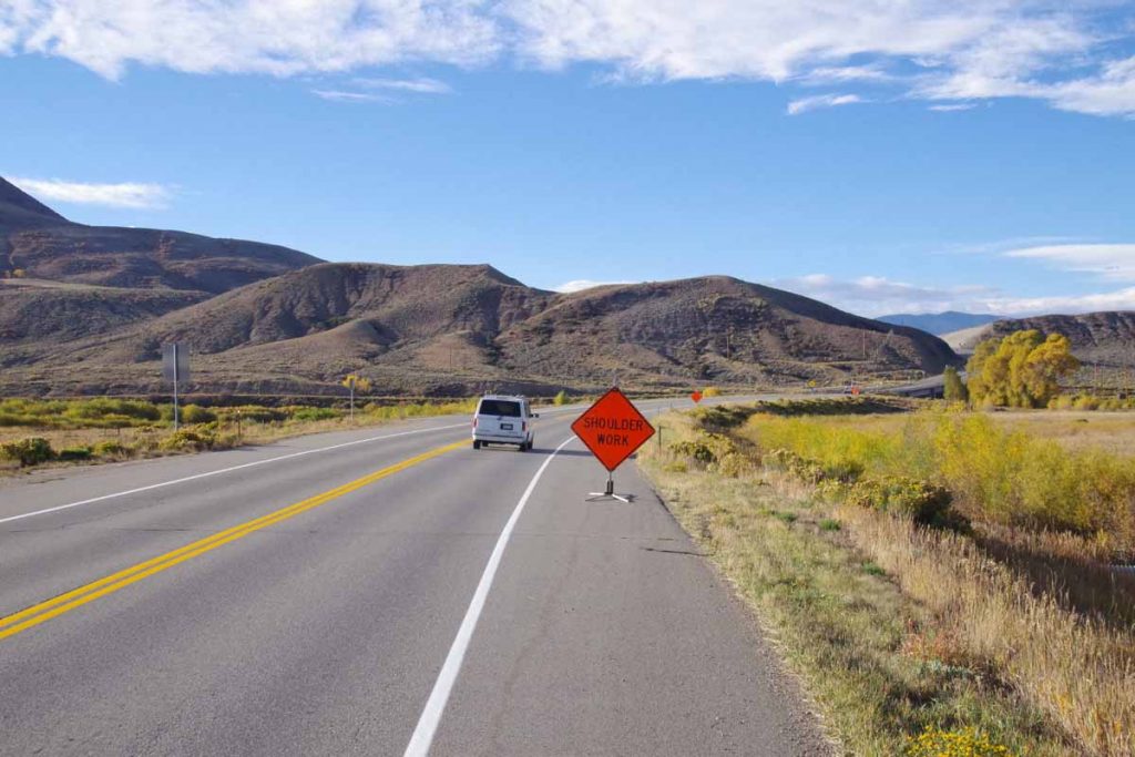
Less wind today. Fortunate as I did climb from ~7300ft to end at ~9700ft. Started the day with breakfast in the Moose Cafe, but this time in Kremmling. Highway 9 had signs about road construction, though this was some of the better riding. Except for signs like the one above, the first seven miles didn’t have much other than a machine they were using to put in rumble strips in a fresh shoulder. Fortunately, the shoulder is wide enough that these rumble strips will be OK.
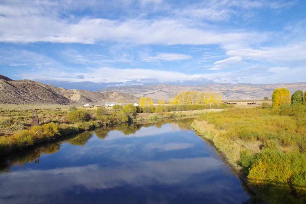
Crossed the Colorado River. Placid and not much flow here in the fall.
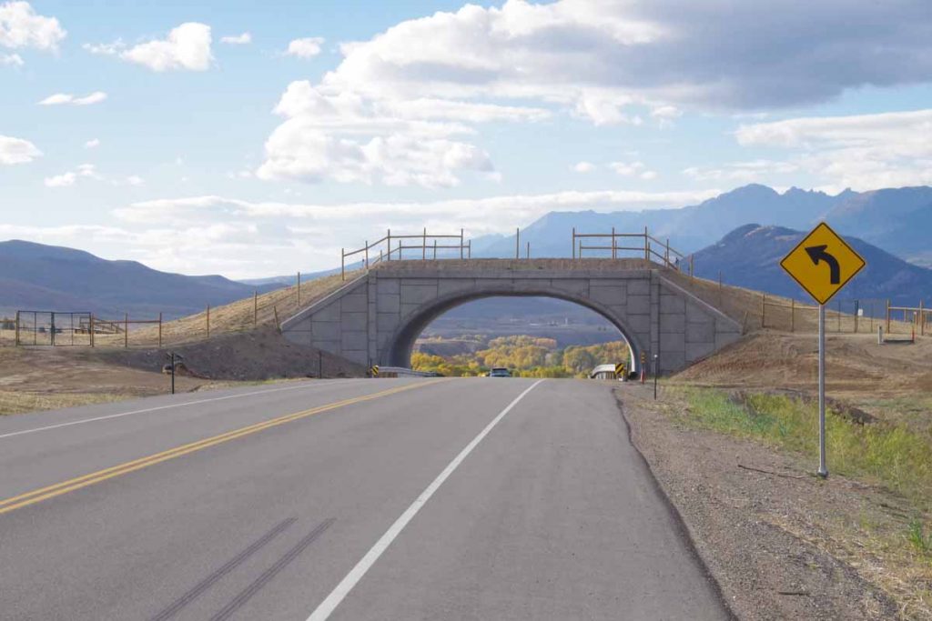
There was also a wildlife bridge. The one above just finished and one later they were still working on. One or two places they had narrowed to allowing traffic one direction only.
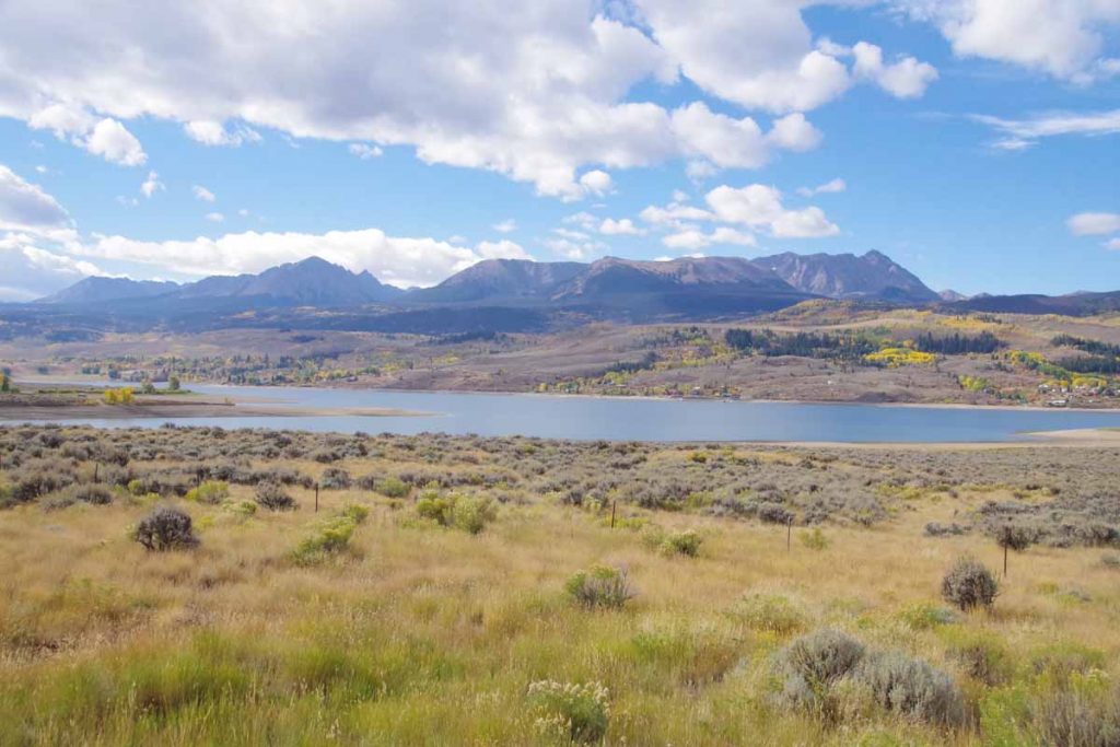
By the time I got to Green Mountain Reservoir the construction was mostly done. Unfortunately, the shoulder also narrowed here. However, with light winds and gentle climbs it was reasonably fast riding. After 38 miles I got myself to Silverthorne and then Dillon.
Expedia has a “mystery hotel” program. They won’t tell you the hotel other than the price and rough location – at least until after you pay. I had seen a place in Copper Mountain that wasn’t too expensive so placed a reservation. Turns out it is a small condo right in the ski area central area. Also one needed to pick up the key cards in Dillon – which fortunately was on the way.
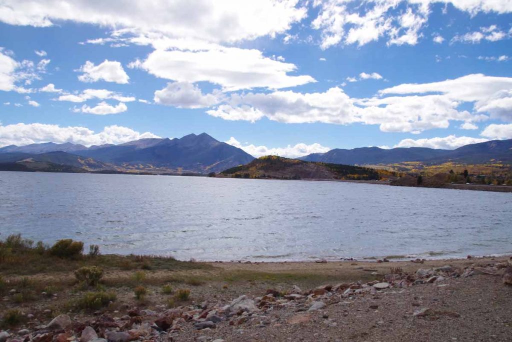
After this I cycled up and along Dillon Reservoir.
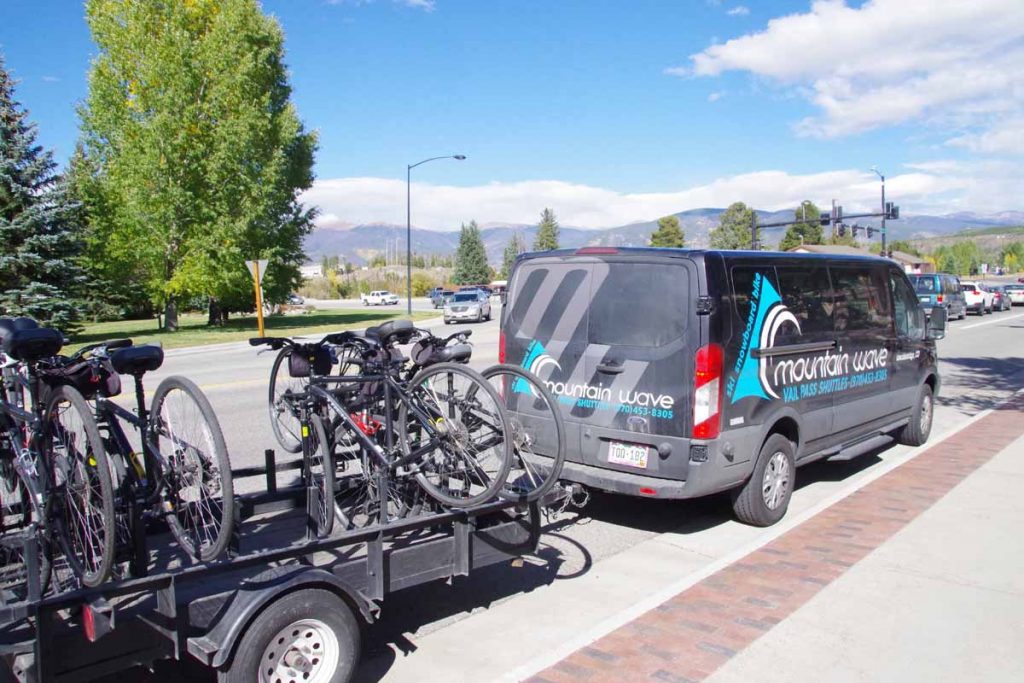
In Frisco was this van which had taken bicycles to top of Vail Pass and then let tourists cycled down the path back to Frisco.
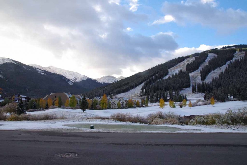
After Frisco were a little over six miles of bike path along the I-70 corridor. After that I found my way to the condo. Things are fairly quiet here now in “mud season” and many of the shops are closed. However, what I like is that I’m already at 9700ft and hence only ~1600ft of climb to get over Fremont Pass on way to Leadville. I have a rest day here and then likely a cold ride over the pass.
I also have some more clarity on travel routes from here. Rough idea is to go
- First, due south via Alamosa, Santa Fe and to Socorro.
- From Socorro, I’ll pick up Adventure Cycling Southern Tier maps. The maps describe a route from El Paso to San Diego. I rode them the other direction in 2001. I will most likely not go all the way to El Paso, but instead head west to catch the Southern Tier route.
- Follow the Southern Tier via Tempe (Phoenix)
- Follow the Southern Tier to San Diego
Still a ways to go in the USA, but nice to have better answer when someone asks “where are you heading?”. For now it will be “Santa Fe”.
Kremmling, on the road and into the wind
Two days riding brought me to Kremmling. This was familiar riding on roads I had cycled several times before.
Day One
Nice to be back on the road again. Today the theme was “beat the wind”. While I did end up with headwinds much of the day, I still felt partially successful with almost no wind the first 10 miles.
The ride from Laramie quickly becomes flat and open. I was in familiar territory and had done this ride multiple times before. The first 26 miles were through wide open land where the wild card is the wind. It once took me 6 hours to cycle that distance with some ferocious headwinds. Fortunately it was calm starting out and lighter headwinds the last half of the distance.
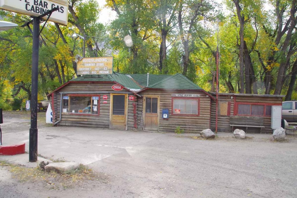
At Woods Landing, one trades the wind for 1000+ feet of climbing. I stopped in and talked with the clerk for a bit. She noted it had been rather hazy, most likely from some of the fires in the area.
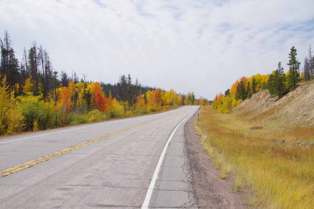
The aspen are beginning to turn. I climbed to slightly over 9100ft before having an occasional descent coming into Mountain Home. Not much later, I crossed the Colorado border.
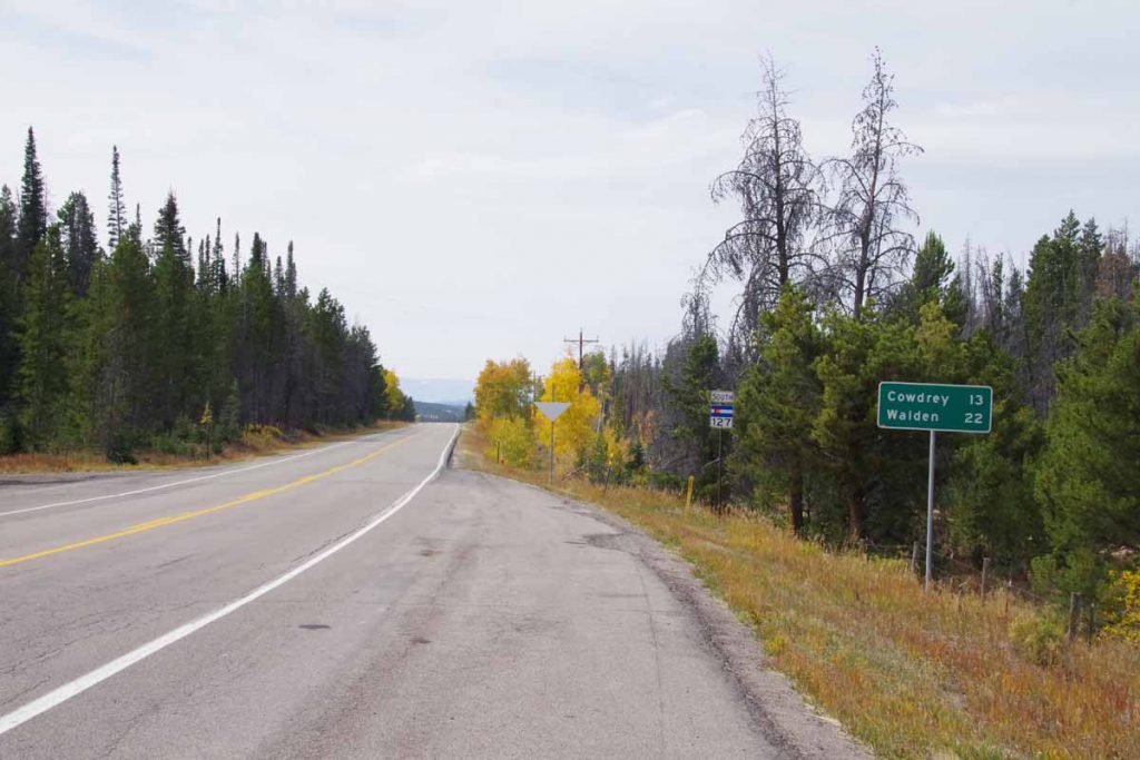
The first indication was the CO 127 road sign.
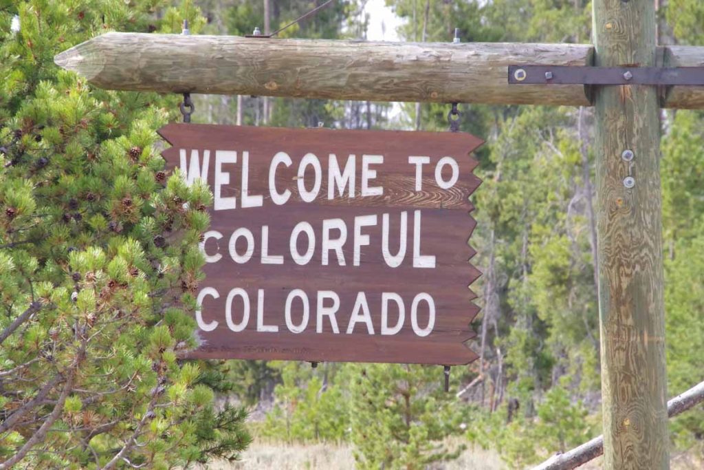
However, shortly thereafter I came to the Welcome to Colorful Colorado sign. It was 9 miles of both headwind and mostly downhill from here to the next road junction.
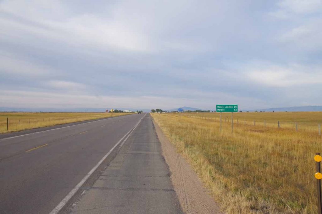
This brought me to North Park, a large treeless and relatively flat area. Walden is in the middle of this space.
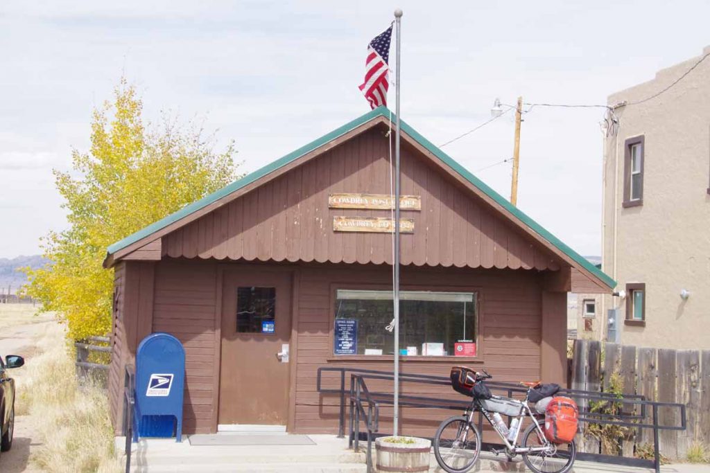
Cowdrey is first. Above is the small post office. There isn’t much else in Cowdrey.
At end of 63 miles I was in to Walden. There are five motels in town and none have vacancies. Apparently, a combination of firefighters, hunters and other workers have made this very popular. It is currently bear and elk season with the latter being bow hunting only. I’m told it will get even busier once the elk season opens for rifles.
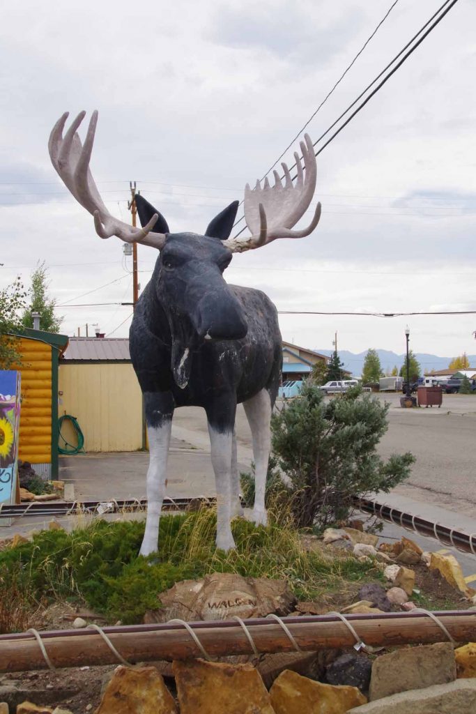
Otherwise Walden dubs itself as the “Moose watching capital of Colorado”. I wandered through familiar haunts before camping in the city park.
Day Two
Warm overnight and the sprinklers didn’t come on. Today definitely had some riding into the wind as it was blowing even at the start. The first 34 miles started in flat open North Park.
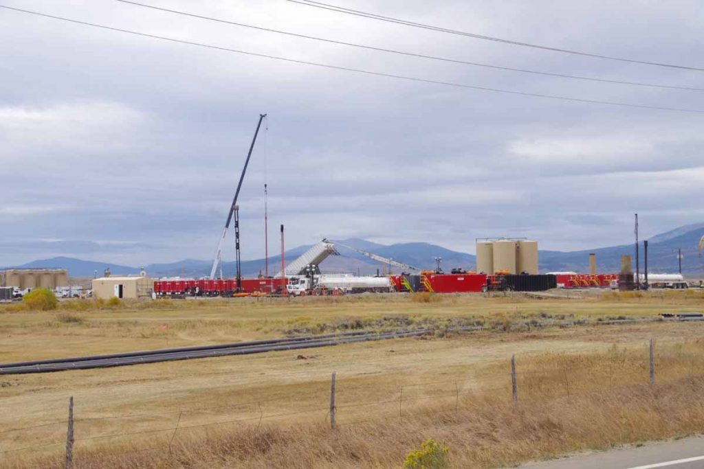
There was some energy development going on at several sites.
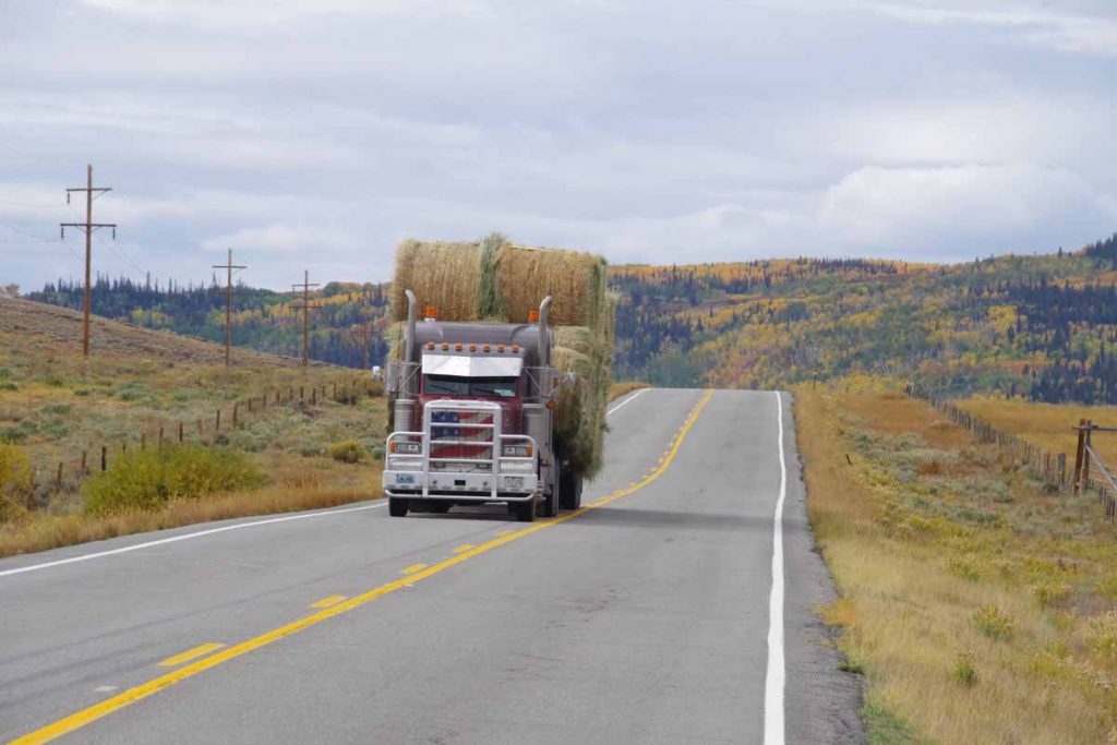
Shoulders on the road were narrow and there was some truck traffic, but all well behaved.
After ~22 miles the road slowly found a valley and followed gradually up to the pass. Definitely have a lot of fall colors.
Not far from the top, one can spot the Rabbit Ears. I wasn’t going up all the way to Rabbit Ears Pass, but instead just over a 8772 ft continental divide crossing named Muddy Creek Pass.
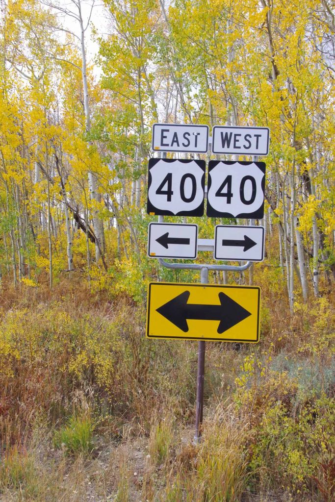
There wasn’t even a sign, so took this photo of the Highway 40 Junction instead. From this point, it was ~1300ft of descent over 27 miles down to Kremmling. Here I definitely noticed some of the wind coming from the south.
Nice view coming towards Kremmling.
Within Kremmling, met this cross-country cyclist headed west. Also met four Great Divide Mountain bike riders on their way south. No photo because I was walking around town without my camera. They had started roughly the same time as myself in Banff and were making good progress.
Overall, nice to be riding on the cleaned and fixed hub again. The past two days were good riding made a little more difficult with headwinds but also over familiar routes.
Laramie, ready to get back on the road
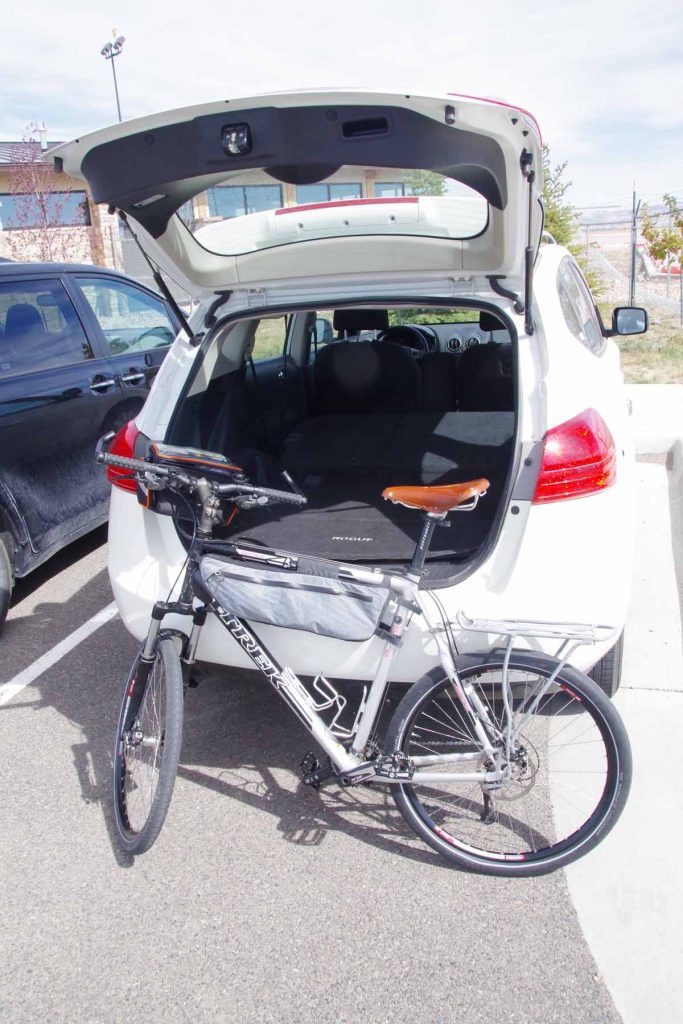
I picked up my bicycle from Lee’s Cyclery in Fort Collins. Diagnosis on the hub was nothing broken, but instead the hub had gotten fowled and oil was dirty and hence the pawls were sticking shut. A good cleaning and light lube and it should be ready to go again.
Otherwise, renewed both the chain and cassette which were worn. The bike rode well on the four miles from airport. Will see how things go from here. In addition, I’m also looking at a possible different hub (DT Swiss) that will be more easy for me to open and clean on the road.
Plan is to depart from here tomorrow headed towards Walden, CO. Still looking at exactly where on the Mexico/US border I will head towards: El Paso or San Diego or somewhere in between.
Pedal the Plains
This past weekend I took an intermission to do an event ride named Pedal the Plains (PTP). The ride was 154 miles spread over three days: 24 on Friday, 59 on Saturday and 71 on Sunday.
Pedal the Plains was started in 2012, I believe as an offshoot of “Ride the Rockies” (RTR) ride which has now been going for 30 years. RTR is a week long supported ride of ~400 miles through the mountains and passes of Colorado. PTP was intended to bring a similar experience to the small towns on the eastern plains of Colorado. This results in several interesting comparisons and contrasts:
- RTR is a more strenuous ride, particularly in terms of climbing as each day one might climb several thousand feet over a pass to get to the next town. In contrast, the Great Plains are relatively flat. The distances on the ride are not necessarily shorter (Saturday has an optional century ride), but as long as the wind cooperates, it is easier riding.
- Many of the mountain towns, particularly the resort towns get many visitors through the summer and winter months. As a result, having 2000 (RTR) cyclists come through town is business and not a huge deal since similar events happen fairly often through the year. There are exceptions as not every mountain town is a resort town but one gets polite service but not necessarily a sense this is special. In contrast, these small plains towns seem to have fewer big events (e.g. county fair, rodeo) and having 1000 (PTP) seems like a novelty and a big deal. One definitely gets a sense of hospitality as the town turns out to help take care of their visitors
- PTP has taken an “education” slant. The aid stops are not just places to refuel on bananas and gatorade, but instead each day there are half a dozen educational themed stops. One learns about life on the plains, about energy, about local history and similar themes. As one cycles along, signs have been placed along the route with short educational factoids and tidbits. I think it started with an idea of “this is our chance to show those folks from Denver what it is like to live out here on the plains” and has grown from there.
Overall, I’ve ridden all five of the PTP rides so far (2012-2016) and when my schedule started to line up, seemed like a good excuse to rent a car, get the bike serviced and then also ride a different bike on Pedal the Plains. I once again enjoyed my trip and will show a few photos below in the order I took them.
Day One
Today the schedule was an opening ceremony at 11am, followed by 24 miles riding from Ordway to Fowler. I drove down from my parents place early in the morning.
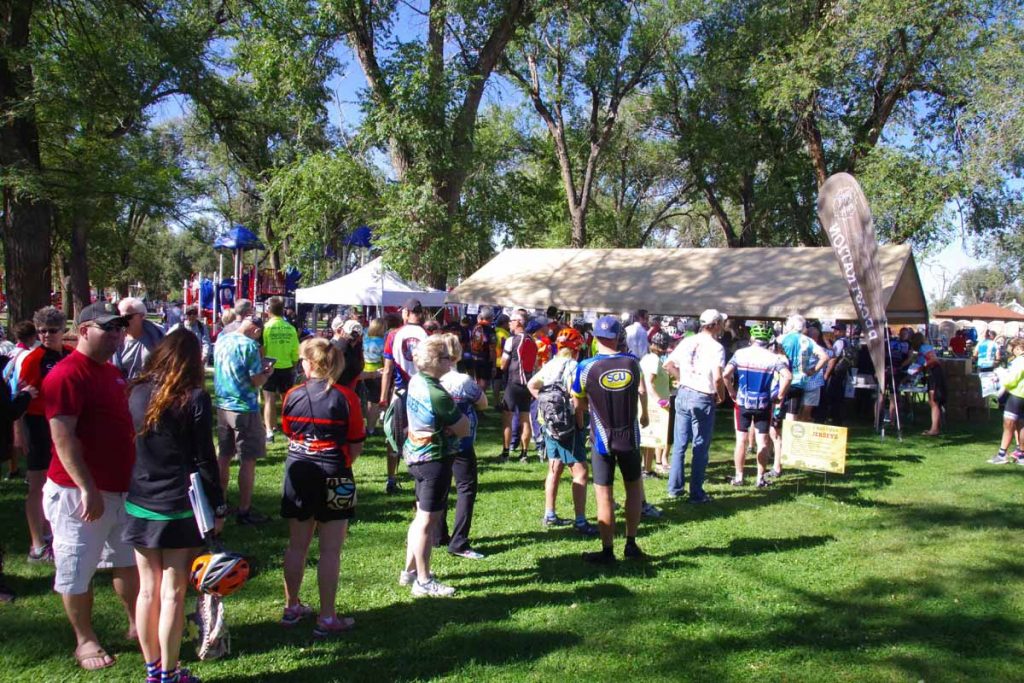
Lines for registration. We were told there were over 1000 participants this year who came from 18 different states. Though the vast majority of people I talked with were from Colorado.
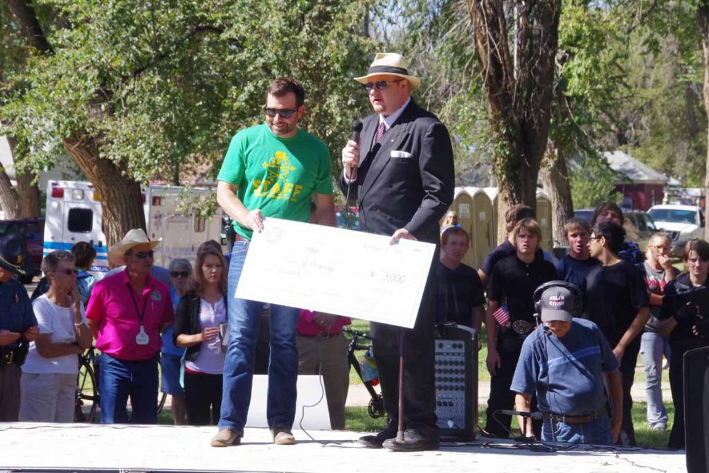
Chandler Smith, tour director presenting a check to the Mayor of Ordway.
The ride is organized by the Denver Post newspaper. The proceeds from the ride go to the Denver Post Community Foundation. That foundation distributes funds at least three different ways (a) each host town gets to pick a local charity to receive funds (b) there is a local art initiative where each town receives funds for a local art project (c) two youth oriented organizations: Future Farmers of America (FFA) and 4H both receive an overall grant. In return both organizations also help provide some volunteers at educational stops.
Our first educational stop was at local exotic animal park. Forget exactly what these critters were, but they also had wallabies and other rescue animals here.
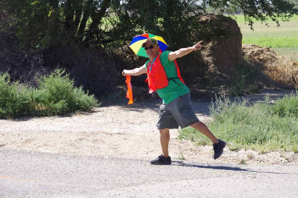
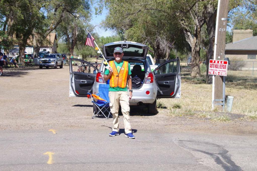
One of the volunteers helping to direct traffic. Overall both route markings and traffic direction was excellent. The busiest intersections had state highway patrol officers or local sheriffs and smaller intersections usually had volunteers such as this one.
For ride as a whole and not just routing, there seem to be several categories of volunteers:
- Approximately 50 people such as this person volunteer in general and help out each day. Many of these seem to come back each year and so have built up knowledge of how to organize the event.
- Governor Hinkenlooper took special interest in getting this event started and his office of local governmental outreach helps with organization as well as providing a number of volunteers.
- Local communities take care of meals as well as volunteers in each town for everything from shuttles to entertainment, etc.
- FFA and 4H clubs come out to help educate as well as provide volunteers.
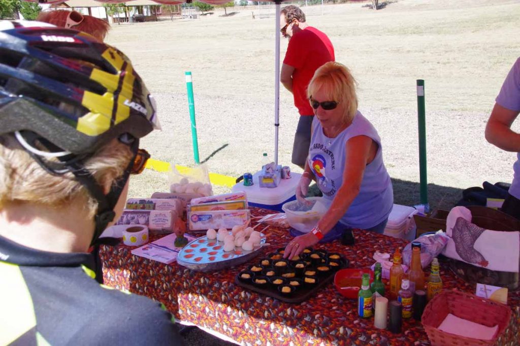
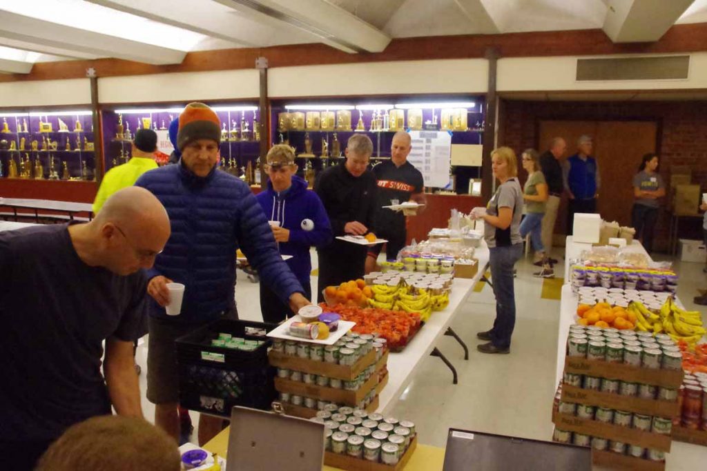
One of the educational stops. In this case, the Egg Growers association has a nice collection of hard boiled eggs on a stick. At end of each day the wheat growers had a truck with cookies and the Western Dairy Association had a truck with chocolate milk.
Educational stop coming into Fowler, this one at their local historical museum.
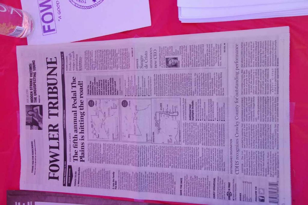
Example of newspaper stories from the Fowler Newspaper letting locals know of the coming event.
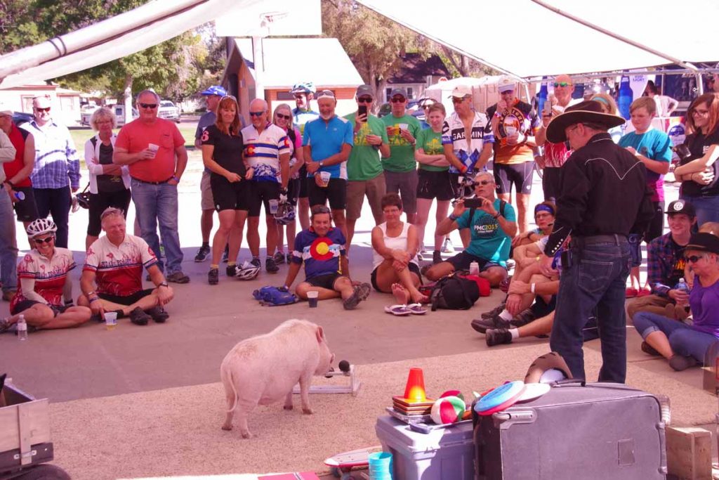
Reaching Fowler, there was local entertainment including this set of trained hogs.
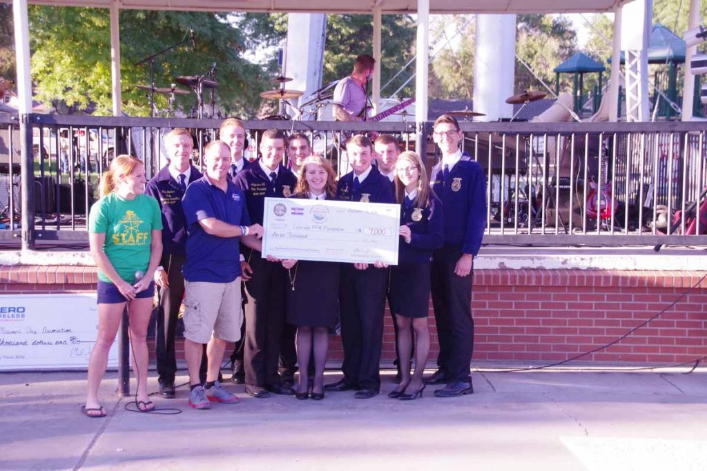
Evening check presentation ceremony. This time to the FFA.
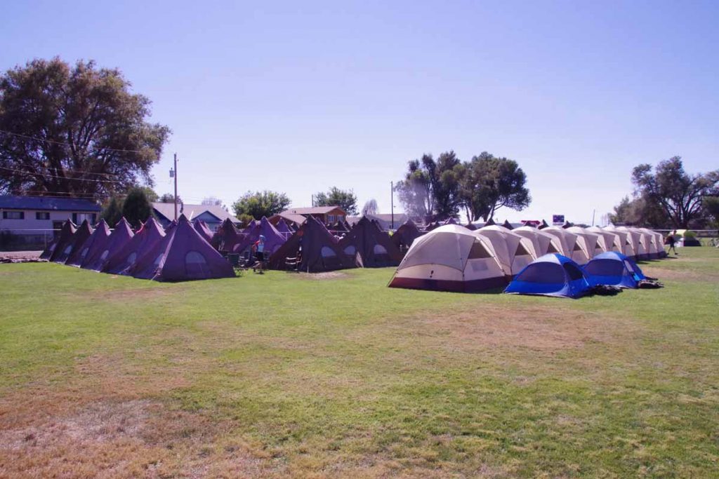
Time to set up my tent in the local field. Overall a fairly easy ride of 24 miles but a lot of nice hospitality. For example, several Fowler churches opened their doors and invited in cyclists who came past. Inside could share cookies and cool water. Also nice chance to talk with locals.
Day Two
Second day the official route was 59 miles with six educational stops. There was an optional century ride and it was possible to register only for the century ride. There was also a five mile “family fun ride”.
Breakfast served from 6:00am to 8:30am. Things started fairly early with a “rolling start” between 7am and 9am so likely not long after 9am the town would be quiet again.
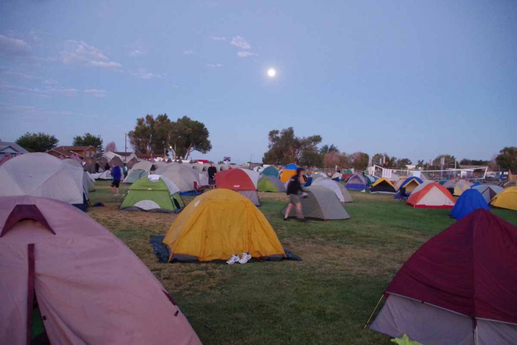
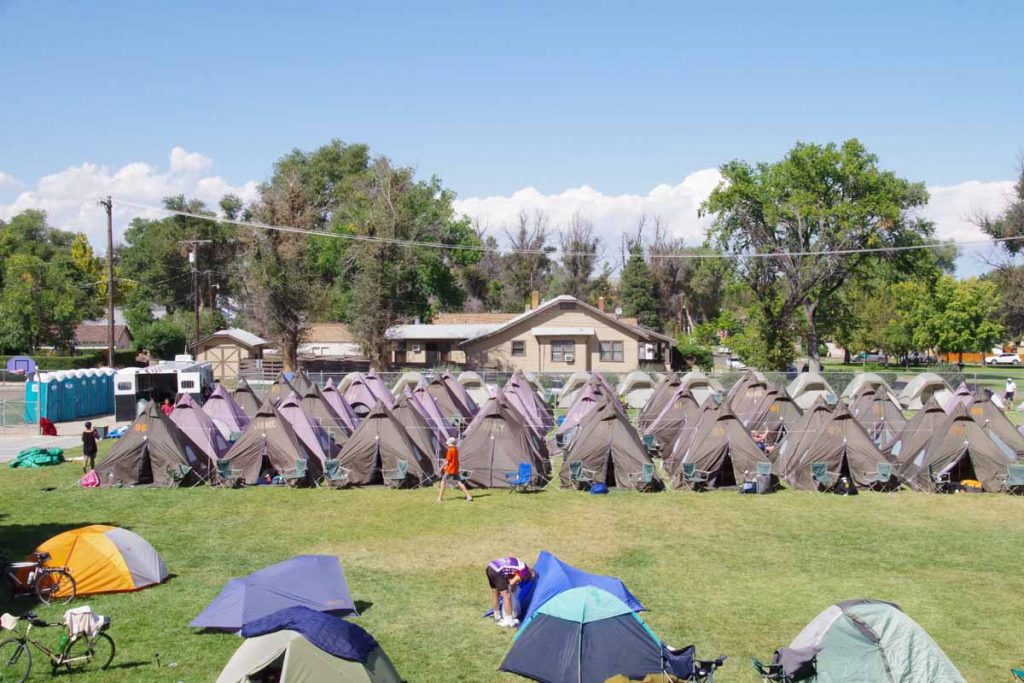
Our tent city under the moon. There were several different lodging options:
- Outdoor camping in local ball field (shown above)
- Indoor camping in the gym
- Sherpa camping, e.g. sleep in a tent city, but set up by others
- Lodging shuttles which ran went to local motels
I did the outdoor camping.
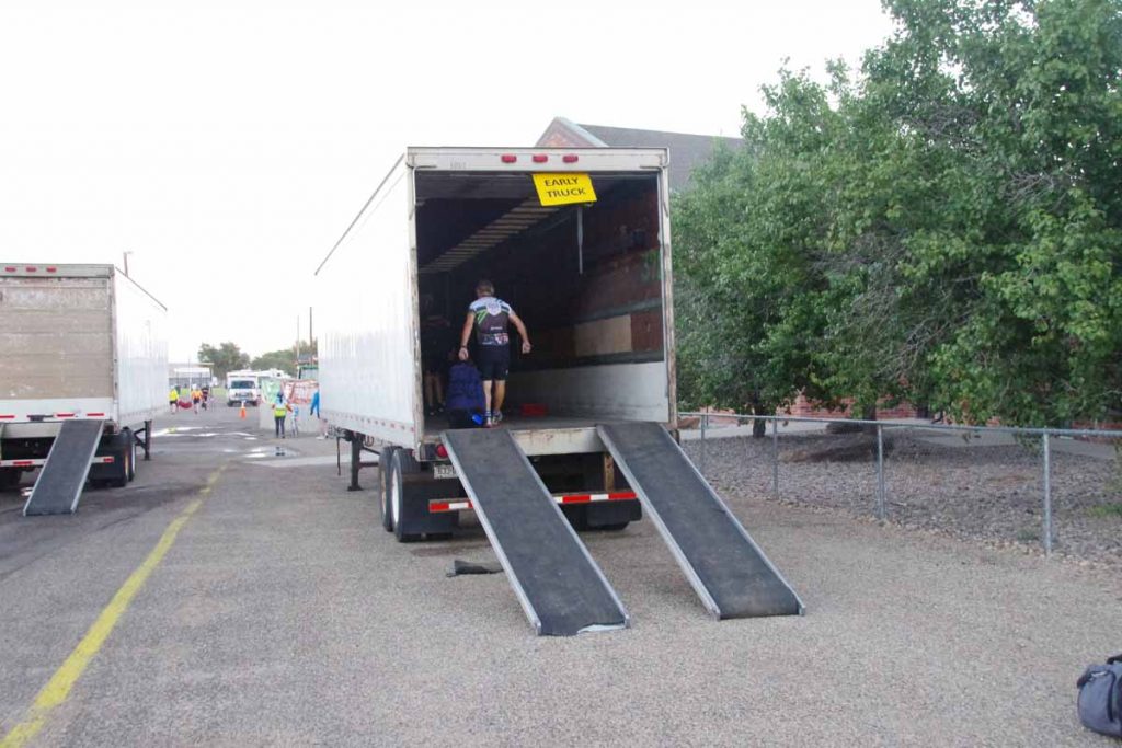
Once the luggage is packed it goes on the truck.
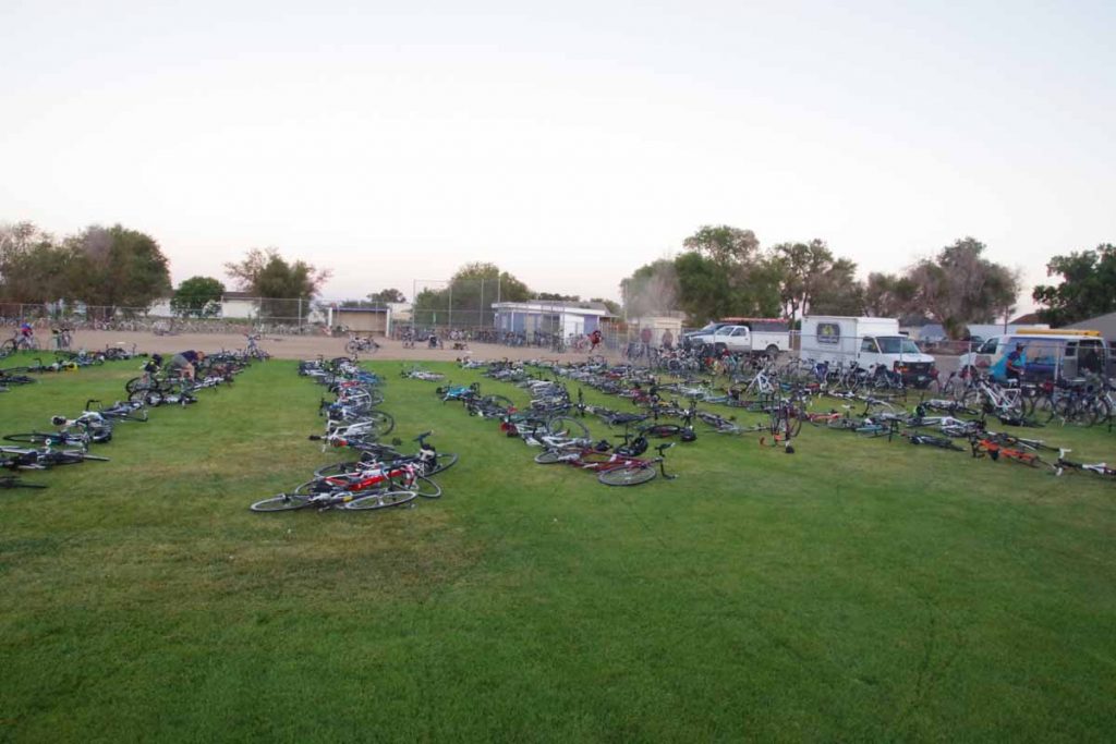
Time to pick up my bike from the “bike corral”. In this case it was a fenced off field with local volunteers checking stickers on the bike with our wrist straps to see that the numbers matched.
After that we were off and cycling.
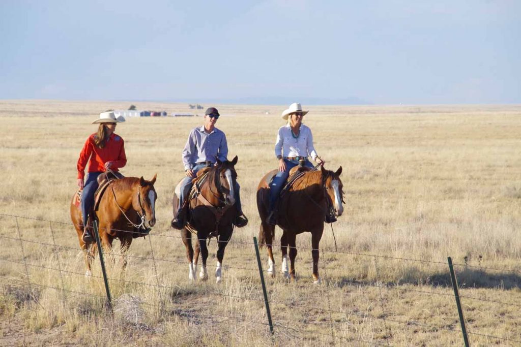
Local horse riders that we saw along the way (I think they specifically decided to do this to show the cyclists, but not 100% certain).
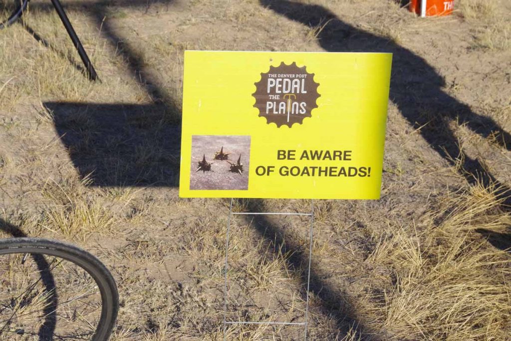
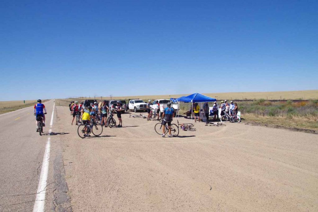
Rest stop warned us about goat head thorns.
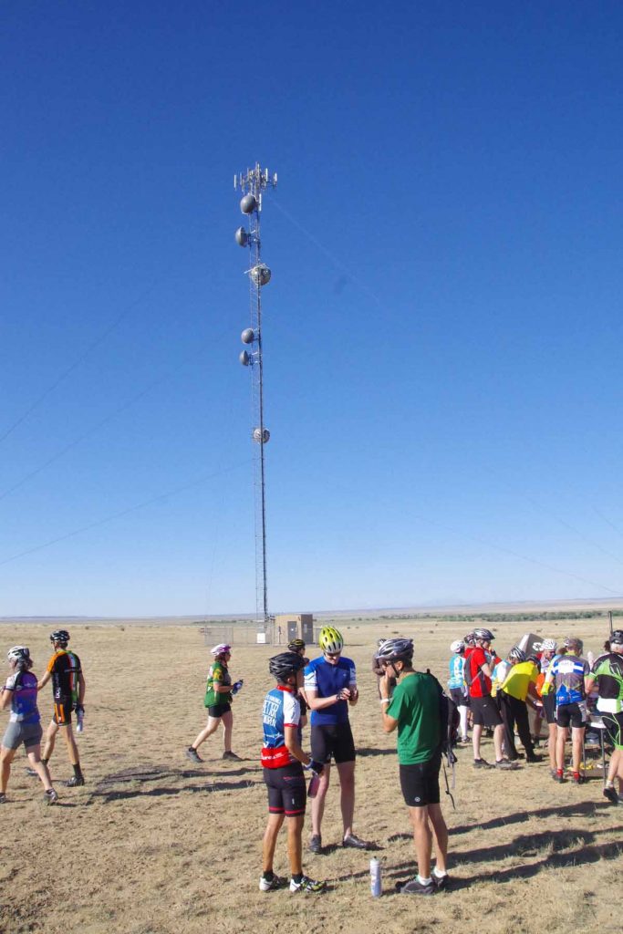
This rest stop was at a local cell phone tower. Viero Wireless, a carrier focused on the plains, was a sponsor and also did this educational stop.
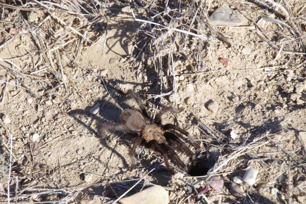
It was tarantula season and these guys were big.
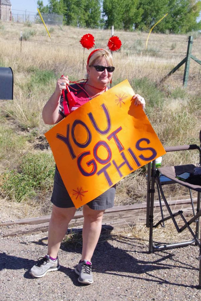
Local encouragement.
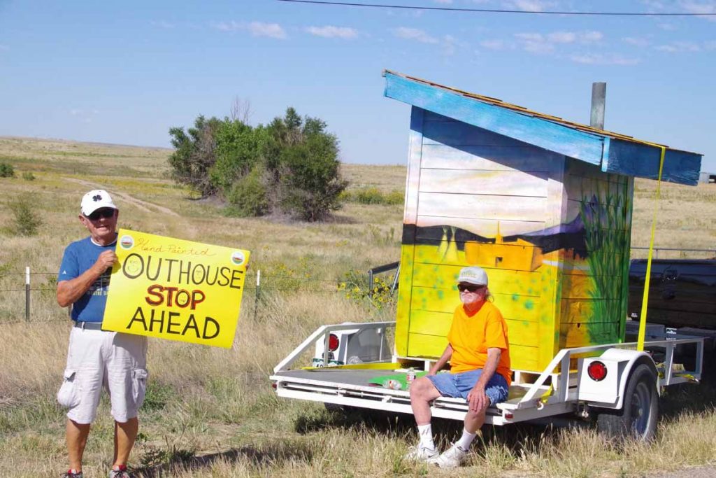
One of the art themes this year was this outhouse. They brought it out along the way as well.
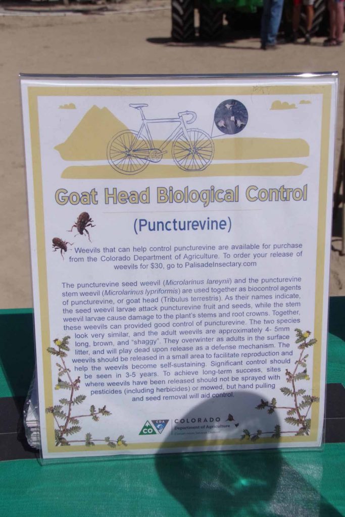
This educational stop had a description of weevils one could purchase that help eat and control goat head plants.
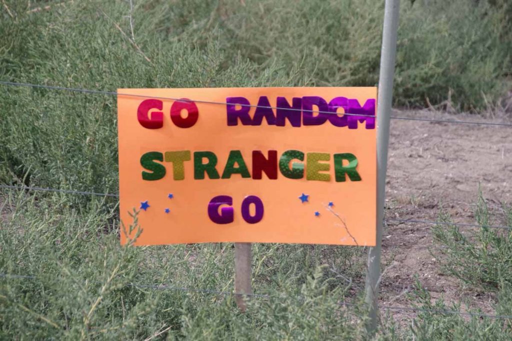
More encouragement.
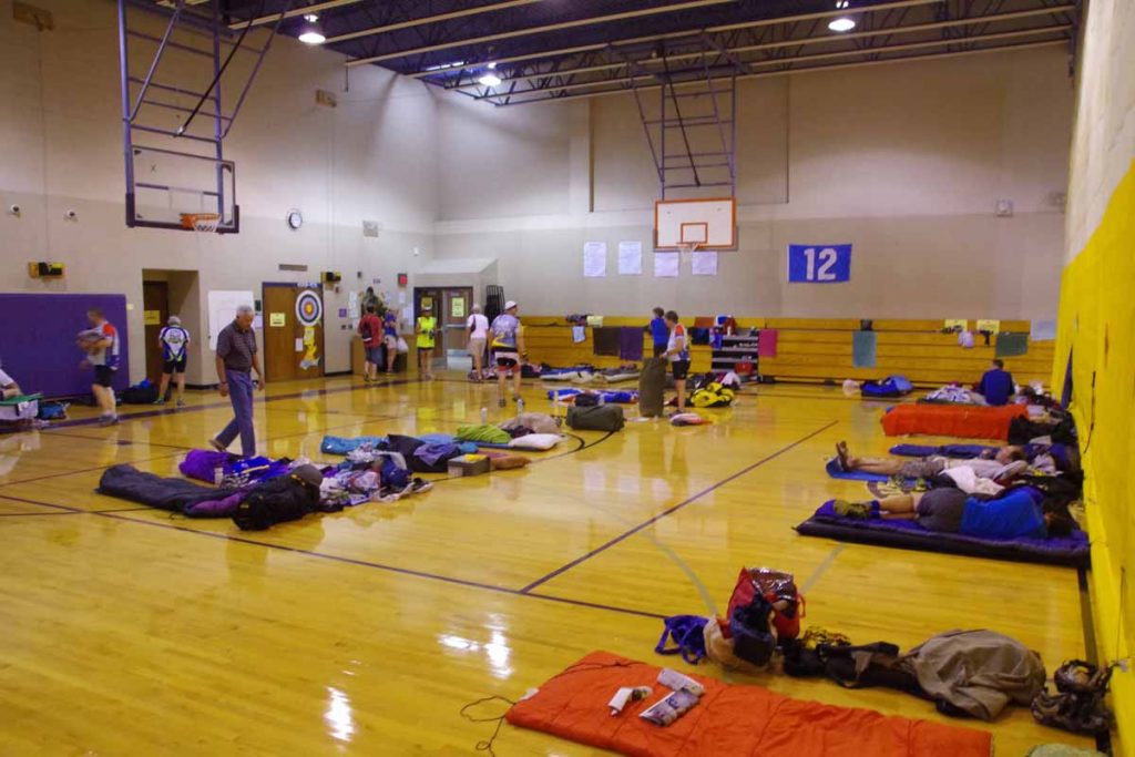
End of the day in La Junta, this time showing the indoor campers. The gym was split into “early risers” and “late sleepers” with different times the lights went on and off.
Our camping area.
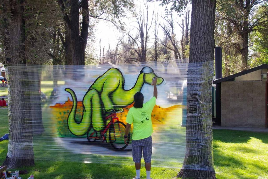
Artist finishing his work.
Day Three
Our third day cycling agenda was 71 miles.
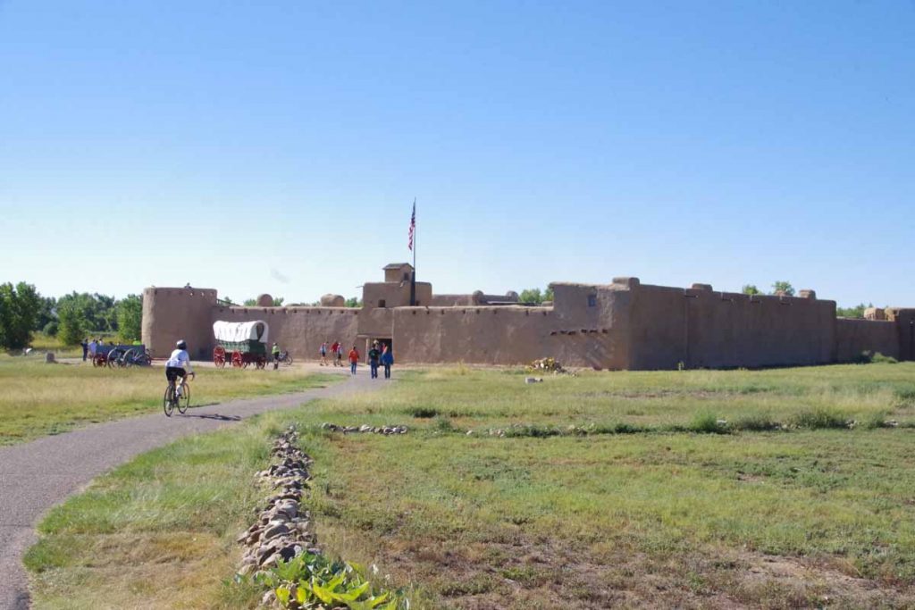
One of the educational stops was Bent’s Fort, a National Historic Site. It was rather interesting place to look around as well as learn the history.
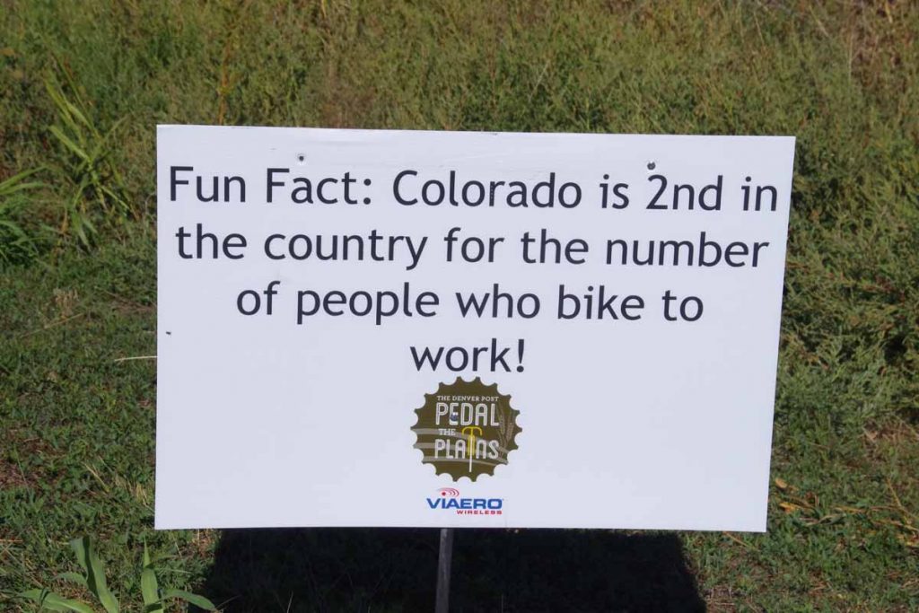
Example of educational signs that are placed along the way.
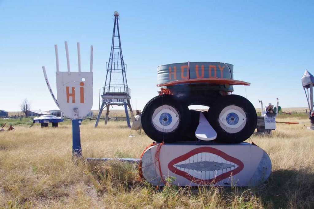
Not a formal stop, but this farm had someone pretty talented in creating this local display.
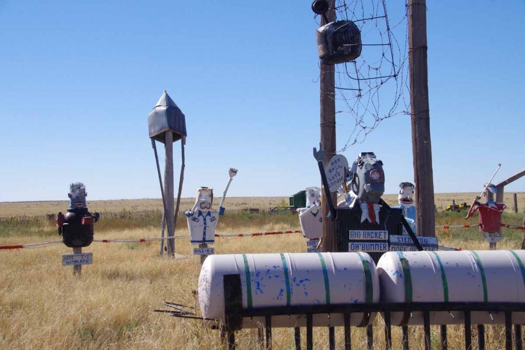
Some political themes to it as well.
This educational stop was done by cattlemen’s association telling us about beef industry.
Another volunteer directing traffic.
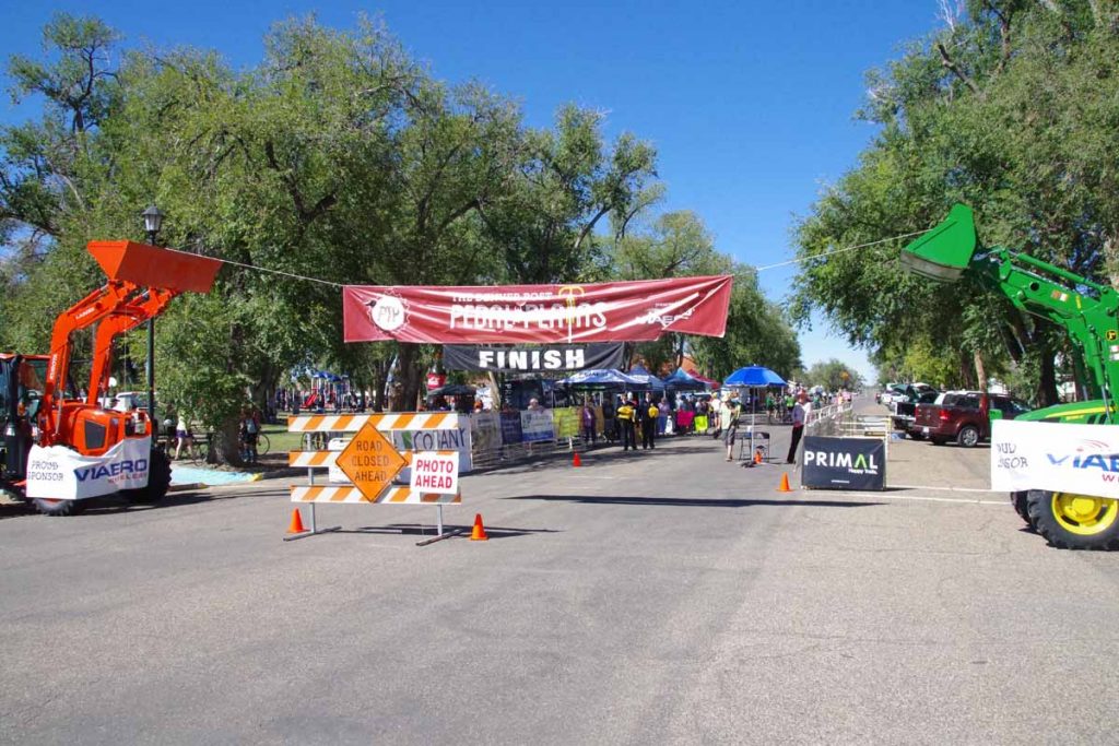
Finish line at end of the ride.
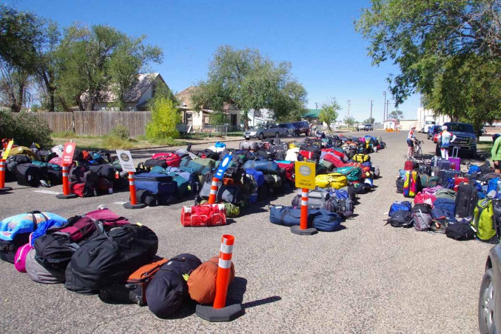
Time to pick up luggage from where it had been unloaded.
Overall, it was a fun ride and well organized. I still really enjoy coming through these little towns as well as nice hospitality. Also a nice little intermission from my overall journey which I will now go back and resume.