
When eating an elephant take one bite at a time. — Creighton Abrams
My goal is to cycle across the Americas from north to south. However, plenty of things could go wrong that prevent me from reaching that lofty goal, and I want to focus on more immediate steps in front of me and thus approach this trip in a more incremental fashion. Just as one eats an elephant one bite at a time, I’ll approach this trip one section at a time and then adjust based on what I learn.
I have roughly divided the trip into phases, with current thoughts described below. As each phase approaches, this gives me a chance to refine the plan and even break later phases into smaller and better defined phases.
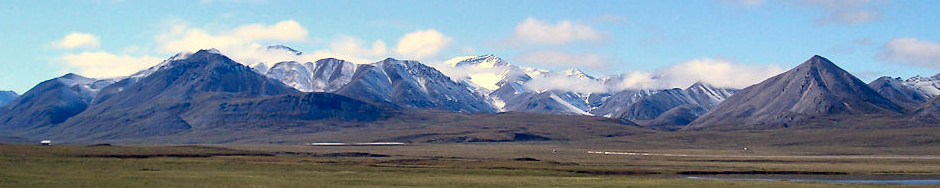
Phase 1 – Riding from Prudhoe Bay to Banff
Plan is to start in Prudhoe Bay at the summer solstice. The first 500 miles to Fairbanks, is mostly gravel, but also a ride I rode once before in 2005. I’ll ride my Trek 520 Touring bike. After Fairbanks, plan is to cycle down the Alaska Highway via Whitehorse to Watson Lake. I also rode this section once before in 1997. After Watson Lake, follow a new route, the Cassier Highway through British Columbia and end up via Banff. Hope to cross to the Canada/US border before Labor Day.
This first phase is a bit of a “training ride” in countries that are easy to travel through (US and Canada) as well as some familiar roads. Hopefully this helps ease into the trip as well as help me sort out some of my equipment choices.
Phase 2 – Great Divide
After the US/Canada border, I’d like to switch try cycling the Great Divide Mountain bike route (GDMBR). This route mapped by Adventure Cycling, is along rough unimproved roads that can be remote. I will hence switch to using my Trek 4500 Mountain bike. If the GDMBR is either too rough or the mountains start getting cold/snow later in the fall, then I’ll back off from the unimproved gravel roads and instead follow some of the larger paved roads that are close to the same route. Eventually this route ends up at the Mexican border in southern New Mexico. Depending on my timing, I might take a short break, and then cross the US/Mexico border near Baja in November/December.
This second phase is a bit different type of “training ride”. Still in familiar country, but now rougher roads and on a mountain bike instead of touring bike. After completing the first two phases, this gives me a good chance to stop and decide my preferred bike for Latin America. I’ll also use this as a checkpoint to finalize any equipment I might need based on what worked, what broke and what I didn’t use.
Phase 3 – Baja
Plan is to cross out of US between Thanksgiving and New Years and spend 330+ days outside the US in 2017. There is primarily one paved road through Baja. A new backroads route, Baja Divide has recently been mapped and there is an organized ride inaugurating this on January 2nd, 2017. I considered this but on reflection of the Great Divide Mountain bike route, realize I prefer the tradeoff of having a smoother ride over more remote riding.
I’ve read a number of journals about cyclists riding Baja and they paint a picture of many miles of desert separating small oasis along the way. Approximate distance is ~1500km.
Phase 4 – Mexico
From La Paz near tip of Baja, I’ll take a ferry across. There are at least two ferries: one to Topolobampo and one to Mazatlan, 450km further down the coast. I’ll see what is available when I arrive and could take either one. After this, the road to Durango has a bad reputation as does the Mexican state of Michoacan and hence will pick a route that avoids both, most likely going via Guadalajara and close to Mexico City and staying closer to highlights. After bypassing Mexico City, next destination is Puebla. From Puebla is a choice: either a more southerly route via Oaxaca and then Pan-American Highway parallel to the Pacific Coast or a more northern route via Chetumal and then Belize City.
Riding to Belize is tempting as a brief respite in English-speaking country as well as chance to refresh the bike, but will see as I get closer. Approximate distance is ~2500km.
Phase 5 – Central America
My destination for this phase is Panama City. I expect a mix of Pan American Highway and following smaller roads, particularly where I can find other cycling journals. More details to be determined as this phase gets closer. Approximate distance is ~3000km.
There is no road between Panama and Columbia. Instead the Darien Gap is 100+ kilometers of swamp and an entire different class of adventure to cross. Most other tourists take boats around or use it as a chance to fly across. I haven’t yet figured out whether I’ll find a boat/ferry or use as a chance to briefly fly back to US, regroup and start afresh in Columbia.
Phases three to five should be a good immersion into cycling into predominantly Spanish-speaking areas as well as less developed areas as compared to US and Canada. On reaching Panama, should also be a good time to figure out what works and how to adjust before South America.
Phase 6 – South America
This phase remains to be planned in more detail based on previous learnings. I’ve got some rough ideas in the faq/where page following the popular routes down through Columbia, Ecuador, Peru, Bolivia, Chile and Argentina. I have also watched with some interest as TDA had their first Cartagena to Ushuaia bicycle trip in 2015. TDA does a good job of supporting that ride, though reading the blogs it is clear it also makes for a very intense trip (at least compared to one you go at your own pace and stop when you need to stop). The TDA trip starts from Cartagena in July 2017 and I expect to be ready to start South America before then.
Hence, my likely plan is to travel self-supported on first parts of South America and join TDA at end of their trip in Patagonia. I’m signed up for the Puerto Montt to Ushuaia segment with TDA.
If all goes well, I will finish in Ushuaia at the December Winter Solstice 2017, 18 months and 15,000 cycling miles from where I started.