Nice to be on the road again after a week in Smithers.
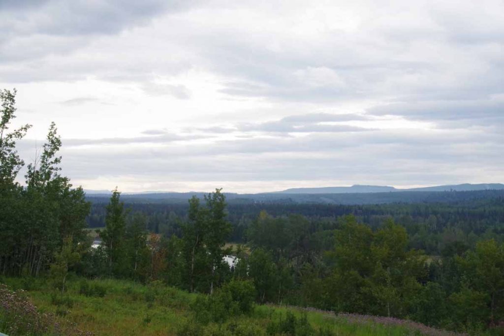
Fewer big peaks to pass by today as the landscape flattened out some. However, still some hills to climb up and over as the road mostly followed the Bulkley Valley.
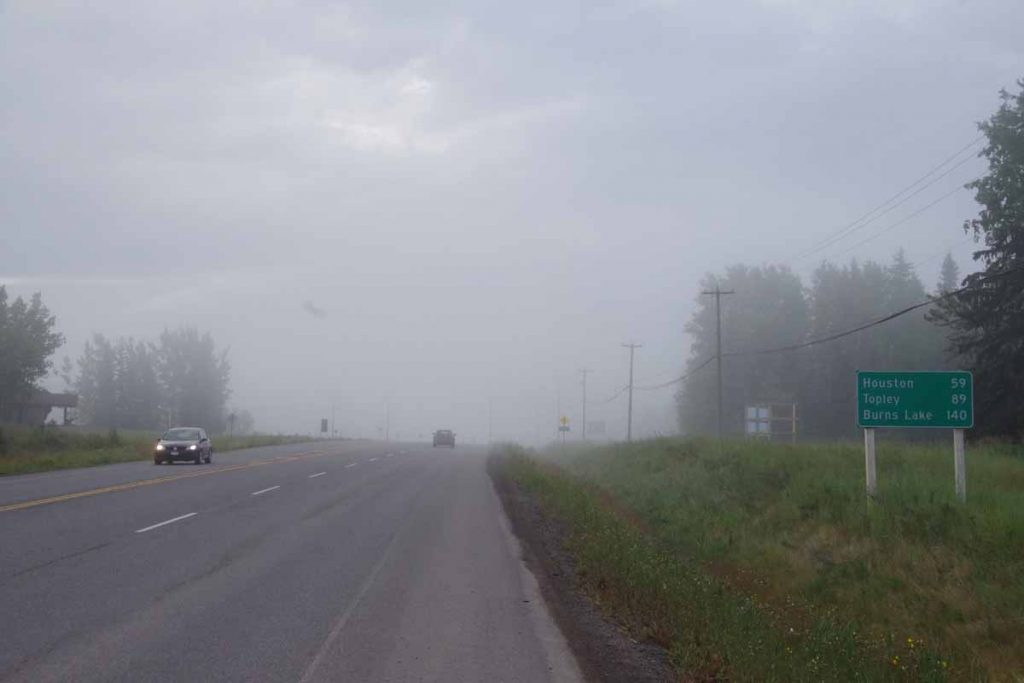
Foggy in the morning as I started out. The road sign gives a good idea of the overall agenda: Houston for lunch, Topley as destination and Prince George in a few days. The bike rode well and even “clicked” as the spring forced the new pawls out. I could definitely notice the difference and had no skip issues today.
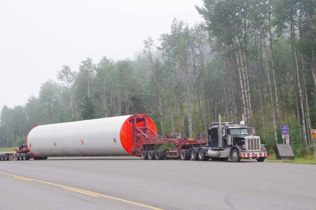
Photo above shows some of the sometimes large things that are moved on the road. Something this big has a pilot car, but things only somewhat smaller pass with mostly just a “wide load” sign. Fortunately, a reasonable shoulder on the Yellowhead Highway and traffic is also considerate.
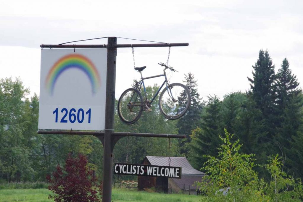
At 15km was Telwaka and shortly after that was what looked like some cabins with the following sign out front. Of course had to get a photo of this which is second time I’ve seen a bicycle-specific welcome sign (the first was on Cassiar Highway before Irkut but it was cold and rainy and I was concentrating on keeping warm).
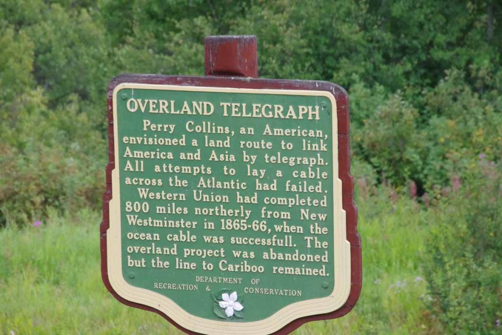
Also not too far from Telwaka was a rest area that had some signs including this one about an overland telegraph. It surprised me that bridging the Pacific would somehow be seen as easier than bridging the Atlantic. However, also gave good idea of importance of telegraph lines a little over a century ago – perhaps equivalent of “fiber” today.
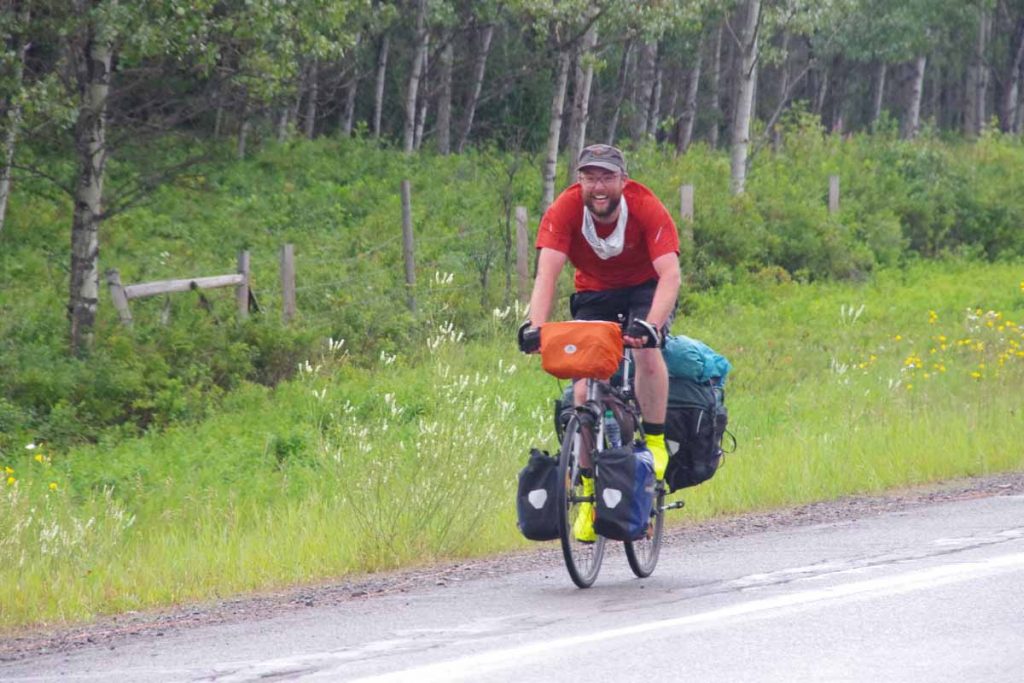
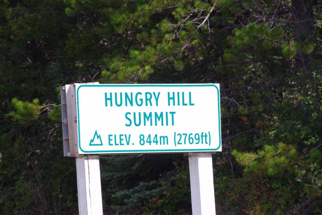
Close to 25km it began to rain for a while. The road also had a few hills to climb over. Fortunately, it was mostly done by 35km when I caught this cyclist coming down the hill. He was headed to Juneau. I asked about hills and he indicated the one he had come down was the largest. Shortly thereafter was a somewhat steep ~3km and then flatter ~5km to reach top of Hungry Hill.
After climbing the hill a good descent back to the Bulkley River and I was nearing Houston. The road shoulder had some more debris, particularly rocks and parts of logs – but was mostly still rideable. Without too much difficulty made it to Houston for lunch.
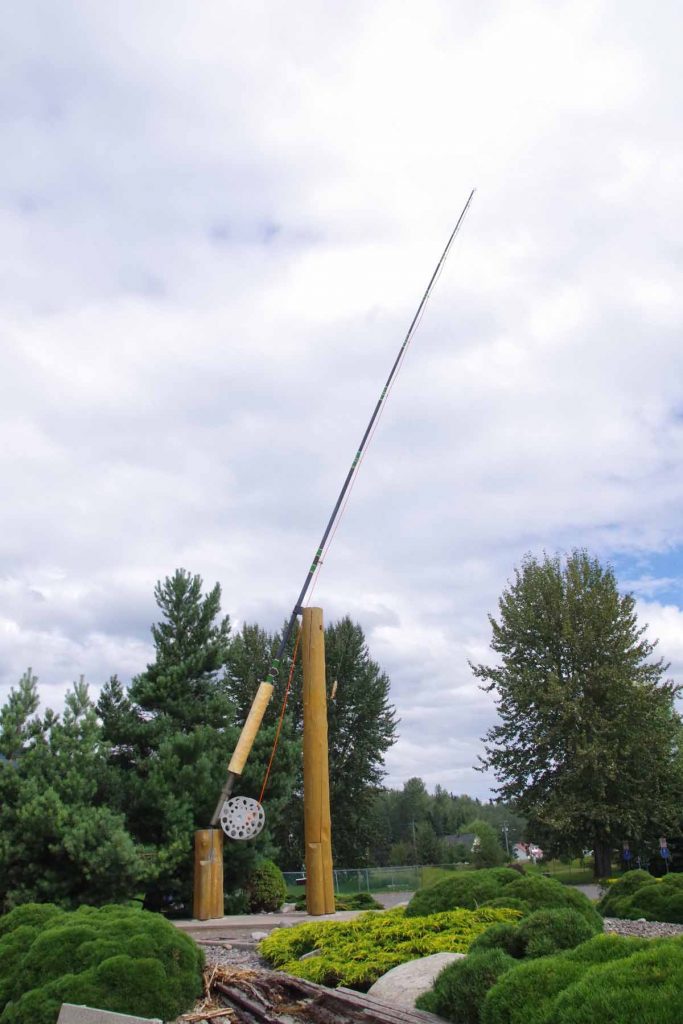
A claim to fame for Houston is the “World’s largest fly rod” as shown here outside the visitor center. The power was out so one restaurant was closed but Subway was able to make sandwiches. Had a sandwich and took a leisurely lunch before getting back on the road.
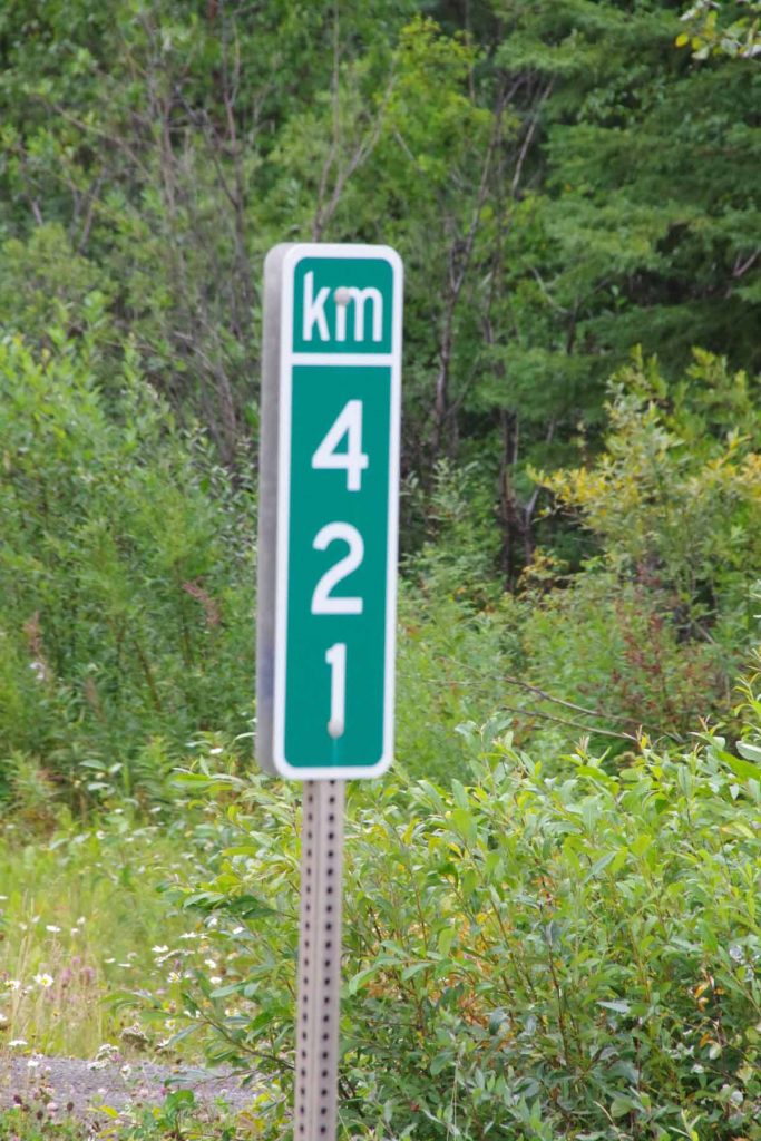
Passed kilometer post 420 (no sign) and then 421 (sign), on a road that normally places signs every 5km. The last 30km was mostly flat with a slight uphill grade as the road followed the drainage uphill.
At 93km was turnoff to Granisle and a store, motel and closed restaurant. I didn’t expect much in next 50km until Burns Lake so figured it was good place to stop for the day.