Elevation on way to Puno

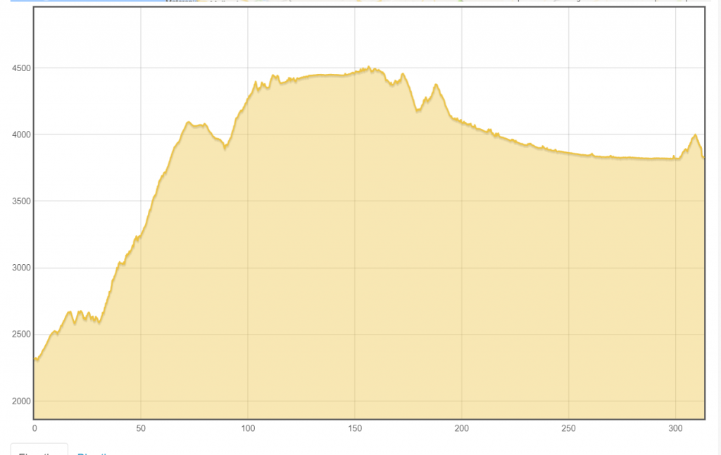
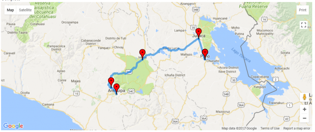
I have been looking at the elevation profile on way to Puno as well as likely places to stop along the way.
Around 25 kilometers down the road is Yura, elevation 2590m/8500ft. This is last place with a hotel for a while.
Around 130 kilometers is Imata, next medium sized town at elevation 4451m/14,603ft. Weather forecasts for Imata seem to have high temperatures around 15C (59F) and lows around -5C (23F) with it warming rapidly after the sun comes up.
It looks like there is also a village around the 80-kilometer mark at that little dip below 4000m/13,100ft on the elevation profile.

Following is a summary of key elevations along the route. It is not *that* much more than I’ve been before, but the trick is to avoid climbing too quickly and give my body some time to adjust to the altitude – while also covering these gaps between villages so I don’t have to carry too much food/water. It is right around 100 kilometers where the road is above the 4000 meter mark and I’ll be camping somewhere once or twice in this gap.
| Elevation (meters) | Elevation (feet) | Description |
|---|---|---|
| 5328 | 17480 | Highest elevation I've been, in a bus; Tanglang La Pass in the Himalaya |
| 4396 | 14421 | Highest elevation I've hiked, Mount Harvard, in Colorado |
| 4200 | 13800 | Typical elevation I found myself much more short of breath hiking in Colorado |
| 2328 | 7638 | Arequipa starting elevation |
| 2590 | 8500 | Yura, last hotels |
| 4451 | 14603 | Imata, village near high point |
| 4528 | 14855 | Highest point on road to Puno |
| 3810 | 12500 | Puno, elevation |

Good luck and keep breathing!
Hey Mev? I haven’t seen a update in 5 days. I hope everything is fine.
–Frank
Been a little concerned that things have been quiet. Hope all is well.
Made it to Puno. No internet between Arequipa and Puno. Blog post with more details underway.