↓
 

A bicycle ride across the Americas

from Deadhorse (SCC) to Ushuaia (USH)

  • Home
  • Plan
  • Blog
  • Photos
  • FAQ
    • Why?
    • Where?
    • What next?
  • Map
  • Equipment
  • Calendar
  • Countries
    • USA
      • Alaska
      • Montana
      • Wyoming
      • Colorado
      • New Mexico
      • Arizona
      • California
      • Texas
    • Canada
    • Mexico
    • Guatemala
    • Honduras
    • Nicaragua
    • Costa Rica
    • Panama
    • Colombia
    • Ecuador
    • Peru
    • Bolivia
    • Chile
    • Argentina
  • Weather
  • Links
  • Contact
Home→Tags bike shop

Tag Archives: bike shop

Sun City

A bicycle ride across the Americas Posted on 2016-10-13 by mev2016-10-13

Spent the day crossing the Phoenix metro area. I’m not all the way through yet, but at least on the northwest side outbound. As cities go, crossing was straightforward, aided in part by a lot of riding on bike paths along the Arizona Canal.
imgp4255
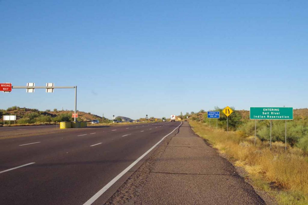
Started back on US 87 with slight descent as I came through the Indian reservation and then to eastern parts of Scottsdale.
imgp4258
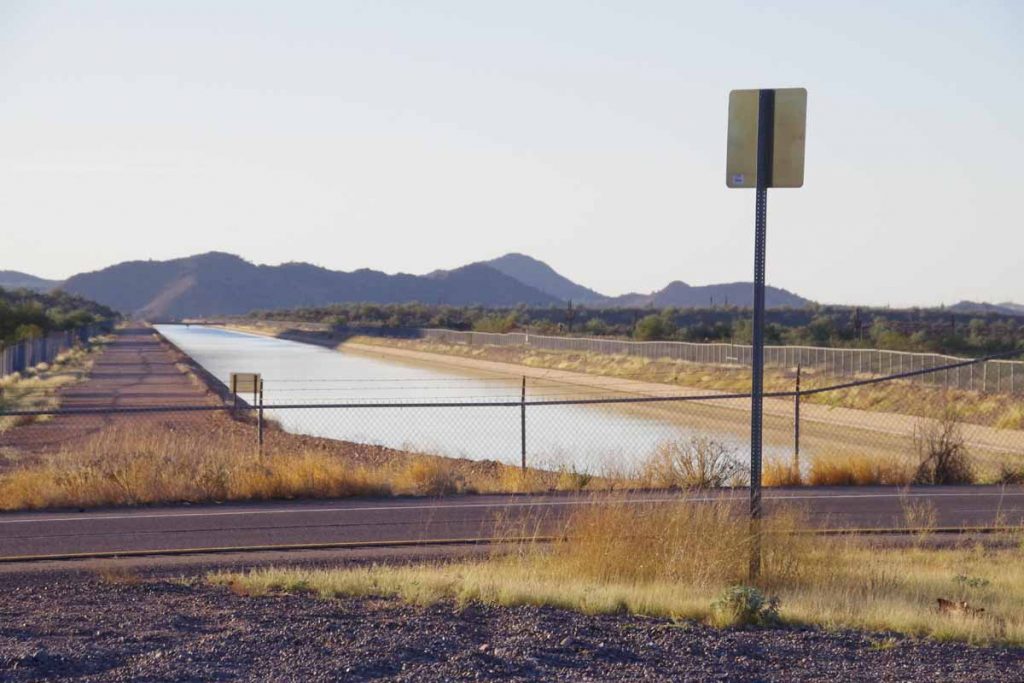
I crossed two larger canals, though access routes along them were blocked.
imgp4260
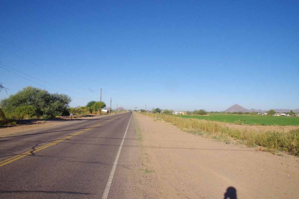
At 11 miles, turned west along flat open country.
imgp4261
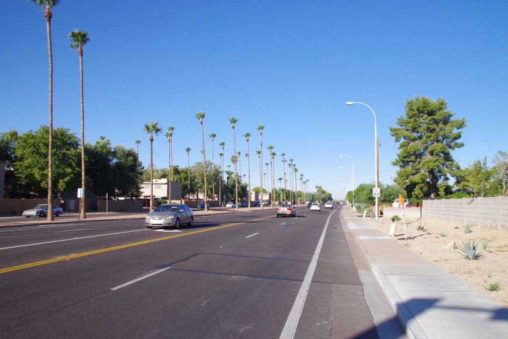
A few miles later and I was on these large boulevards as I came into Scottsdale proper. Stopped for a bit at a McDonalds and figured out my overall routes. I was also waiting just a bit until the bike shops would open.
imgp4262
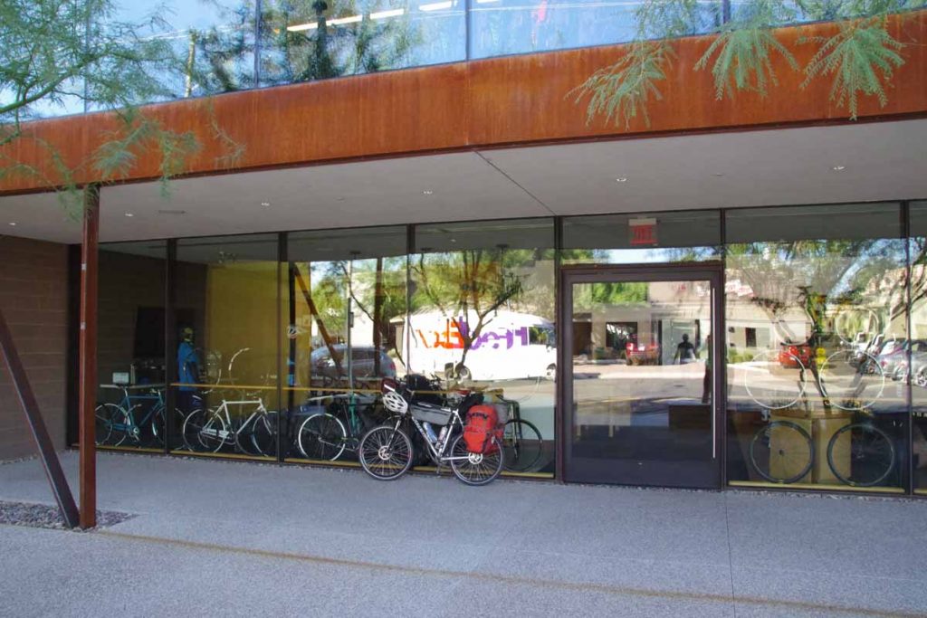
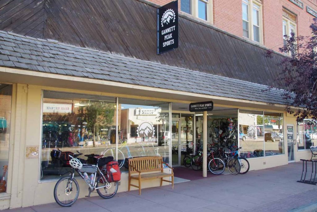
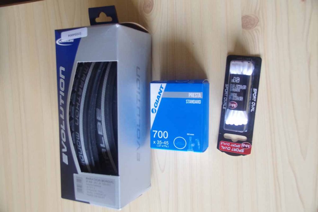
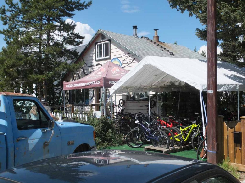
I found a shop named Bicycle Haus and was there when they opened at 10am. Yesterday I had noticed my front brake pads were pretty much worn. Still fine on the ride, but with a lot of the descent, their stopping power was diminished. So I had both front and back brake pads replaced. Also checked the chain which wasn’t very stretched yet. I was happy they were able to check the bike right when I came in.
aimgp4264
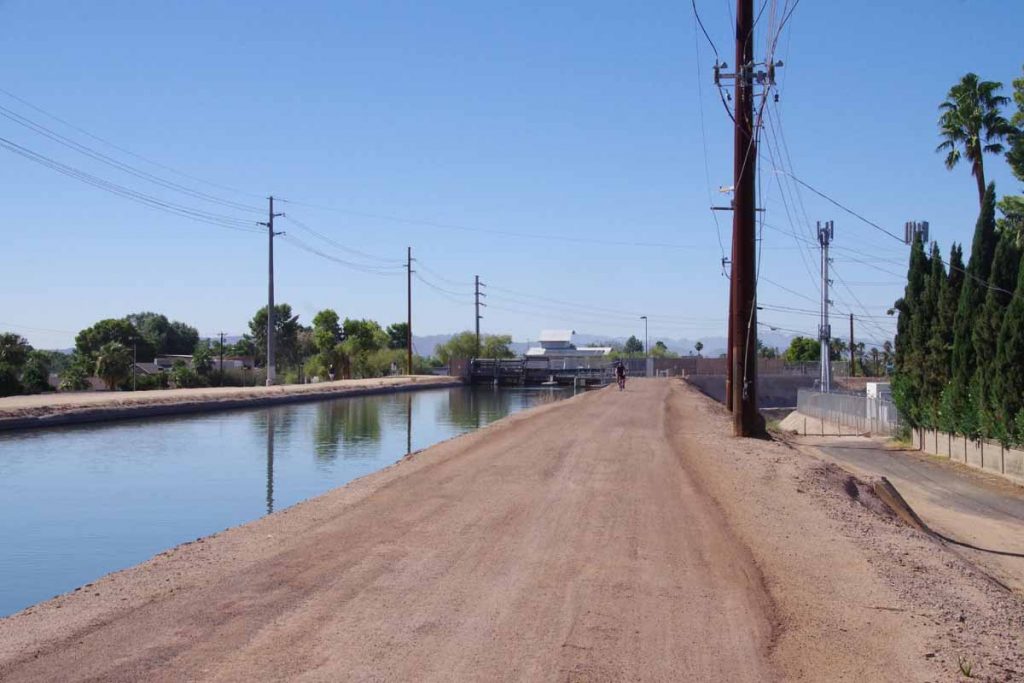
I now found myself to the Arizona Canal and followed it using the Google Maps instructions. Every few miles it seemed to have me switched sides. Also this part of the canal was not paved, but the hard-packed gravel was easy to ride. The Adventure Cycling route was a mile or two further south, I believe since they avoid gravel, whereas Google Maps bicycle instructions much more easily pick gravel roads.
imgp4265
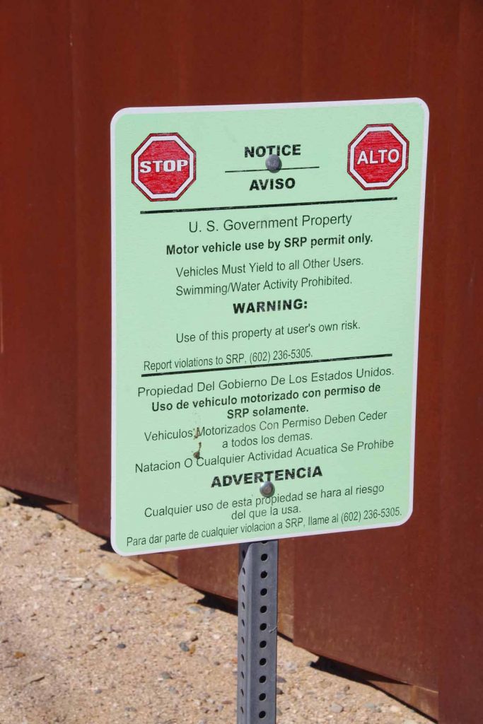
Signs along the canal.
imgp4266
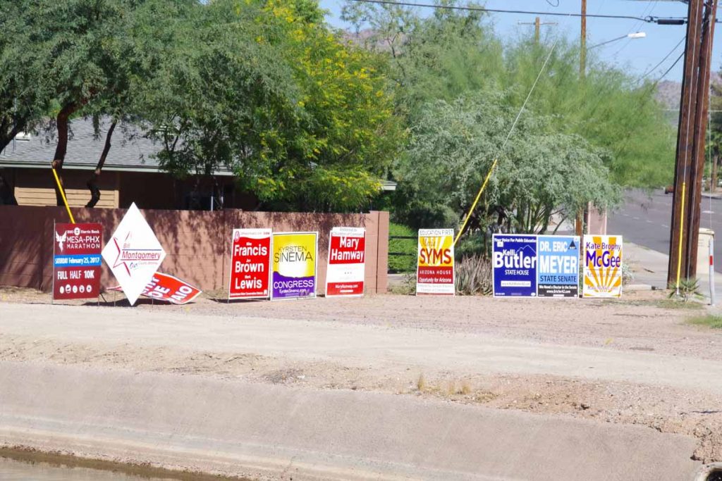
The intersections also seemed to have a lot of political signs. Definitely more now here in Arizona than I’ve seen elsewhere.
imgp4267
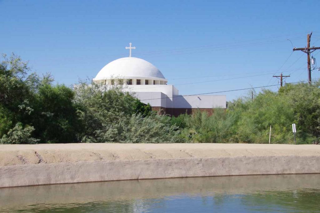
Around the 32 mile mark, I came past this Greek Orthodox temple and this also marked the point where the Adventure Cycling route joined for real – and the canal route stayed paved.
imgp4269
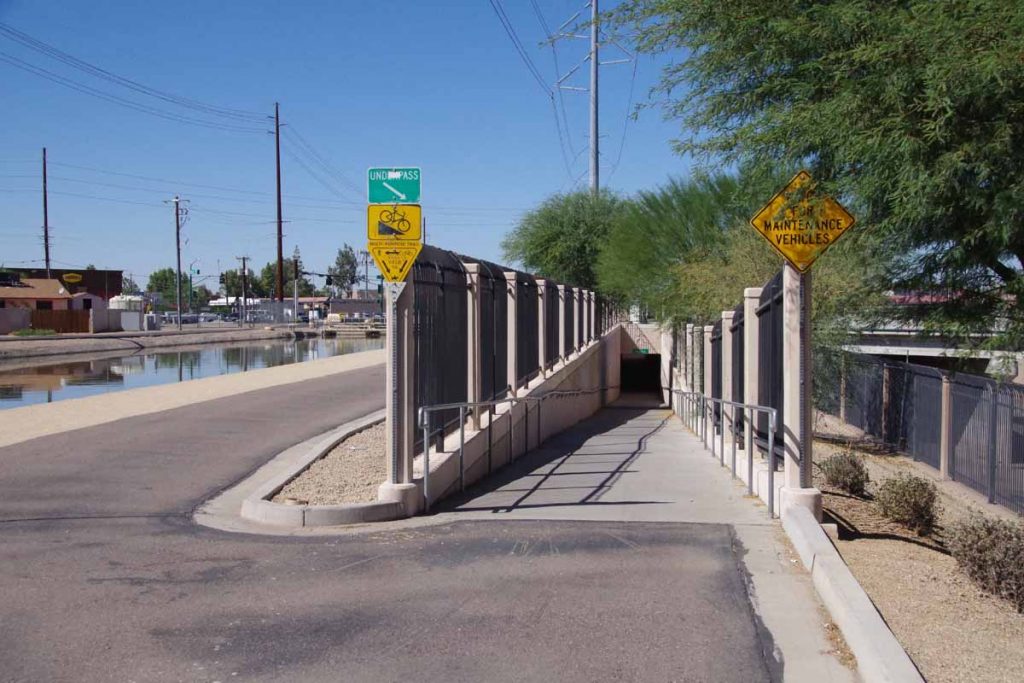
There weren’t many cross streets but pretty much most of them had these underpasses, which was nice to keep traveling along the route. There were homeless people in the cool shade of a few of these tunnels, but still enough room to travel past. The temperatures got up to low 90F (32-33C) so warm but not abnormally so. Gradually there were fewer tunnels and more streets I needed to cross normally. Eventually, got to end of the canal route.
imgp4271
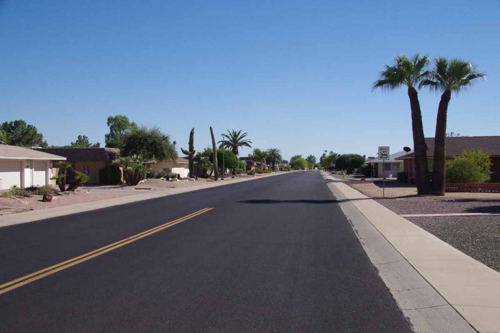
Here the route brought me through some neighborhoods like this one.
imgp4272
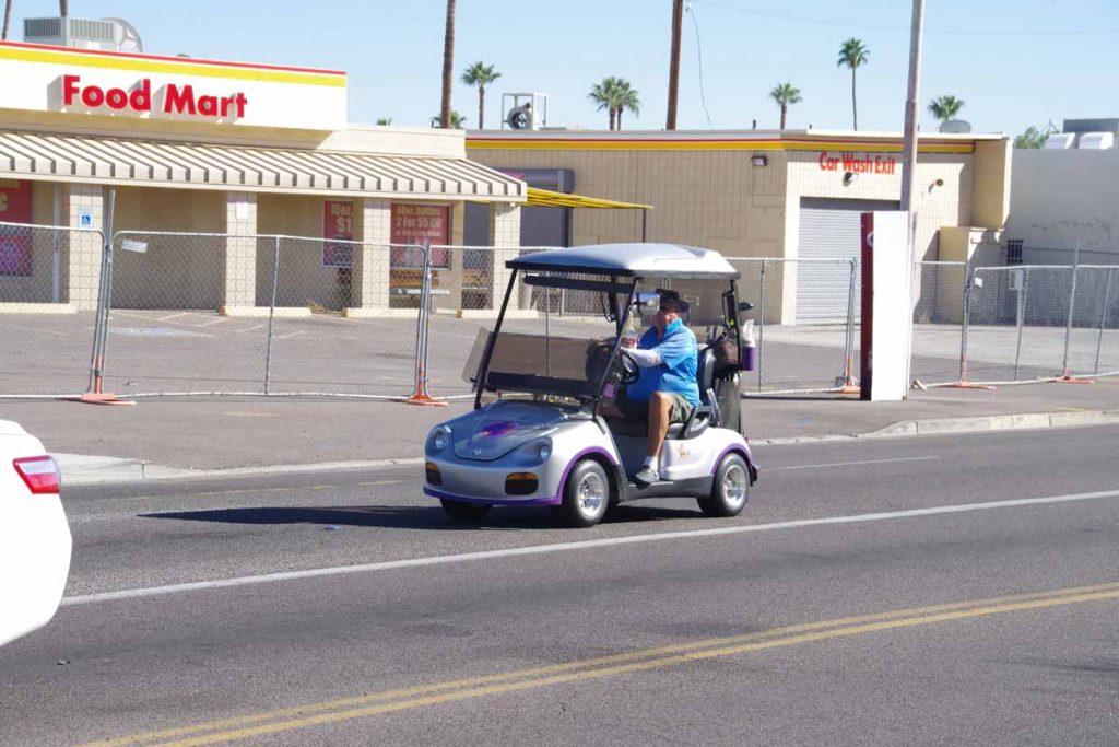
What I did find interesting is more people driving on city streets with their golf carts like this fellow.

Eventually found myself at edges of Sun City and turned onto US 60. Major highway again headed outbound, but hopefully good shoulders and not too bad to finish departing the city. I’ve also now finished “map 15” of the adventure cycling route so 14 maps from here to San Diego.

Posted in Arizona, USA | Tagged bike shop, canal, crossing city

Lander, wide open spaces

A bicycle ride across the Americas Posted on 2016-09-10 by mev2016-09-10

Higher than average miles today (75 miles) but still an easy day as winds and elevation drop were favorable.
imgp3767
Today was a day with 45F (25C) temperature swing. Morning was cold 34F but mid-afternoon was over 80F. Flag flying above meant I started out with tailwinds! While they didn’t last much beyond the first 20 miles, the wind and elevation drop made for a fast and easy start.
imgp3769
At 12 miles I crossed over onto Wind River Indian Reservation where I would ride for the next 58 miles. This sandstone was just a few miles after entering the reservation. Other than the entry/exit signs and a few shops, I didn’t necessarily notice that much different about this reservation.
imgp3771
Parts of it were still agricultural and other parts were wide open lands or grazing land. At 25 miles was Burris which mostly seemed to consist of a house and a sign and 5 miles later some more ranches near Crowheart.
imgp3772
Met a cyclist who started in Tennessee, rode to New York City and was now heading west. We traded information about the road ahead. Also had a snack at the Crowheart store. By now the wind had shifted some, occasionally a cross-wind or even slight headwind but fortunately not very hard.
imgp3775
There was a rest area at 41 miles that had this description of the wind. Mentioned on the sign are bighorn sheep. There is a bighorn sheep museum in Debois, but unfortunately their fall hours yesterday closed at 4pm and I just missed them. Three miles later, the road split.
imgp3777
The next mile was a bit of a climb and then I was out in the wide open spaces.
aimgp3778
Fort Washakie seemed to be a bit more of a town and had another gas station convenience store to stop. By now the road thermometers were over 80F and also a bit more traffic on the road. Cycled the last 15 miles to Lander. Lander is a pretty big town: over 7000 residents and first traffic lights I’ve seen since entering Wyoming four days and 200+ miles ago.
imgp3780
There is a large bike shop here, Gannett Peak Sports that gives an ice cream bar to touring cyclists (thanks!) and also had a log book that you could sign. Added my entry along with the others. They definitely get some traffic through here. Otherwise got out the maps and looked for next few days. Approximately two days cycling to Rawlins and then some different choices.

Posted in USA, Wyoming | Tagged bike shop, plains

Whitehorse, riding to the big city

A bicycle ride across the Americas Posted on 2016-07-12 by mev2016-07-12

I figured I would ride the 100 miles from Haines Junction to Whitehorse in two not very difficult days. I had cycled this road twice before both times in a day, but even then it was a long day.
IMGP2921
It was a cool morning and all was riding well as I departed around 7:30am. Past the airport and soon in the more rural areas. However, I did notice a few more “subdivisions” in this segment, so looks like more people are moving or putting summer cabins here. Around 15km, I could see a small patch of wet pavement ahead. Rather strange thing as I cycled into the sprinkling rain on the pavement and then 3km further it was dry again. It was as if a rain cloud had chosen just this small part of the road to water. Looking back I could see the rainbow in photo above.
IMGP2923
Otter Falls was at 32km and good spot to have a real breakfast. Friendly waitress who suggested I take the road past Champagne rather than the main road. Also a friendly and curious dog who mostly was trying to figure out if I’d give it a treat. The pavement was still good to this point, though started getting more chip seal after this. A few small hills to go over but overall going fast than previous days.
IMGP2924
At 59km signs told me of 8km of road construction. Lots of dust here and a hard surface that was tougher to ride. Fortunately, at 60km was the turnoff to Champagne. This was the old road until 2002 when a bypass was constructed. Champagne was a native (First Nations) village that was 5km into the road. This route was great! Not only was there no traffic, but the chip seal was similar in surface to the main Alaska Highway. I also got to skip 7km of dusty dirt road. There were two short steep hills but nothing too bad.
IMGP2925
The town of Champagne had a tourist information sign as well as this building with collection of hubcaps. Presumably, the collection is growing less now.

It was another 10km along the Champagne old road until I rejoined the Alaska Highway. I figured I would go a bit further and then find a spot close to water and camp for the night. Still early, but this way I would split the ride into two easy segments. At Mendenhall there was sign for B&B/Cabins that were now “closed” and at 90km was a wayside rest area but signs for no camping as well as no water.

However, 2km further the road crossed Stoney Creek. Found a lovely camp site where a side road went up to the creek and set up tent to relax for the afternoon. While I was there three different vehicles pulled up. Folks got out and either filled up water jugs and/or let a dog loose to frolick in the water. Apparently, this is where folks in Mendenhall subdivision get their water.
IMGP2930
Next morning got my bags together and set off a little past 7am. Right now I’ve got four panniers and am working through how I might reduce things to two panniers for the Great Divide Route. I should be able to do it, but will need to carefully sort through what I’m using and what not.

Start of the morning always seems to go quickly with a lot of energy and fairly quickly rode past the Takhini River Bridge.
IMGP2932
This area has a region known as the Salt Flats where local water has become very alkaline and also a number of small lakes such as the one above. Either the hills increased a bit after this or I my early enthusiasm was wearing less but was getting more tired once I passed the city limits sign.
IMGP2934
near 45km. However, city limits doesn’t mean city and I had more than 15km to go. Whitehorse struck me as an interesting small/big town. In the next section the town was small enough that they could list multiple signs with services: first the gas stations, then the motels, then the other services, etc. However, this went on for nearly 10km along the road and hence the big part of it.

Without too much difficulty, I got myself into the city center and found a motel. This is the first town in 1000km with a Walmart.
IMGP2935
More importantly, I got several key items in my shopping list: a tire, a tube and shoelaces. There are two bike shops in town.
DSCF1248
I stopped by both and was impressed that both had reasonable Schwalbe foldable tires. My front tire went flat just as I went to the motel, but plan is to put a new tire in the front, get ride of the one with sidewall tear and use my old front tire as a spare [there will be a quiz :)]. That should last until next town with a bike shop which I’m told is Smithers BC ~1250km from here.
DSCF1249
I was even impressed that the town is big enough there are bike lockers to rent and store a bike. I’ve wandered around to the Walmart, past the downtown as well as visited both bike shops. Plan for tomorrow is to take a rest day here and be a tourist before doing the next section to Watson Lake. It is nice being in a big city even if the population is ~25,000 or so.

Posted in Canada, Yukon | Tagged bike shop, rainbow, tire
©2023 - A bicycle ride across the Americas - Weaver Xtreme Theme
↑