↓
 

A bicycle ride across the Americas

from Deadhorse (SCC) to Ushuaia (USH)

  • Home
  • Plan
  • Blog
  • Photos
  • FAQ
    • Why?
    • Where?
    • What next?
  • Map
  • Equipment
  • Calendar
  • Countries
    • USA
      • Alaska
      • Montana
      • Wyoming
      • Colorado
      • New Mexico
      • Arizona
      • California
      • Texas
    • Canada
    • Mexico
    • Guatemala
    • Honduras
    • Nicaragua
    • Costa Rica
    • Panama
    • Colombia
    • Ecuador
    • Peru
    • Bolivia
    • Chile
    • Argentina
  • Weather
  • Links
  • Contact
Home→Tags continental divide

Tag Archives: continental divide

Quemado

A bicycle ride across the Americas Posted on 2016-10-06 by mev2016-10-06

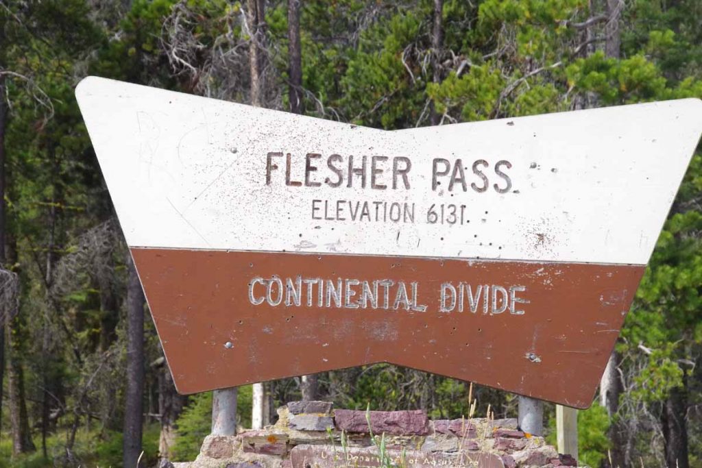
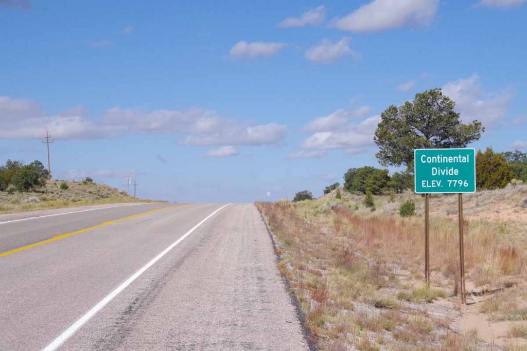
Crossed the continental divide and back in the Colorado River drainage.
imgp4192
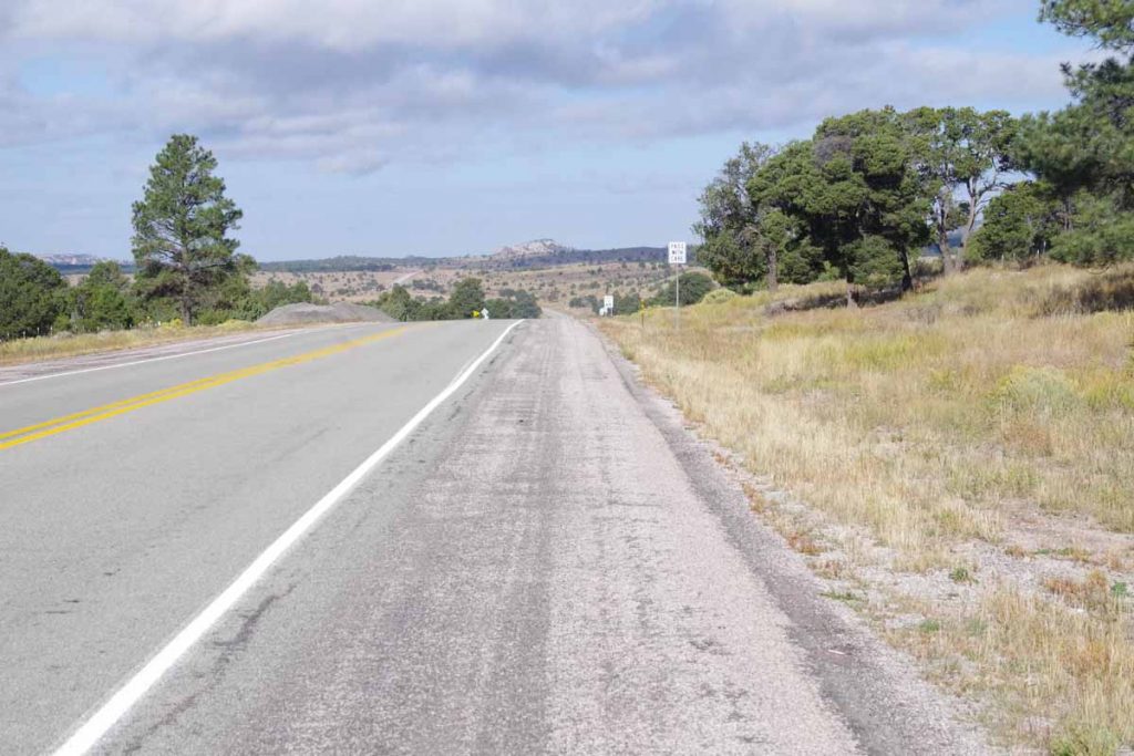
Datil is at 7300ft. First 11 miles were a gradual climb to 8095ft elevation, mostly following a drainage with scrub trees along the way. Photo above was as I crossed the high point.
imgp4193
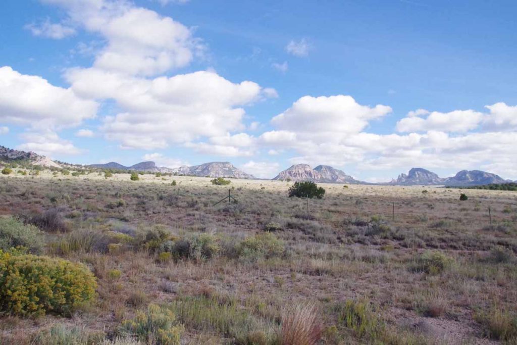
The Datil Mountains were now to my right. It was across some drainages and a net drop of a few hundred feet before I crossed the continental divide.
imgp4195
A few miles later, I reached Pie Town. With a name like that, no excuse to at least stop and have some pie.
aimgp4200
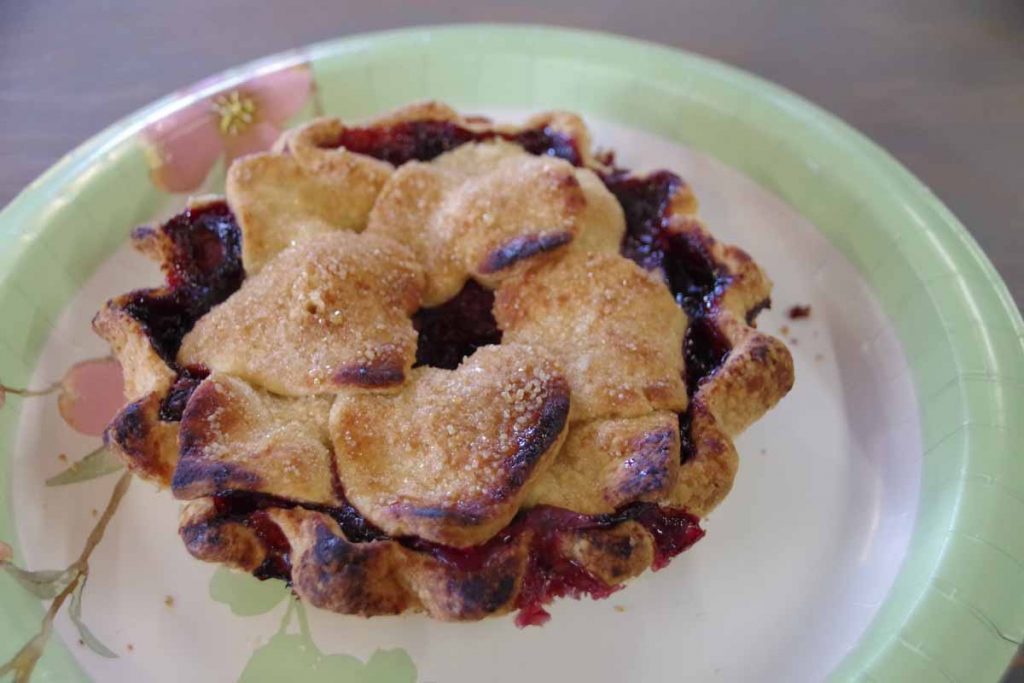
I had a small “very berry” pie. Pie Town is also a crossing point to the Great Divide Mountain Bike Route. While I didn’t see other cyclists, I did have a local give me directions to the “Toaster House” – a local cyclist-only lodging listed on the GDMBR maps.
imgp4199
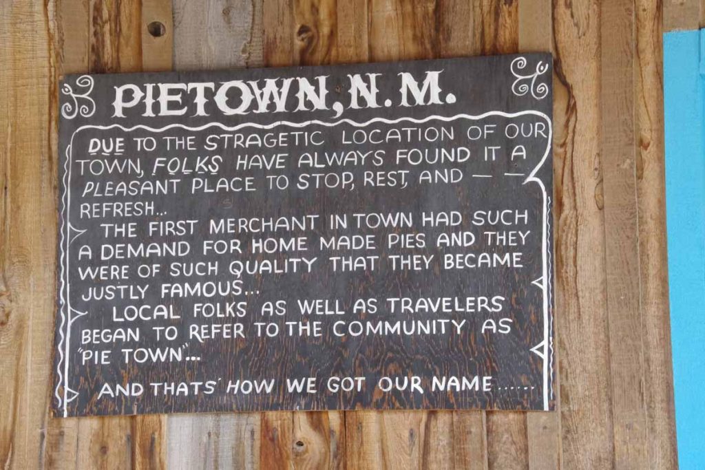
Here is the story of how Pie Town got its name. There were actually three cafes in town, though only one was open when I arrived.
imgp4201
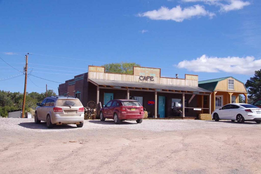
This is the one I ordered the pie above.
imgp4198
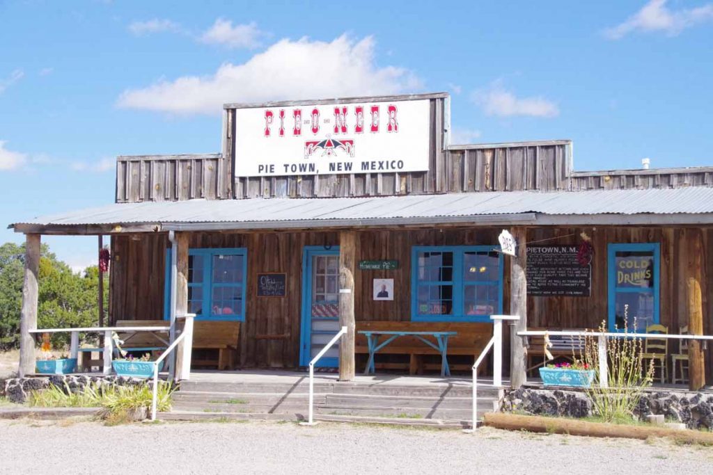
The Pie-o-neer was opening later in the day.
imgp4202
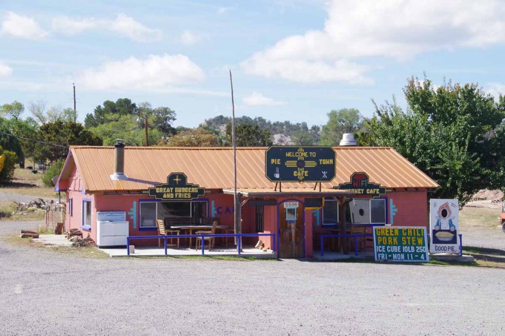
The cafe was the third place. All three seemed to advertise pies so I wasn’t the only one getting pies.
imgp4203
After this another 22 miles with ~1000ft of net descent as I cycled through mostly open countryside. Light headwinds again as this seems to be a consistent weather pattern.
imgp4204
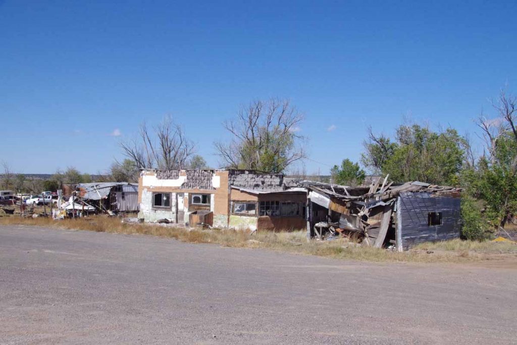
Part way along was a settlement known as Omega. Buildings above had seen better days.

After this came into Quemado, “home of the Eagles” and otherwise a small main street.

Posted in New Mexico, USA | Tagged continental divide, pie, wind

Helena, two easy days

A bicycle ride across the Americas Posted on 2016-08-31 by mev2016-08-31

Two easy days riding to Helena.
IMGP3601
I was slow getting started from Lincoln. I hadn’t taken a rest day since Banff and thought of taking a day in Lincoln, but in end decided on two easy days instead. The agenda for the first day was to ride over Flesher Pass. Turned out not too difficult as it was only 1600ft higher than Lincoln.
IMGP3602
Eleven miles on the main road before turning to road 279. There was quite a bit of construction traffic, but fortunately the trucks were only going one mile down the road. After that it was a slow steady climb for 9 miles to the summit. My cycle computer rarely said over 6% so it was a case of shifting into low gear and slowly riding up.
IMGP3604
Getting close to the top, here was the view looking back on the road.
IMGP3605
Official summit sign here.

After that a reasonable descent that brought me down into Canyon Creek. The creek was a bit narrow and the road closely followed the creek. Some national forest but also a fair number of vacation cabins here. A little past 30 miles, the canyon opened up and it was more dry landscapes with irrigation. My map had indicated “Canyon Creek Store”
IMGP3607
I was there in time for a late lunch. Inside of the store was cute with a lot of antiques but also food and other items. They also had small RV park/campground. Decided to stop there for the afternoon. It was hazy out, apparently several different fires in the area.
IMGP3608
Two pickups. This scene was along the way the next morning. As best I could tell, they were radio-ing down to some riders on horseback down below who were herding cattle. From here into Helena was a good road that climbed over low ridge and then descended into the Helena Valley. After 13 miles, turned north to more suburban/rural roads on outskirts of Helena.
IMGP3609
Not much later was the city limits itself.
IMGP3610
Overall, two fairly easy days that brought me to Helena. Chance to relax as well as pick a more precise route using the maps I have. I was thinking of US 287, but that has bad reviews so most likely take some of the alternate route on GDMBR.

Posted in Montana, USA | Tagged continental divide, haze
©2023 - A bicycle ride across the Americas - Weaver Xtreme Theme
↑