↓
 

A bicycle ride across the Americas

from Deadhorse (SCC) to Ushuaia (USH)

  • Home
  • Plan
  • Blog
  • Photos
  • FAQ
    • Why?
    • Where?
    • What next?
  • Map
  • Equipment
  • Calendar
  • Countries
    • USA
      • Alaska
      • Montana
      • Wyoming
      • Colorado
      • New Mexico
      • Arizona
      • California
      • Texas
    • Canada
    • Mexico
    • Guatemala
    • Honduras
    • Nicaragua
    • Costa Rica
    • Panama
    • Colombia
    • Ecuador
    • Peru
    • Bolivia
    • Chile
    • Argentina
  • Weather
  • Links
  • Contact
Home→Categories USA→Montana

Category Archives: Montana

West Yellowstone

A bicycle ride across the Americas Posted on 2016-09-06 by mev2016-09-06

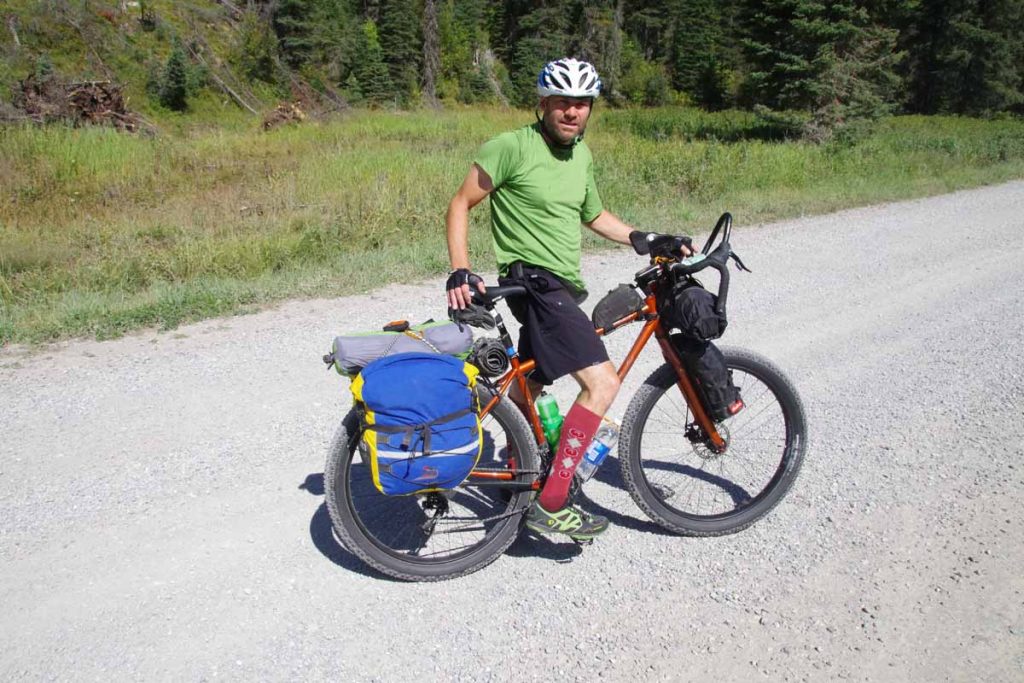
Two days cycling brought me to West Yellowstone. Both days with cooler temperatures, but weather forecasts look good from here.

Day One
IMGP3656
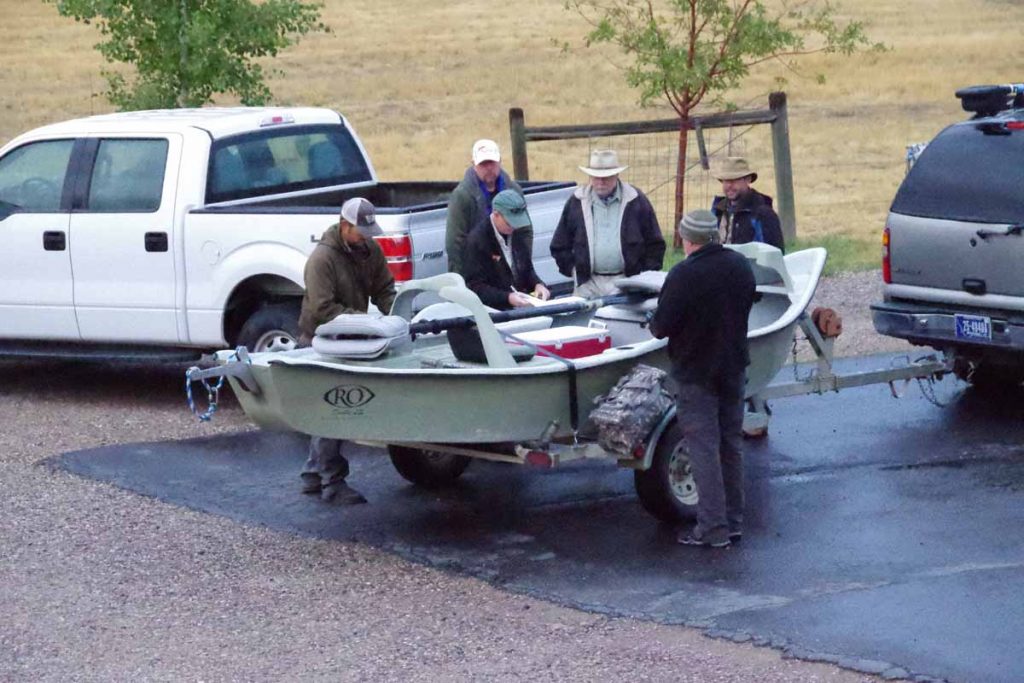
Fishermen were getting ready early as I prepared for a cold day of cycling following my rest/rain day.

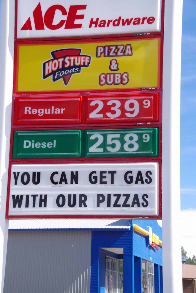
Sunday had been cold and wet in Ennis. Good time to drop by laundromat and otherwise take it easy in Ennis. Wet weather was forecast to continue Monday morning, but other than periodic showers, Monday was definitely better than Sunday.
IMGP3658
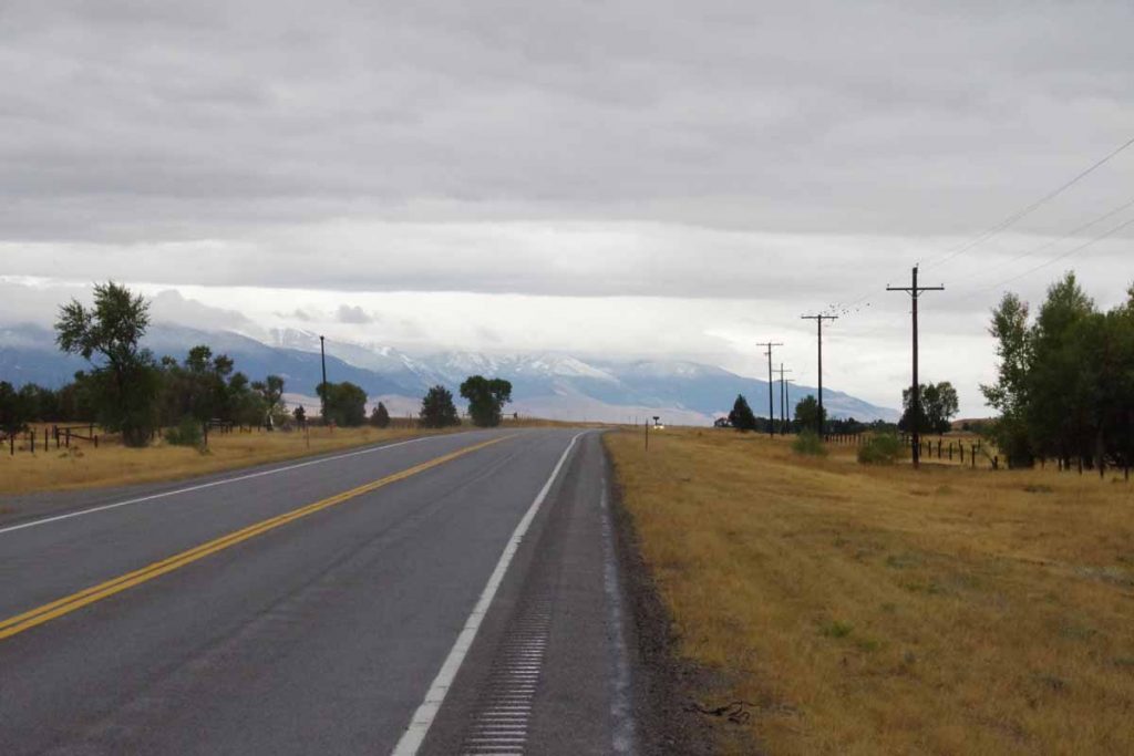
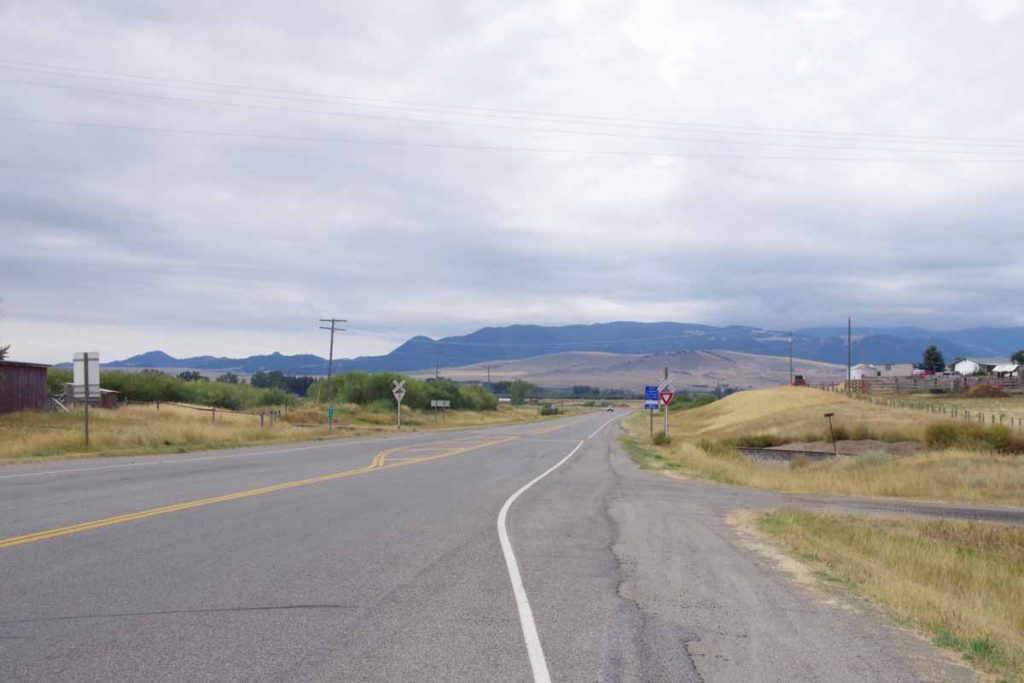
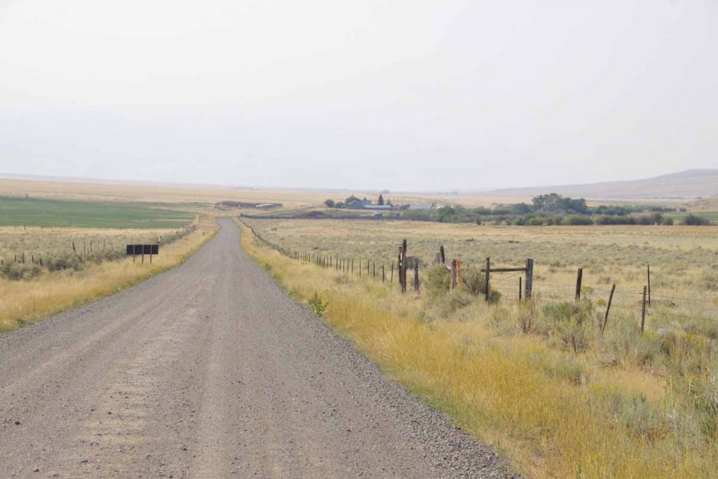
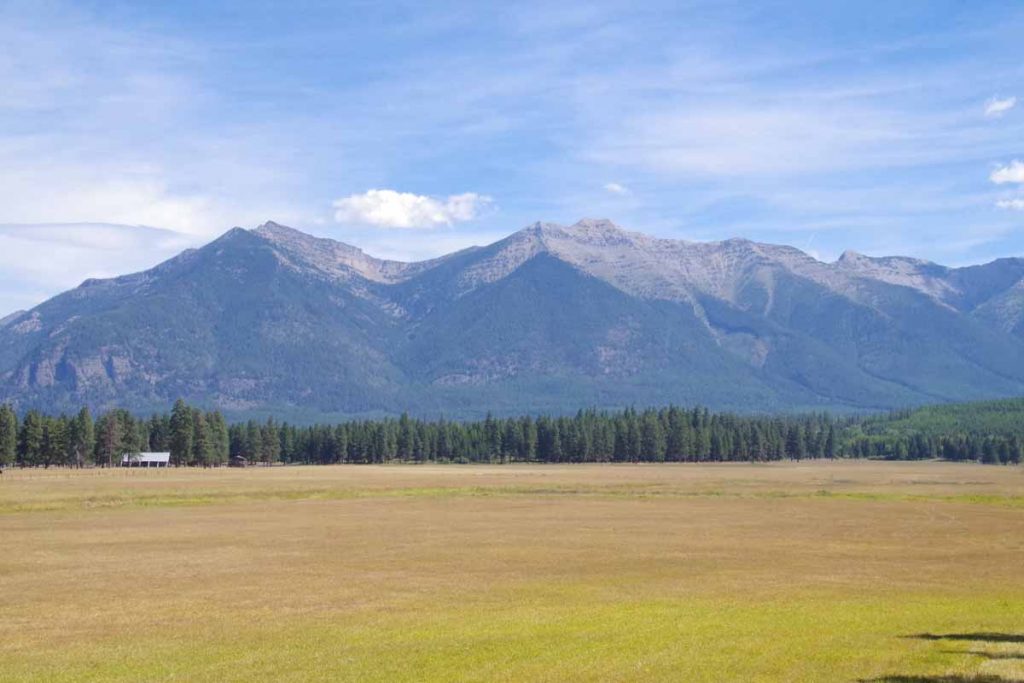
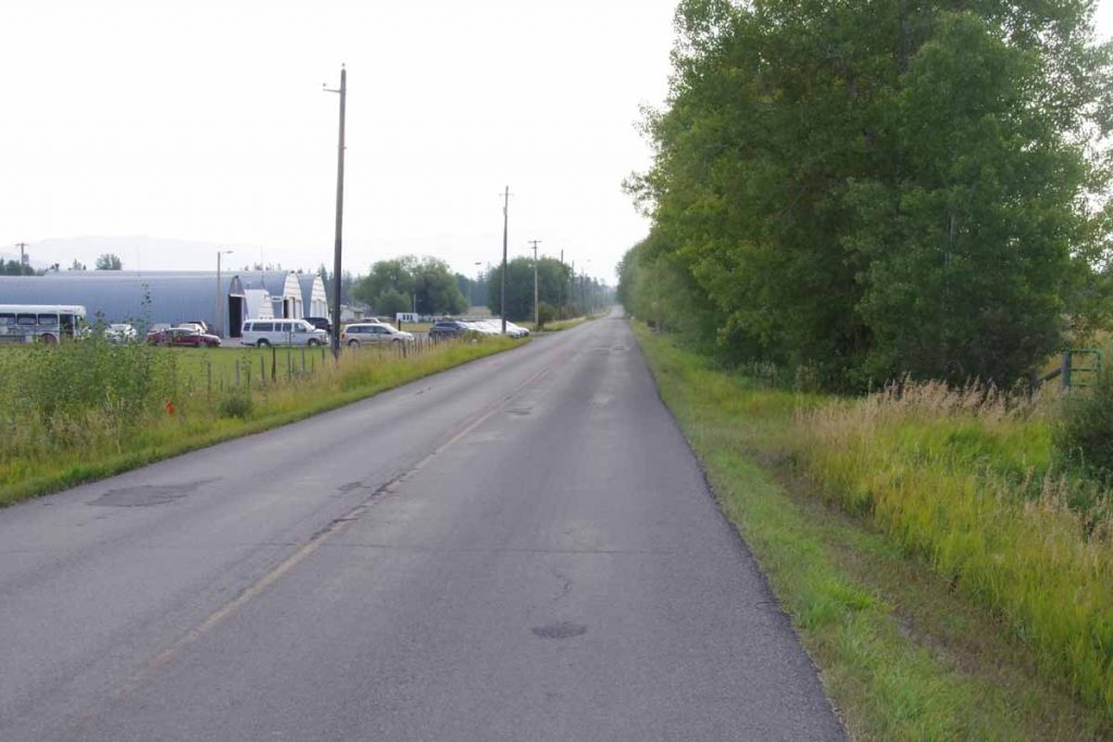
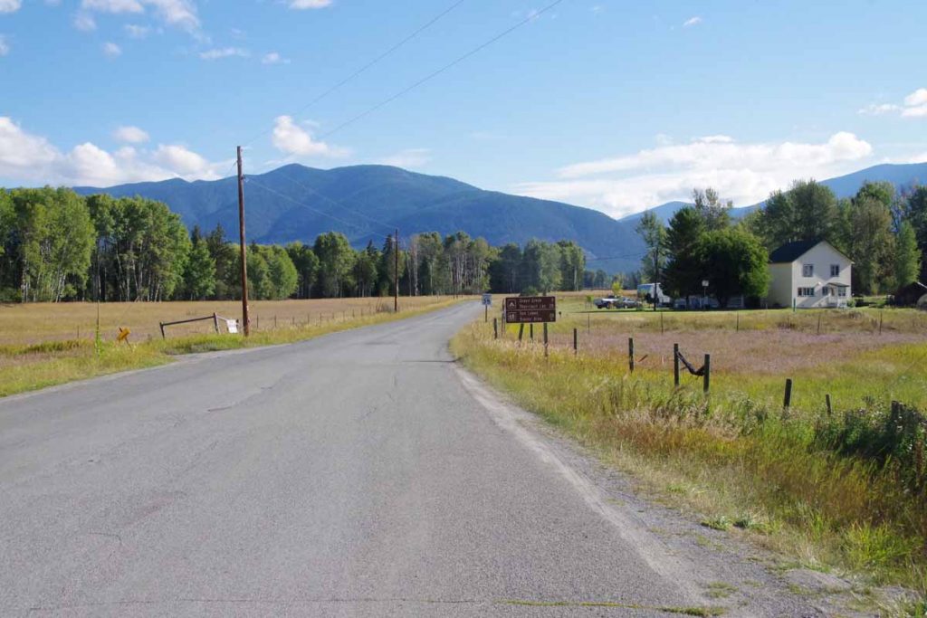
Photo above gave a nice overview of the day. Water in the rumble strip divots and snow up on the higher peaks. The distance was only 38 miles but included 1100 ft of net climb and some headwinds on the second half of the ride.
IMGP3660
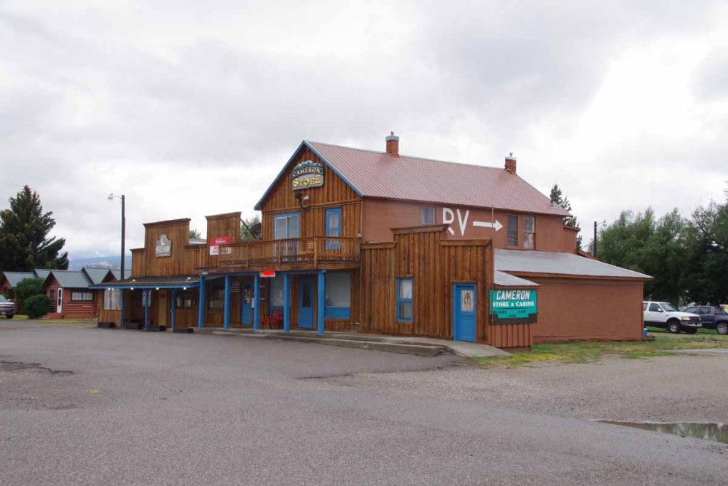
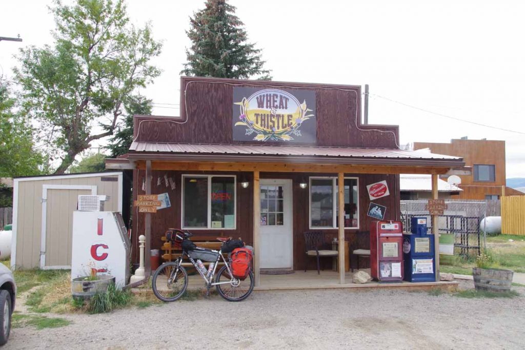
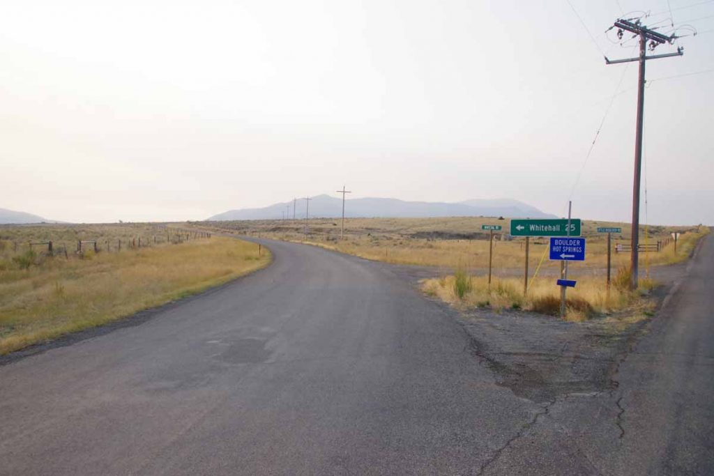
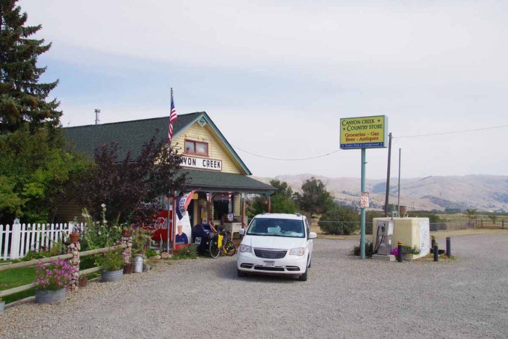
At 11 miles was Cameron store which was closed for Labor Day. However, it was still a good spot to shelter from the wind and eat a snack. After that, continued to follow the road as it slowly followed the Madison River.
IMGP3662
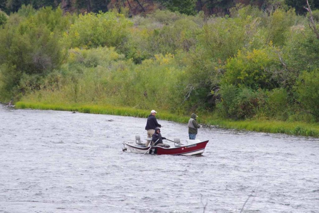
There were several boat ramps with access to the river. I saw a number of boats like these. Seemed like one person was guiding the boat with oars while others might stand in the boat with their fishing rods. Stopped briefly at a rest area at 34 miles and then cycled the last bits to a placed named “Driftwater Resort”. It was still overcast and cool (7C or 45F) when I arrived but later in the afternoon the sun came out again and it warmed a few degrees.

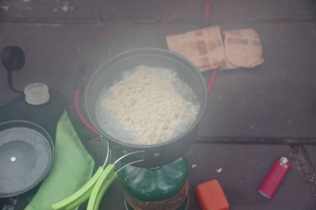
Overall Driftwater Resort was a nice overnight. In the evening, the bar and grill opened and I had a large enough pizza that I ate two thirds for dinner and left the rest for breakfast.
Day Two
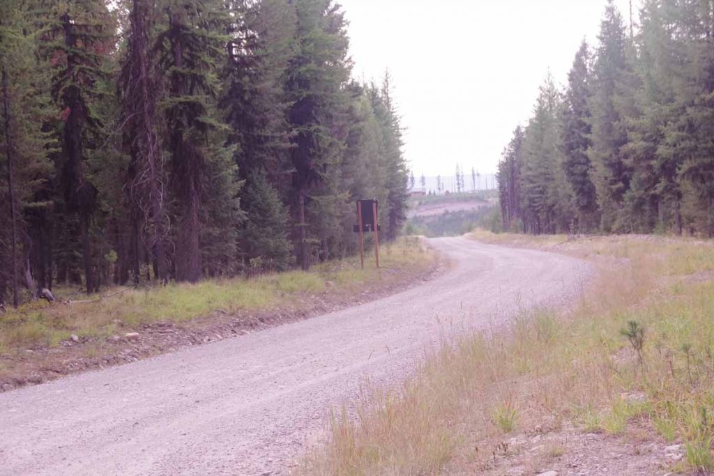
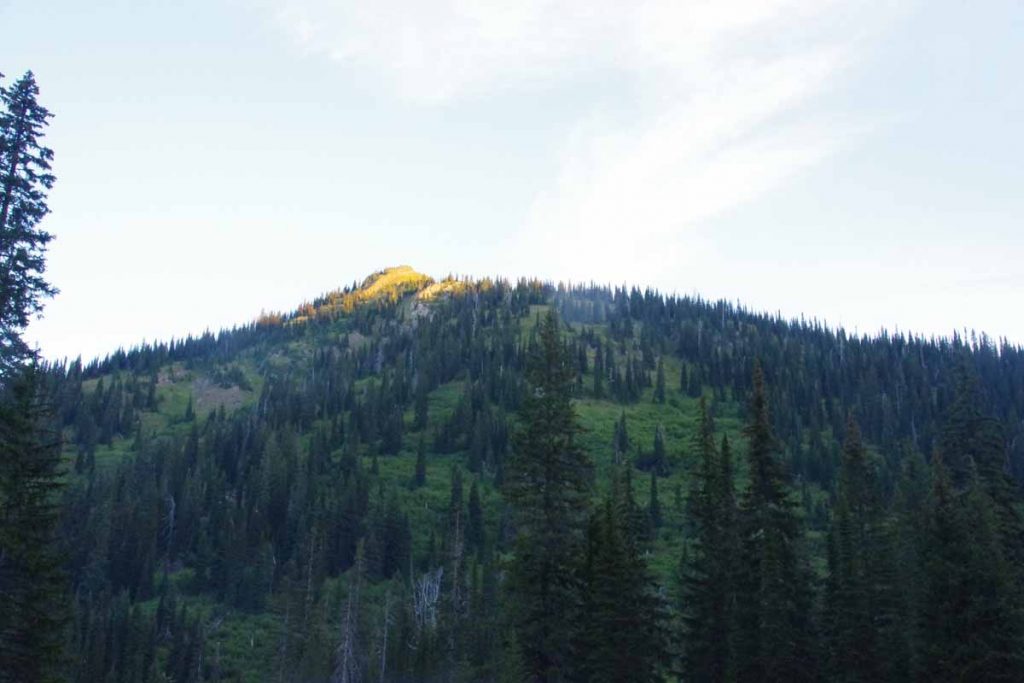
Overnight frost but bright sunshine had me hopeful it would quickly warm up. Some recent snow on the higher peaks.
IMGP3664
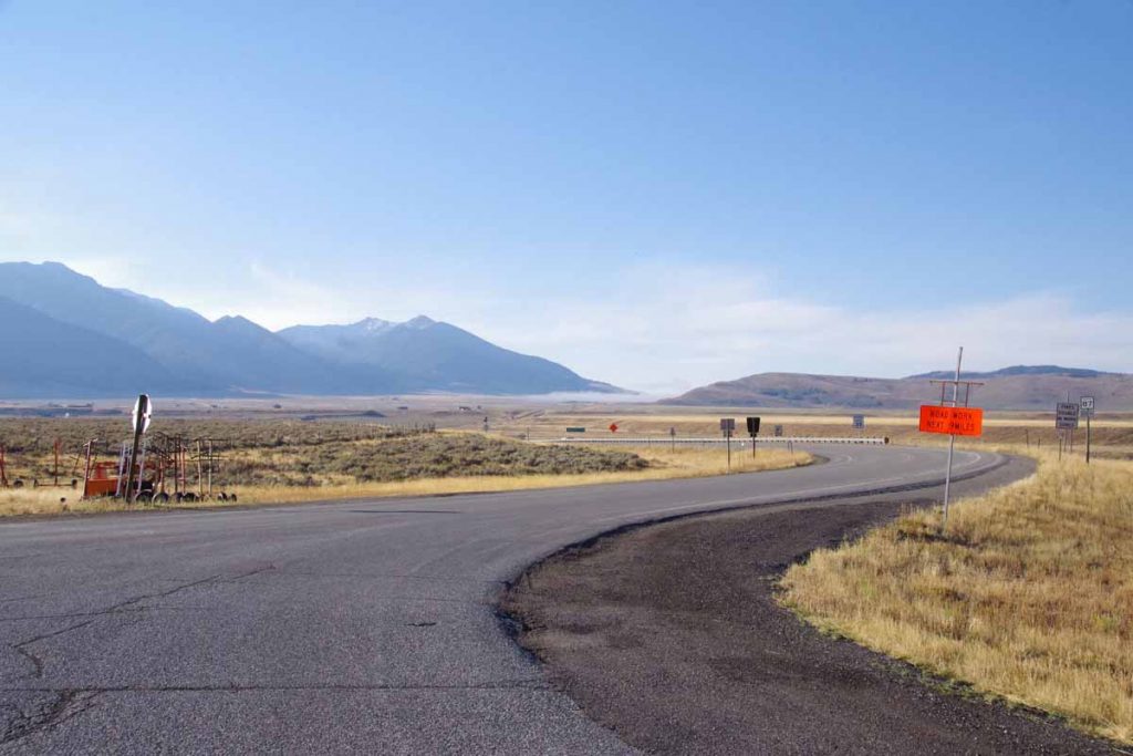
At 2.5 miles the road junction split, though both routes were just about the same distance. This was the other road leading south over Raynolds Pass and briefly through Idaho.

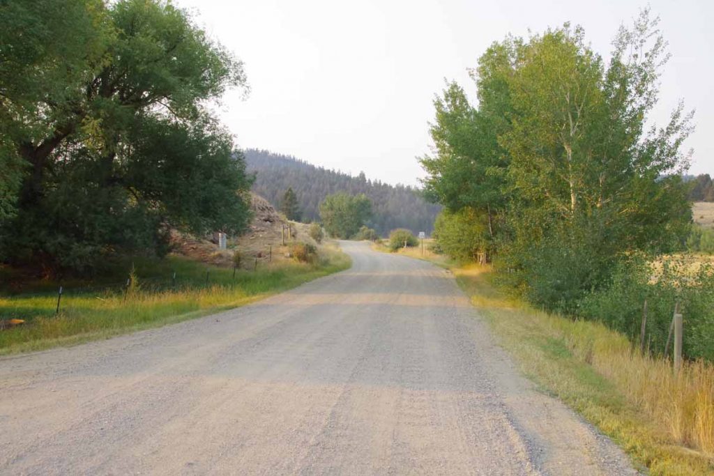
The road I took followed the river and then went via Earthquake Lake and Hebgen Lake. There were multiple signs along the way about the August 17th, 1959 magnitude 7.3 earthquake that hit the area (wikipedia description). Rock slides killed 28 people and blocked the Madison River to create Earthquake Lake. It was interesting understanding more about the story as I cycled past the signs.
IMGP3668
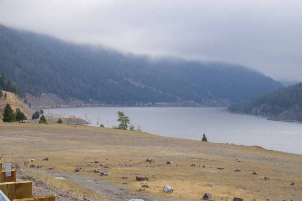
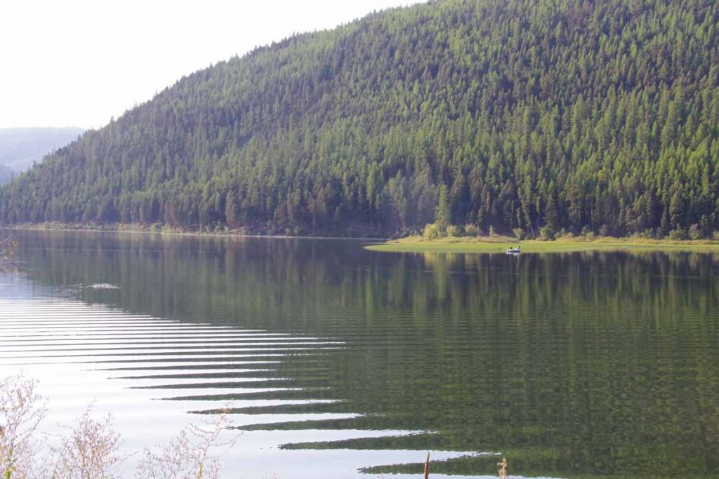
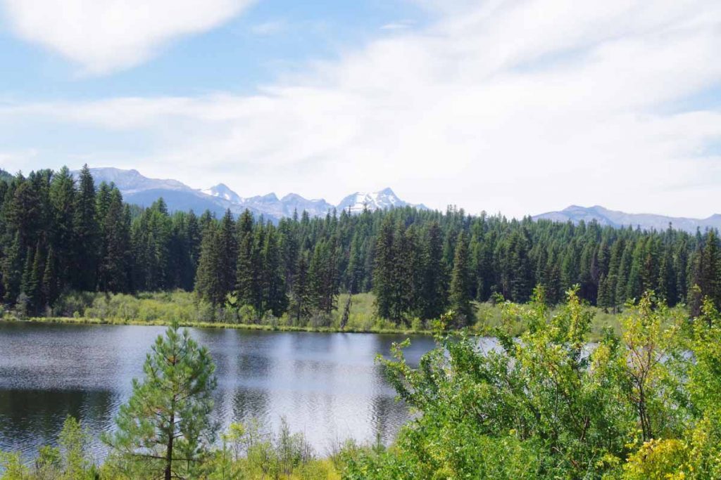
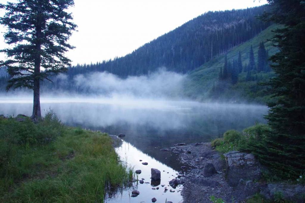
Here is Earthquake Lake. Notice that it had become cloudy and quite a bit cooler, so back to ~2C (35F) for most of this stretch.
IMGP3670
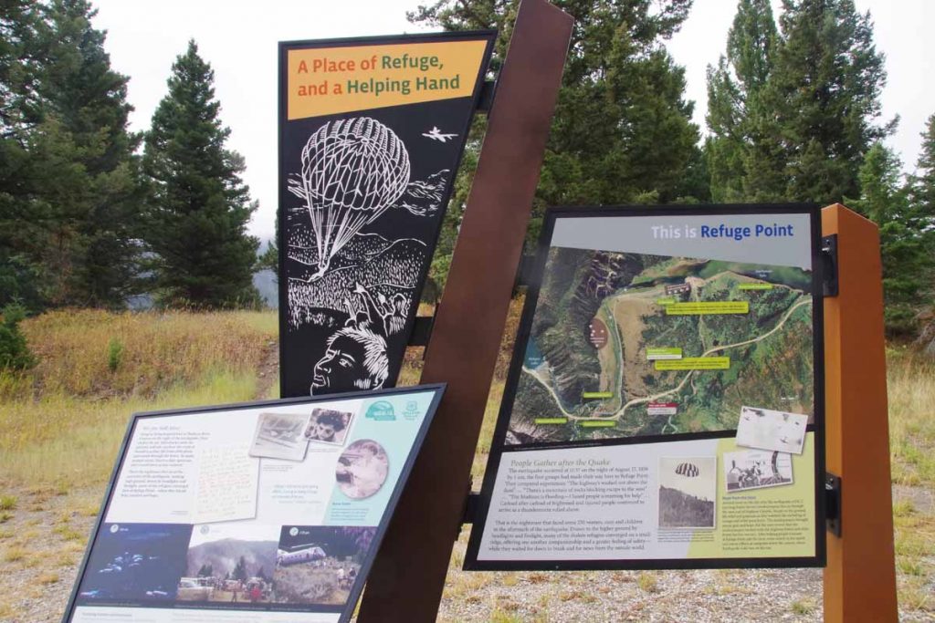
Here was a sign that described Refuge Point. The road had been blocked and survivors made their way here. The mural also shows smokejumper firefighters who parachuted in to help.

After Earthquake Lake, came past the dam for Hebgen Lake (which fortunately held during the earthquake).
IMGP3672
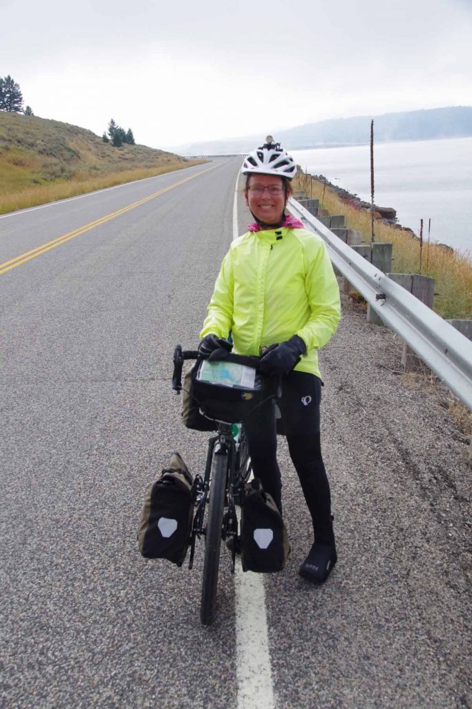
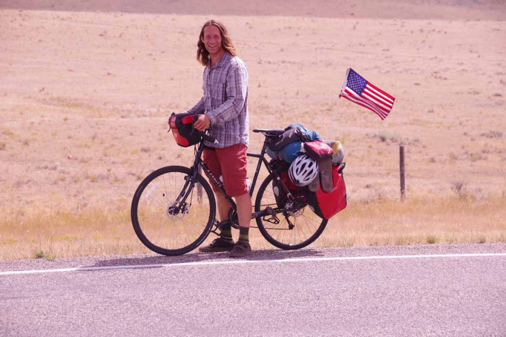
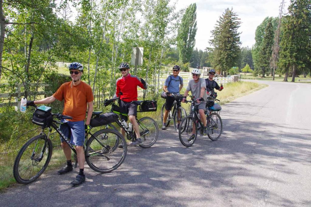
Met a touring cyclist on her way riding from Canon City, CO to Corvallis, OR.
IMGP3673
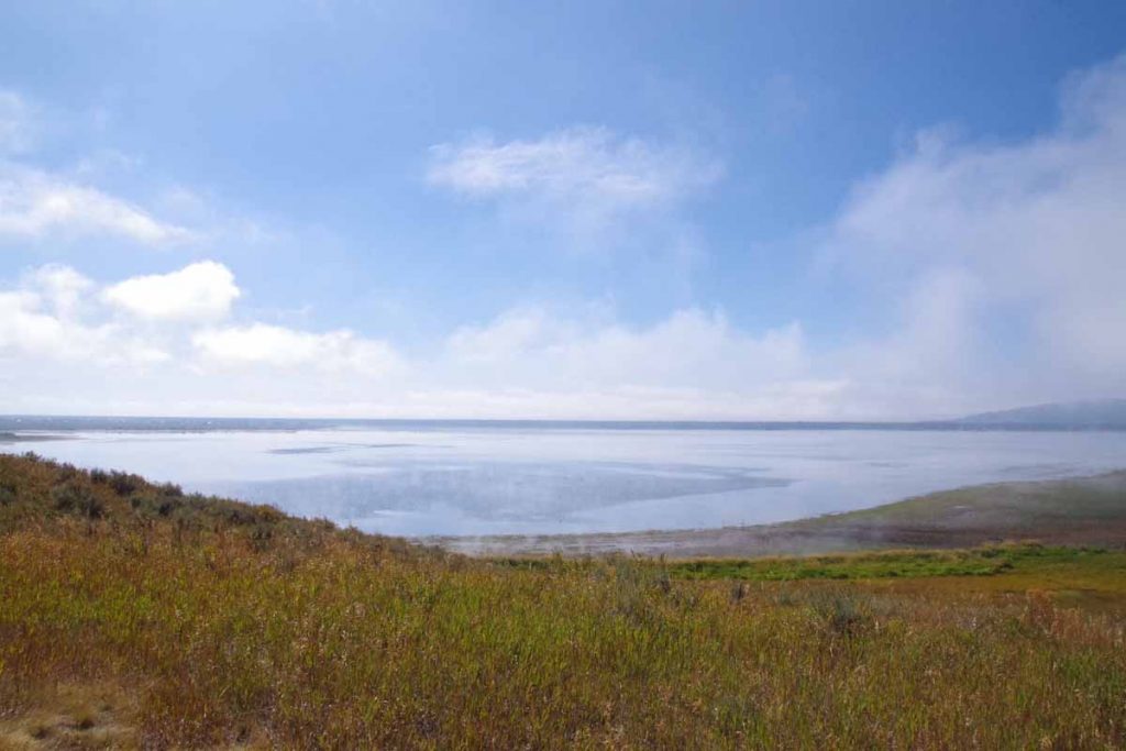
Here was another view of Hebgen Lake as the worst overcast had cleared and it finally started warming up. Still interesting to see in parts the lake was still steaming earlier as if the water temperature was warmer than the air.

After Hebgen Lake, joined US 191 and cycled the last eight miles into West Yellowstone.
IMGP3678
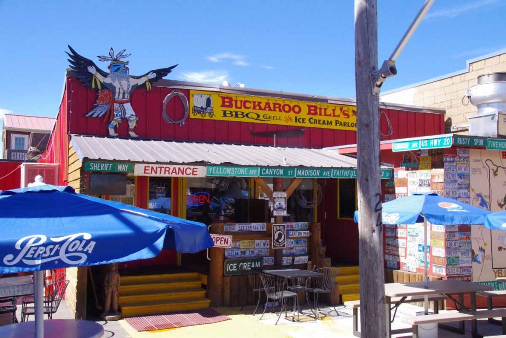
West Yellowstone is a touristy and somewhat expensive little town. I got a chance to walk around some of the shops including the local bike shop. Also stopped in the Visitor Center where I could look over the maps as next few days are planned out.
IMGP3677a
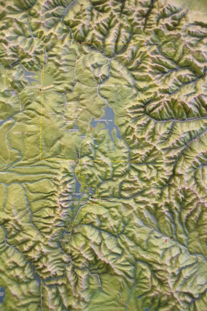
Good topographic view of the area. General plan is numbered on map above (1) West Yellowstone (2) cross into Yellowstone and camp at Yellowstone Lake (3) go south via Teton National Park and Moran, WY (4) cross Togwotee Pass and then over via Dubois, WY. In addition to being a bit hilly, this is somewhat higher elevation so glad I waited just a bit for the worst of the wet to pass through the area.

By the also passed two milestones in the ride to West Yellowstone: (1) passed 5,000km of cycling for this trip and (2) passed south of the 45th meridian – half way from North Pole to equator and also half way from Arctic Circle to the Tropic of Cancer (pretty close to southern tip of Baja).

Posted in Montana, USA | Tagged cold, earthquake, other cyclists

Ennis, fly fishing town

A bicycle ride across the Americas Posted on 2016-09-03 by mev2016-09-03

IMGP3629
Today a nice ride from Whitehall to Ennis. The cold front had come through last night with some gusty winds and rain drops, but overall not much cooler this morning. Whitehall is known for its murals of the Lewis and Clark expedition and I saw a few as I passed through town.

First eight miles were on secondary roads parallel to I-90. After that I turned south and started to see more signs pointed for Yellowstone.
IMGP3632
Next 15 miles were on MT 369 which had a few climbs through the hills. It was an agricultural area and in a few spots, I could smell fresh cut hay. Also passed along a sign for a potato grower.
IMGP3635
These three big tractors came past as I moved off the road to leave plenty of room.
IMGP3640
At fifteen miles I noticed my rear tire being squishy soft again. Looks like one of the inner tire layers has a bit of a tear. Might still be ok in emergency, but decided to swap in my spare tire.
IMGP3641
At 22 miles turned south on US 287. There was a 3-4 foot shoulder that also had a rumble strip. Most of the time, I could ride to right of the rumble strip and in any case traffic was fairly light.
IMGP3642
Harrison had this nice little store and excuse to stop. Decided I would try for lunch in Norris, 11 miles further though. Unfortunately, reaching Norris, the bar only started serving food after 2pm. So back on the road.
aIMGP3644
Next 9 miles to McAlister had a fairly large hill. This is a view part way up the hill and looking back.
IMGP3645
What goes up, must come down and nice to see this sign as I reached the top.
IMGP3647
Part way down, I met this cyclist coming the other way. He had started in New Jersey and was getting closer to his end destination of Seattle. I’m far enough off the GDMBR, but now closer to the “Transamerica Trail”, so expect I might see some other East/West cycle tourists here.

At the bottom was McAlister and chance for a late lunch. After that only 6 more miles to Ennis to end a nice day of cycling.
IMGP3650
Ennis has this statue of a fly fisherman on the main intersection and this theme seems play here.
IMGP3652
Several shops where you can buy from a large assortment of flies.
IMGP3653
A fly fishing festival being held over Labor Day weekend.
IMGP3654
A number of large painted fish placed at different places around town.

I booked a room for two nights and plan to take a rest day here. Weather forecast now calls for ~60% chances of rain for both Sunday and Monday. This looks like a fairly arid region and is only 4900ft, so not sure it will be particularly severe here. However, still a nice spot to get a rest day before cycling closer to Yellowstone and higher elevations.

Posted in Montana, USA | Tagged fly fishing, potatoes, tire

Whitehall, just over the hill

A bicycle ride across the Americas Posted on 2016-09-02 by mev2016-09-02

Today a shorter ride as I keep one eye out on the weather forecasts.
IMGP3621
Pretty easy ride today. The paved route, MT 69 is 38 miles from Boulder to Whitehall, but there is a shortcut of 26 miles that goes over the hill rather than around. Only half the route is paved, the rest is gravel. However, there was also construction on MT 69.

Even though not a long distance, I left early to avoid a cold front that was expected to pass through in afternoon with gusty winds and thundershowers.
IMGP3622
After two and a half miles the road turned to gravel. I was warned there was a dog here that liked to give chase, but fortunately didn’t see any signs here. Next several miles climbed on a dusty and washboard road. Most of the grade was gentle but there was a mile of ~6% grade as well.
IMGP3624
A few cattle grates and a few cows as well. They all seemed quite curious. At the six mile mark, crested top of the hill a little over 5600ft. The road continued to be dusty and washboard here so had to carefully pick my path. Several miles later, left the trees and road became much more rocky and tougher to navigate.
IMGP3626
A pickup slowed and asked if this was way to Boulder. In return, I found out where the gravel stopped (at 16 miles). A lot easier cycling after that.
IMGP3627
More descent here and some irrigated agriculture. Last 10 miles were pretty easy on pavement and made it into Whitehall early.
IMGP3628
This town was split a bit between businesses clustered near the interstate (I-90) and those on MT 69 where the railroad tracks. Found a place and relaxed for the afternoon.

I’ve been keeping an eye out on the weather forecasts. After the cold front comes through, a weather alert says, “The National Weather Service in Great Falls has issued a Winter Weather Advisory for elevations above 6000 feet for snow… which is in effect from noon Sunday to noon MDT Monday…” I’ve seen this in the forecasts for several days and hence taken slightly slower pace – in to see if I can cross into Yellowstone after the worst comes through.

Posted in Montana, USA

Boulder, cute little town

A bicycle ride across the Americas Posted on 2016-09-01 by mev2016-09-01

aIMGP3616
Today’s ride was a half day to Boulder, MT. A little town with Main Street, flags and yellow ribbons adorning the lamp posts. The Great Divide Route has some notorious tough sections near Helena and Butte, but today I was on an alternative listed as “Boulder Alternative, 6.5 miles longer and includes 11.2 miles of interstate riding. This alternative avoids some of the most challenging terrain along the route” which is fine for me.
IMGP3611
Left this morning and the first 16 miles were on a frontage road along I-15 similar to photo above. A gentle climb, temperatures around 50F (10C) made for a fairly easy ride, first to Clancey and then to Jefferson City. There were hints of a SW wind (headwind) starting to pick up.
IMGP3613
At 16 miles an on-ramp to the interstate. Not a lot of traffic and slightly increased grades and winds, but still a reasonable ride. After five miles cycling on the shoulder, topped out around 5600ft and then descended ~700ft down into Boulder.
IMGP3614
Photo above gives reasonable overview. Boulder is at the far end with a low ridge behind it. One road (MT 69) goes off to the left, and I-15 goes to the right. Over the low ridge is a paved+gravel road that heads further south.
aIMGP3616
I was into Boulder close to noon. Now a choice of whether to ride over that hill to continue to Whitehall or find a spot in town. It was a cute town, and some more headwinds helped make my choice.
IMGP3617
Here is part of the Thursday Farmer’s Market.
IMGP3619
Here is city hall.

In the afternoon a quick gusty rain shower came through. Tomorrow we expect a front to come through with cooler temperatures as well as increased chances of rain on Sunday and Monday and cool most of next week. Also one of the reasons for shorter day as figure I’d rather have that weather instability here at lower elevations before going across Yellowstone after that.

Posted in Montana, USA | Tagged cute little town

Helena, two easy days

A bicycle ride across the Americas Posted on 2016-08-31 by mev2016-08-31

Two easy days riding to Helena.
IMGP3601
I was slow getting started from Lincoln. I hadn’t taken a rest day since Banff and thought of taking a day in Lincoln, but in end decided on two easy days instead. The agenda for the first day was to ride over Flesher Pass. Turned out not too difficult as it was only 1600ft higher than Lincoln.
IMGP3602
Eleven miles on the main road before turning to road 279. There was quite a bit of construction traffic, but fortunately the trucks were only going one mile down the road. After that it was a slow steady climb for 9 miles to the summit. My cycle computer rarely said over 6% so it was a case of shifting into low gear and slowly riding up.
IMGP3604
Getting close to the top, here was the view looking back on the road.
IMGP3605
Official summit sign here.

After that a reasonable descent that brought me down into Canyon Creek. The creek was a bit narrow and the road closely followed the creek. Some national forest but also a fair number of vacation cabins here. A little past 30 miles, the canyon opened up and it was more dry landscapes with irrigation. My map had indicated “Canyon Creek Store”
IMGP3607
I was there in time for a late lunch. Inside of the store was cute with a lot of antiques but also food and other items. They also had small RV park/campground. Decided to stop there for the afternoon. It was hazy out, apparently several different fires in the area.
IMGP3608
Two pickups. This scene was along the way the next morning. As best I could tell, they were radio-ing down to some riders on horseback down below who were herding cattle. From here into Helena was a good road that climbed over low ridge and then descended into the Helena Valley. After 13 miles, turned north to more suburban/rural roads on outskirts of Helena.
IMGP3609
Not much later was the city limits itself.
IMGP3610
Overall, two fairly easy days that brought me to Helena. Chance to relax as well as pick a more precise route using the maps I have. I was thinking of US 287, but that has bad reviews so most likely take some of the alternate route on GDMBR.

Posted in Montana, USA | Tagged continental divide, haze

Lincoln

A bicycle ride across the Americas Posted on 2016-08-29 by mev2016-08-29

IMGP3590
Today a nice ride all on pavement. First fifteen miles finished MT 83 and passed picturesque Salmon Lake. Must be fish as I saw several boats out in the water. The last few miles went to junction with MT 200, also known as Clearwater Junction.
IMGP3592
Clerk at the Kwik Stop store told me the bull above was ~50 years old and recently had been listed in an article of the “five most recognized images of Montana.” The clerk also explained a sign for me from yesterday. One of these Adopt a Highway signs had listed “The Boman Family, five griz and one cat”. “griz” refers to University of Montana Grizzlies in Missoula and “cat” refers to Montana State University Bobcats in Bozeman.

The next 24 miles I had also done on my first trip across America on May 30th 1992. I was riding a bit longer then and covered 125.9 miles with 5210 feet of climb that day from Missoula to Helena.
IMGP3593
Photo above gives a good overview of agenda for rest of the day and also showed that the country was starting to open up some with larger views. MT 200 had good shoulders and initially looked like it might be a headwind, but fortunately subsided. After 13 miles I came to small town of Ovando. I had a touring cyclist pass me here. He was traveling from Portland, OR to Yellowstone but was stopping for the day in Ovando.
IMGP3597
I had lunch at Trixi’s, actually an omelet breakfast since they served them until noon. After that more big sky country to ride eleven miles to junction with MT 141. Not much later, I noticed my rear tire was soft. Looks like a hole in the same place as I had in Whitefish again. Looks like a hole has gotten into the outer tire. Patched this up, but if continues again, perhaps swap in my spare tire.
IMGP3598
How many Brahams symphonies do we need?

The last fifteen miles more closely followed the river and had very slight uphill. I was amused to see signs listing “downtown Lincoln”. Lincoln itself has one flashing traffic light – yellow on the main road and red for a cross street – so that must be downtown. Only other thing I’ve known about Lincoln is this is hometown for the Unabomber who had his cabin here. However, haven’t found any plaques or signs for this.
IMGP3600
Not too much trouble to find myself a place to stay. The GDMBR also goes through downtown Lincoln, so will either take this route tomorrow or will go one pass further (Flesher Pass) on likely a two day ride to Helena.

Posted in Montana, USA | Tagged Brahams symphonies, flat tire

Seeley Lake, one road

A bicycle ride across the Americas Posted on 2016-08-28 by mev2016-08-28

Cycling instructions were simple today: get on MT 83. Follow it 57 miles to Seeley Lake. Along the way, the first two thirds was a gradual ascent from ~3300ft to ~4300ft following the Swan River and the last third was a gradual descent from ~4300ft to ~4000ft.

Sunrise keeps getting later and breakfast at lodge was 8am so it was almost 9am by time I was on the road.
IMGP3580
I stopped at the general store half a mile down the road since I wasn’t certain how many services I would find in Condon part way. Adventure Cycling maps indicated both a restaurant and a store, but folks at the B&B told me Condon was “mostly trees”.
aIMGP3581
The route did go through a narrow corridor along the trees. While it didn’t give much in terms of views, I was glad because it kept everything cooler and also didn’t need to worry about wind. I expect in WY, I will miss these trees. The route went through the Flathead National Forest and a short bit of Montana Swan Lake Forest. The official GDMBR was on other side of the valley following the gravel roads up and over some low hills, but I was just as happy with my flatter and paved route.
IMGP3582
As I got closer to Condon, I didn’t see much in way of businesses but did notice at least three “we build your log house” businesses and also noticed many churches. Not sure where the houses are that people go to the churches but Condon had a Baptist, Lutheran, Catholic and Community Church. Also a post office and photo above was in front of the museum. Right about noon, I came to Swan Lake Cafe. There were no cars in front, but it was open. They explained to me once church service was over, it would get crowded. So had my burger just slightly ahead of the crowds.
IMGP3584
After Condon there were one or two places the views opened up as the road gradually continued to climb. The GDMBR briefly came to 83 and for 1.6 miles as it crossed from right side of the valley to the left.
IMGP3585
At 40 miles, I came to the Lolo National Forest sign which marked the top of the divide between Swan River and Clearwater River. By now it was 85F (30C). Also here was nice lookout over Summit Lake.
IMGP3586
The last 17 miles slowly went along several lakes and then into resort community of Seeley Lake. Otherwise a reasonable and not too difficult day. I think this next photo is about gasoline and not about pizza.
IMGP3587
Now sorting out exactly what direction I follow from here. Most likely staying on paved roads to Helena and I’m told GDMBR near Helena and Butte is some of the more difficult bits, so I’ll probably be on pavement there.

Posted in Montana, USA

Swan Lake, cruising the Flathead Valley

A bicycle ride across the Americas Posted on 2016-08-27 by mev2016-08-27

IMGP3573
Today a somewhat easier and flatter day mostly on pavement. While all but the last ~12 miles were part of the GDMBR, expect this to be part of several days mostly on pavement paralleling the route rather than riding all the gravel roads. Fixed my flat tire and otherwise set up for leisurely departure from Whitefish.

Last night I visited with Tim Travis. Starting in 2002, Tim spent over a decade bicycle touring and living on the road with his bicycle. His first two years were on year in Mexico and Central America followed by one year in South America. I was familiar with Tim from following his web site from early days and otherwise on the web – and also recently re-read his first two books – and also believe Tim used my Australia web site to help plan his travels there. It was fun catching up.
IMGP3574
The first eleven miles today were on the GDMBR through back roads to Columbia Falls. I had made arrangements to meet my sister-in-law, Natalie, there for an early lunch. It was fun connecting there as well.

After lunch, I headed south and had intermittent south winds (headwinds) for rest of the day – though not as bad as I had feared when I heard of the 20-30mph SSW forecast. This area was a mix of agricultural as well as some forest with vacation homes (or perhaps permanent from people who live in resort-like setting). There was also some hay and some cattle.
IMGP3575
These cows were friendly and curious and I didn’t even have to “moo” to get them to come over.
IMGP3576
I met my group of Great Divide riders for the day on this segment as well. They initially came past me, but I was able to pass them later. They were doing a segment of the divide this year from Whitefish MT to Lima MT and had support drivers along and hence the light loads. Despite the lightly loaded bikes, I was just as fast on the flats and eventually left them behind when they stopped for lunch.

I took one stretch on “206” to avoid a few miles of gravel, but otherwise took the official route including a 2.3 mile section of gravel. It was reasonable cycling – through with my later start and lunch stop, I was a little later than normal. Stopped at 44 miles in Ferndale at gas station for bite to eat and then rode the last 12 miles to a nice B&B lodge on Swan Lake.
IMGP3577
Photo above is of Swan Lake and here I had left the GDMBR as it goes on other side of the lake on gravel roads that go up and down some of the hills. Supposed to be reasonable riding, though I figured I’d make some progress following the paved roads on this side. Apparently, upcoming sections near Helena and Butte I’ve got some recommendations to consider skipping the roughest bits there.
IMGP3578
There is photo of the lodge, where also had dinner and plan breakfast tomorrow before setting off. The lodge had some friendly cocker spaniels several of which had “don’t feed me” signs around their collars.

Posted in Montana, USA | Tagged flat terrain, other cyclists

Whitefish, over to the North Fork and back

A bicycle ride across the Americas Posted on 2016-08-26 by mev2016-08-26

I chased a bear. Not on purpose of course. On the first day of three, I had just crested the Whitefish Divide and was carefully navigating my bike along a rocky downhill road. All the sudden as I looked up, saw a galloping black bear ahead, running away. He must have been along the road, heard me coming and then decided to bolt. Not sure what else to do, I continued cycling after him (but letting him safely get away) and from then until rest of the day, I made extra noise rounding corners.
IMGP3538
It was a three day, ~90 mile ride primarily on gravel. This time I followed the guide book directions of where to stop. Overall, it was three not extremely difficult days, through some rugged terrain. Riding started simple enough starting from Eureka. At the motel this morning were at least three riders. Chris (who you’ll see later), myself and Scott one of the Scottish riders. Scott and his other rider (David) I had met before Elkford and they had decided they had different goals – so David forged ahead and Scott was going to make an easy pavement ride to Whitefish, catch a train and spend his US holiday other than on the divide.
Day One
The route went for a mile along US 93 before turning to the back roads. Once again, some nice pretty and paved routes, though also with a few short hills. After 9 miles back to US 93 and then at 10.8 miles the real adventure started.
IMGP3539
Above is the photo of Graves Creek Road. Started paved and reasonable grade.
IMGP3540
Quite a few deer in this area.
IMGP3545
The road slowly followed the creek uphill. In total there would be ~2000 ft of climb before reaching the summit.
IMGP3549
After ten miles, the pavement ended and it became a good quality gravel road. Notice they even bothered to occasionally trim the worst of the trees overlapping the road, so can’t be so rugged yet.
IMGP3550
Chris who had been in motel this morning, also came past. Chris is from Oberlin, OH area and had ridden the southern half of the Great Divide last year and was riding other bits this year. He cautioned the NM section was particularly challenging as water was not always found even at the infrequent locations shown on the map. (The more I hear of NM section, more I suspect I’ll be on paved roads and not GDMBR by then).
IMGP3551
After a few miles of good gravel, the road steepened and much bigger climbing began. I decided to walk the last two miles to top of Whitefish Divide. On the way down is where I encountered the bear mentioned above (sorry no photos, both myself and bear were excited enough).
aIMGP3553
From the top, mostly descent of 5.6 miles and there was Tochuck Campground. While it was still early afternoon, I decided to stop partially since I’d decided to follow the guidebook and partially since there wasn’t an immediately obvious campground close, particularly one with bear containers.

Later that evening another GDMBR cyclist came through. She was a young woman who was probably slower than me, but with a lot of drive. Only cyclist I had met so far that didn’t take the Fernie alternative.
Day Two
IMGP3554
It was cold overnight. My little thermometer above was still above freezing, but my bike computer recorded -2.7C (27F). Campground was hidden in the trees and I mostly got breakfast before sun really reached down.
IMGP3555
A fairly common breakfast is ramen noodles, tuna and oatmeal (not together).

From here I followed the road downhill for 9 miles. Slowly it became less rocky which was nice. At the bottom, the road intersected with the North Fork road.
IMGP3558
This road was wider, but at least as rough. Also surprising how much “No Trespassing” signs as well as private cabins were found here. In hindsight I was glad I’d stayed in the campground since not clear it would be easy to just camp beside the road without being on private property.
IMGP3561
At the 18 mile mark, the climb started up Red Meadow road. This would be ~1500ft spread over a dozen miles. Both the road surface and the climb were surprisingly nice. Except for the last two miles, I could just go into lower gear and slowly pedal my way up.
IMGP3562
These berries were found along the way.

Again, it was early afternoon, but decided to follow the guidebook again. It got cloudy and briefly rained on two occasions. Otherwise, it was nice camping near Red Meadow Lake. They also had bear containers here.
IMGP3564
In the evening it rained again.
Day Three
Cold morning. There was ice on the tent and ice on the picnic table.
IMGP3566
Some mist coming up from the lake shortly before sunrise. I thought I might wait until the sun came down the mountain.
IMGP3567
However, even though the sun hit the highest peaks close to sunrise, nearly two hours later it still hadn’t gotten to the campground, so finally gave up and packed in an icy tent. Definitely has me cautious about too much camping at elevation.

My bike computer recorded -1.7C (29F) even at 9am when I started, so expect it was a few degrees colder before then. My sleeping bag is warm enough but still a bit chilly to ride early in the morning. The initial descent was rocky again most of the first 5.6 miles to Upper Whitefish Lake. After that it got better and was predominantly downhill.

At 22 miles I came to pavement again.
IMGP3570
Hooray! However, a few shorter little hills to climb along Whitefish Lake and I was in middle of downtown. Now some errands to take care of:

  • Glacier Cyclery replaced my pedals. Best guess is the horrible racket heard before Eureka was one of the bearings falling apart. Still have slow leak in back tire, but will figure this out tomorrow before departure.
  • Went to post office to pick up a SIM card I had let Amazon send “General Delivery”. Unfortunately, when the sender uses UPS, that doesn’t seem to work and UPS bounces it back as “invalid address”. Only cost me $1 to try and Safeway nearby had the same SIM card kits
  • Connected with few people I know in the area and made arrangements to meet up.

Overall, I’m glad I did this three day out and back over the Whitefish Divide as well as tried to follow the guidebook list of three easy days. From here, I’m considering doing a bit more main highway rather than GDMBR, though I’m also told the immediate next bits are not that difficult.

Posted in Montana, USA | Tagged bear, rocky road

Eureka, Montana!

A bicycle ride across the Americas Posted on 2016-08-23 by mev2016-08-23

Back in the USA.
aIMGP3534
Today another day of pavement cycling that was mostly flat and brought me across the border back to the USA. The “Fernie Alternative” followed gravel roads on east side of the Elk River, but I stayed on Route 3 on the west. The road was moderately busy but had a good shoulder. I also saw other cyclists (three going my way, two going the other way) along this stretch as well. Seems like others don’t always buy the “Canada” map and then guidebooks don’t describe the Fernie alternative.
IMGP3527
Just outside Fernie I passed signed for the resort. Apparently, the peak season is still winter but summer is picking up as well.
IMGP3529
A little while later there was a tunnel with lights to indicate bicycles in the tunnel. I didn’t see any explicit button to press so perhaps it detected automatically. I did find a spot later that where the “wildlife detection” system with flashing lights and picture of a deer started to go off when I cycled past.
IMGP3530
At 18 miles was Elko and a mile later was road 93 to the border. This road was much quieter. Something in my drive train started making a bunch of crackling noises. A bit concerning as I tried to figure it out. Eventually not long after I crossed the US border it stopped. My best guess was some of the bearings in my right pedal, but will likely check this in Whitefish when I get there.
IMGP3531
This road continued flat, though there was one good hill both up and down to cross the Elk River. A little past 1pm, I came to the US customs and immigration station. Entry was very simple. They asked where I lived, how long I had been in Canada and if I had food with me. I pointed out my freeze dried meal bag and also an apple. However, no citrus and they were happy.

I had a late lunch at the Duty Free place on US side. There was also one on the Canadian side and not quite sure if they sell the same things or different.
IMGP3536
After this just nine miles of quiet country cycling brought me to Eureka. Along the way the noise in my drive train fixed itself. Found a motel and then the forest service office (for maps) and then grocery store to stock up. I wasn’t quite able to get a working US SIM card yet, so no phone along the way. Wifi also a bit spotty. Plan is to take three days and follow the back roads over to Whitefish.

On the Canada page I have updated a table with all the distances and climbs for the last seven weeks I’ve spent in Canada. There is similar on the Alaska page. Overall totals for Canada were 3215km and 25,972m of climb. You can also find links to Strava to see profiles for individual days of riding.

Posted in Montana, USA | Tagged border crossing, pedal
©2025 - A bicycle ride across the Americas - Weaver Xtreme Theme
↑