↓
 

A bicycle ride across the Americas

from Deadhorse (SCC) to Ushuaia (USH)

  • Home
  • Plan
  • Blog
  • Photos
  • FAQ
    • Why?
    • Where?
    • What next?
  • Map
  • Equipment
  • Calendar
  • Countries
    • USA
      • Alaska
      • Montana
      • Wyoming
      • Colorado
      • New Mexico
      • Arizona
      • California
      • Texas
    • Canada
    • Mexico
    • Guatemala
    • Honduras
    • Nicaragua
    • Costa Rica
    • Panama
    • Colombia
    • Ecuador
    • Peru
    • Bolivia
    • Chile
    • Argentina
  • Weather
  • Links
  • Contact
Home→Tags cold

Tag Archives: cold

Leadville, Fremont Pass

A bicycle ride across the Americas Posted on 2016-09-24 by mev2016-09-24

A chilly ride over Fremont Pass to Leadville.
imgp3991
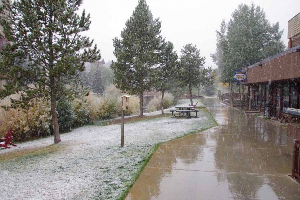
Yesterday was a quiet rest day in Copper Mountain. It is “mud season” after the summer resort season and not yet ready for ski season. In the afternoon a cold front came through with wind as well as snow flurries. As you can see above, it didn’t really accumulate much and mostly made things wet.
imgp3994
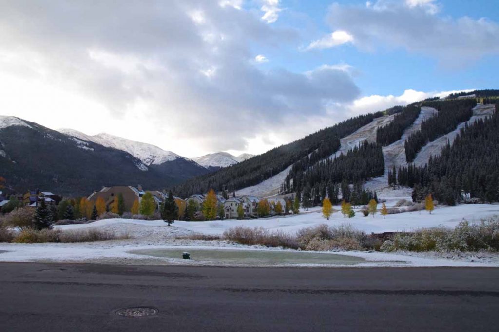
It was cold the next morning and I waited until the sun got a chance to get up. The lowest temperatures my cycle computer showed for the ride was -5C (23F), just a bit on the chilly side for the gear I have with me. At least the storm had passed through and no wind.

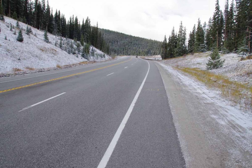
After 0.5 miles I reached the junction with CO 91 and climbing began almost immediately. Fortunately a fairly gentle ~3% type grade until the 4.5 mile mark where there was a two mile hill with grades closer to 6%. The climbing took enough effort that I kept warm.
imgp3997
There were road markings left on the road, on photo above you can barely see “Ali” a bit ahead. This was the last part of a sequence on the road: “Float like a butterfly” (0.25 mile gap), “Sting like a bee” (0.25 mile gap), “R.I.P. Ali”. One of the markings indicated it was from RTR (Ride the Rockies). This past summer, the RTR route did the “Copper triangle” from Copper Mountain to Leadville to Vail and back to Copper Mountain. It is also a popular ride other times as well. In any case, nice to have some of the hazards marked and interesting these markings are still there three months after RTR.
imgp4002
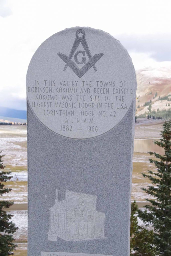
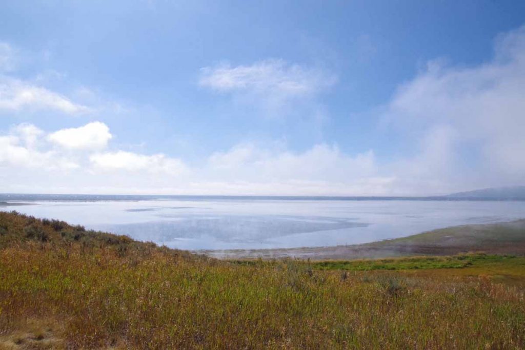
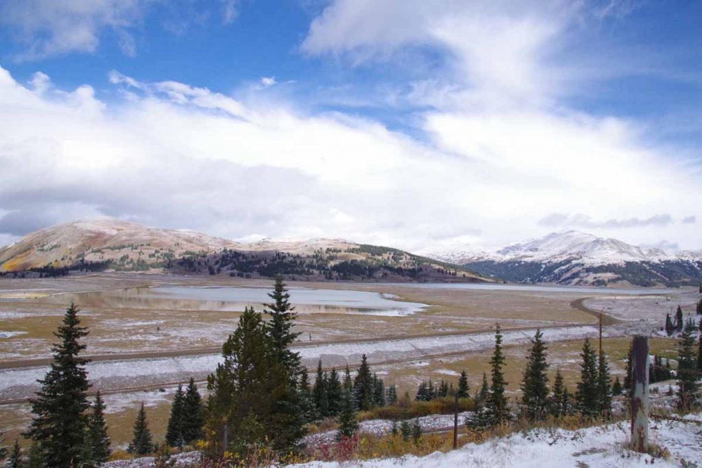
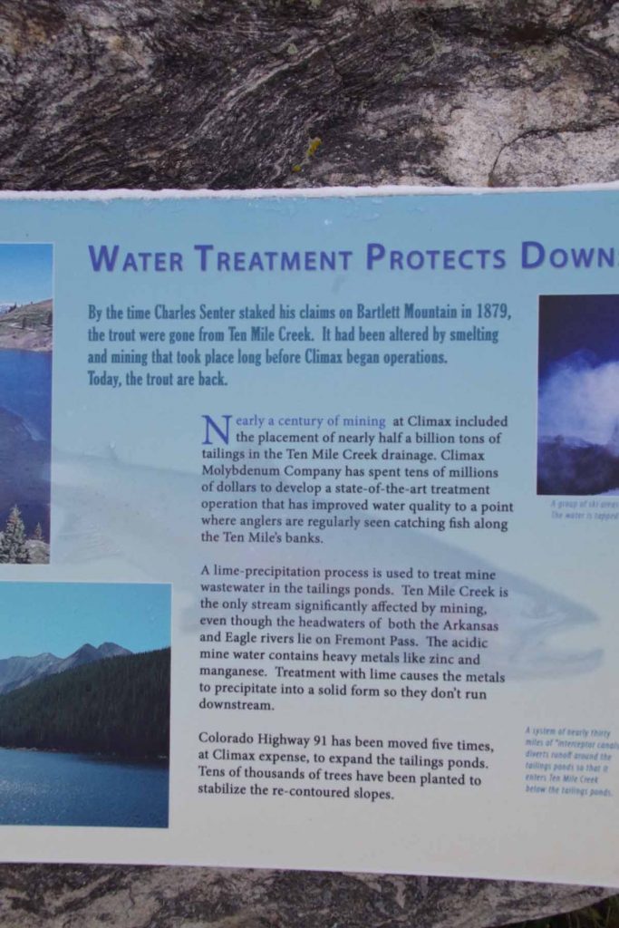
After seven miles the road flattened with a majority of the climbing completed. One could look over the large tailing ponds, not frozen yet. The marker above marked the former towns that had been flooded over by tailings and mine debris.
imgp4003
Here is a photo taken right next to the monument.
imgp4007
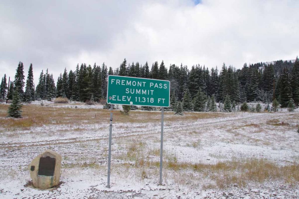
Not long after this, the last little bit of climbing brought me to summit of Fremont Pass. The marker on left tells that this was also a boundary of the 1803 Louisiana Purchase.
imgp4005
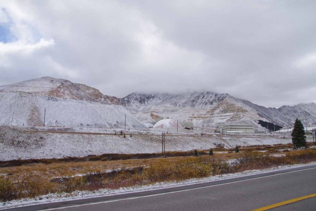
Just before reaching the summit, I could see the Climax Molybdenum Mine. At its peak output, this mine supplied 3/4s of the worlds molybdenum. It was shut down in 1995 and recently reopened in 2012.
aimgp4011
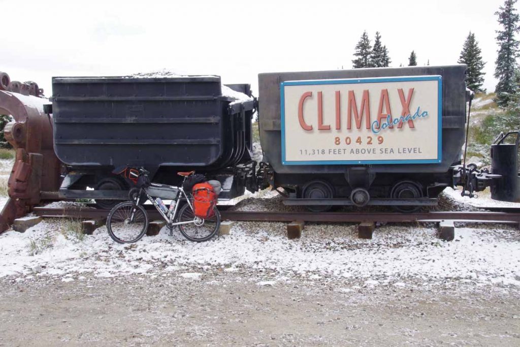
There was a little display here about mining.
imgp4015
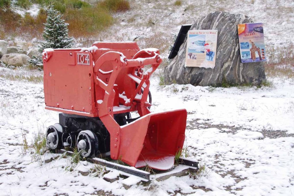
Included was a description of the tailings (half a billion tons!) that helped bury little towns below.
imgp4018
From the top of Fremont Pass, the temperature was now up to -1C (30F) and warmed a bit from there. However, there was also a cold west wind and I was no longer climbing, so felt colder on the way down than the way up.
imgp4020
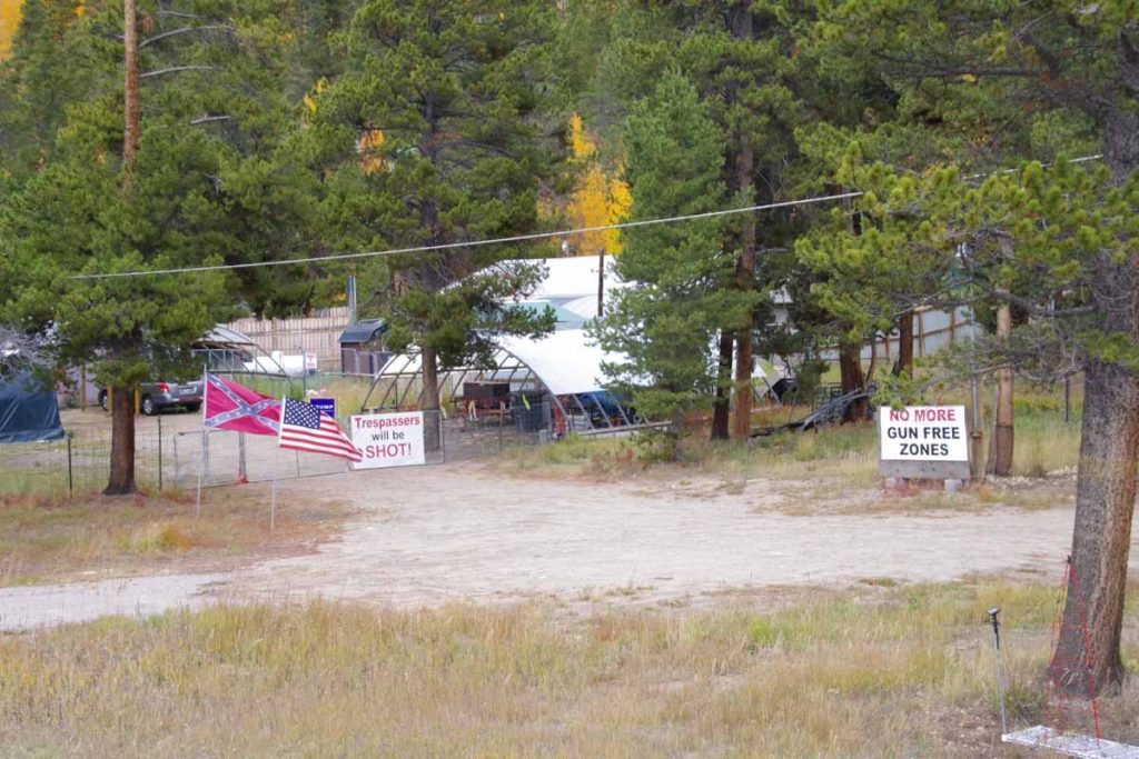
On the way down, this place seemed to broadcast his political views, complete with confederate flag and Trump sign.
imgp4023
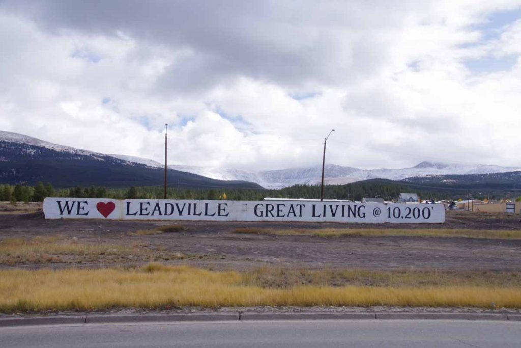
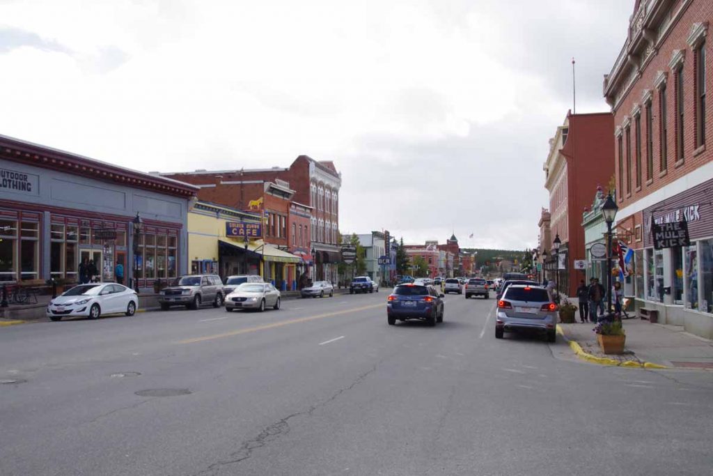
Without too much trouble I found my way to Leadville and had lunch in the old downtown.
imgp4025
After that found a place to stay not much further. It was a short ride and never did warm up much – but also nice to see some Fremont Pass again.

Posted in Colorado, USA | Tagged cold, molybdenum, pass

West Yellowstone

A bicycle ride across the Americas Posted on 2016-09-06 by mev2016-09-06

Two days cycling brought me to West Yellowstone. Both days with cooler temperatures, but weather forecasts look good from here.

Day One
IMGP3656
Fishermen were getting ready early as I prepared for a cold day of cycling following my rest/rain day.

Sunday had been cold and wet in Ennis. Good time to drop by laundromat and otherwise take it easy in Ennis. Wet weather was forecast to continue Monday morning, but other than periodic showers, Monday was definitely better than Sunday.
IMGP3658
Photo above gave a nice overview of the day. Water in the rumble strip divots and snow up on the higher peaks. The distance was only 38 miles but included 1100 ft of net climb and some headwinds on the second half of the ride.
IMGP3660
At 11 miles was Cameron store which was closed for Labor Day. However, it was still a good spot to shelter from the wind and eat a snack. After that, continued to follow the road as it slowly followed the Madison River.
IMGP3662
There were several boat ramps with access to the river. I saw a number of boats like these. Seemed like one person was guiding the boat with oars while others might stand in the boat with their fishing rods. Stopped briefly at a rest area at 34 miles and then cycled the last bits to a placed named “Driftwater Resort”. It was still overcast and cool (7C or 45F) when I arrived but later in the afternoon the sun came out again and it warmed a few degrees.

Overall Driftwater Resort was a nice overnight. In the evening, the bar and grill opened and I had a large enough pizza that I ate two thirds for dinner and left the rest for breakfast.
Day Two
Overnight frost but bright sunshine had me hopeful it would quickly warm up. Some recent snow on the higher peaks.
IMGP3664
At 2.5 miles the road junction split, though both routes were just about the same distance. This was the other road leading south over Raynolds Pass and briefly through Idaho.

The road I took followed the river and then went via Earthquake Lake and Hebgen Lake. There were multiple signs along the way about the August 17th, 1959 magnitude 7.3 earthquake that hit the area (wikipedia description). Rock slides killed 28 people and blocked the Madison River to create Earthquake Lake. It was interesting understanding more about the story as I cycled past the signs.
IMGP3668
Here is Earthquake Lake. Notice that it had become cloudy and quite a bit cooler, so back to ~2C (35F) for most of this stretch.
IMGP3670
Here was a sign that described Refuge Point. The road had been blocked and survivors made their way here. The mural also shows smokejumper firefighters who parachuted in to help.

After Earthquake Lake, came past the dam for Hebgen Lake (which fortunately held during the earthquake).
IMGP3672
Met a touring cyclist on her way riding from Canon City, CO to Corvallis, OR.
IMGP3673
Here was another view of Hebgen Lake as the worst overcast had cleared and it finally started warming up. Still interesting to see in parts the lake was still steaming earlier as if the water temperature was warmer than the air.

After Hebgen Lake, joined US 191 and cycled the last eight miles into West Yellowstone.
IMGP3678
West Yellowstone is a touristy and somewhat expensive little town. I got a chance to walk around some of the shops including the local bike shop. Also stopped in the Visitor Center where I could look over the maps as next few days are planned out.
IMGP3677a
Good topographic view of the area. General plan is numbered on map above (1) West Yellowstone (2) cross into Yellowstone and camp at Yellowstone Lake (3) go south via Teton National Park and Moran, WY (4) cross Togwotee Pass and then over via Dubois, WY. In addition to being a bit hilly, this is somewhat higher elevation so glad I waited just a bit for the worst of the wet to pass through the area.

By the also passed two milestones in the ride to West Yellowstone: (1) passed 5,000km of cycling for this trip and (2) passed south of the 45th meridian – half way from North Pole to equator and also half way from Arctic Circle to the Tropic of Cancer (pretty close to southern tip of Baja).

Posted in Montana, USA | Tagged cold, earthquake, other cyclists
©2023 - A bicycle ride across the Americas - Weaver Xtreme Theme
↑