↓
 

A bicycle ride across the Americas

from Deadhorse (SCC) to Ushuaia (USH)

  • Home
  • Plan
  • Blog
  • Photos
  • FAQ
    • Why?
    • Where?
    • What next?
  • Map
  • Equipment
  • Calendar
  • Countries
    • USA
      • Alaska
      • Montana
      • Wyoming
      • Colorado
      • New Mexico
      • Arizona
      • California
      • Texas
    • Canada
    • Mexico
    • Guatemala
    • Honduras
    • Nicaragua
    • Costa Rica
    • Panama
    • Colombia
    • Ecuador
    • Peru
    • Bolivia
    • Chile
    • Argentina
  • Weather
  • Links
  • Contact
Home→Categories USA - Page 4 << 1 2 3 4 5 6 7 >>

Category Archives: USA

Post navigation

← Older posts
Newer posts →

Salida

A bicycle ride across the Americas Posted on 2016-09-25 by mev2016-09-25

Downhill, little wind and warmer. Big contrast today from yesterday as I followed the Arkansas Valley downhill from Leadville to Salida. While it was a route I’ve done multiple times, I still enjoy coming down past the Sawatch range and the 14ers.
imgp4027
It was barely below freezing starting out. I had a nice descent from Leadville but that also meant less pedaling to keep warm. In photo above, I crossed the Arkansas River. Still pretty small here. The valley opened up, but fortunately not much wind either direction.
imgp4029
At 14 miles was a turnoff to CO 82 for Twin Lakes as well as the road that goes over Independence Pass. The sign indicated there was a scheduled burn to get rid of extra fuel. After this the road went through more of a small canyon and past the town of Granite.
imgp4030
Picture above shows both the canyon, railroad and remains of a stagecoach road. The stagecoach route was created when Leadville had its gold and silver rush.
imgp4031
After this through the town of Buena Vista. The main street was narrowed due to construction, but traffic otherwise well-behaved. A short refuel stop before going on the road.
imgp4039
Photo above is Mount Princeton and Antero. Looking back at my photos, many of them were of the different 14ers as I came past, though there is also some similarity.
imgp4041
Mount Princeton is interesting because of the white “chalk”, which is actually coloration of the granite coming from mineral springs.
imgp4043
Rafting is a huge business during the summer. Places along the road seem to mostly be closed for the season.
imgp4044
Past some ranches and cattle as well as this fake bull.
imgp4045
Sign about the early Pike expedition through the area.

At 49 miles the road split and I took the high road to Poncha Springs. It went over a small ridge and back up to 7600ft before I turned back onto US 50 and descended back to Salida. Overall nice to have an easier ride today. Otherwise get ready for another pass (Poncha Pass) tomorrow.

Posted in Colorado, USA | Tagged downhill, Sawatch Range

Leadville, Fremont Pass

A bicycle ride across the Americas Posted on 2016-09-24 by mev2016-09-24

A chilly ride over Fremont Pass to Leadville.
imgp3991
Yesterday was a quiet rest day in Copper Mountain. It is “mud season” after the summer resort season and not yet ready for ski season. In the afternoon a cold front came through with wind as well as snow flurries. As you can see above, it didn’t really accumulate much and mostly made things wet.
imgp3994
It was cold the next morning and I waited until the sun got a chance to get up. The lowest temperatures my cycle computer showed for the ride was -5C (23F), just a bit on the chilly side for the gear I have with me. At least the storm had passed through and no wind.

After 0.5 miles I reached the junction with CO 91 and climbing began almost immediately. Fortunately a fairly gentle ~3% type grade until the 4.5 mile mark where there was a two mile hill with grades closer to 6%. The climbing took enough effort that I kept warm.
imgp3997
There were road markings left on the road, on photo above you can barely see “Ali” a bit ahead. This was the last part of a sequence on the road: “Float like a butterfly” (0.25 mile gap), “Sting like a bee” (0.25 mile gap), “R.I.P. Ali”. One of the markings indicated it was from RTR (Ride the Rockies). This past summer, the RTR route did the “Copper triangle” from Copper Mountain to Leadville to Vail and back to Copper Mountain. It is also a popular ride other times as well. In any case, nice to have some of the hazards marked and interesting these markings are still there three months after RTR.
imgp4002
After seven miles the road flattened with a majority of the climbing completed. One could look over the large tailing ponds, not frozen yet. The marker above marked the former towns that had been flooded over by tailings and mine debris.
imgp4003
Here is a photo taken right next to the monument.
imgp4007
Not long after this, the last little bit of climbing brought me to summit of Fremont Pass. The marker on left tells that this was also a boundary of the 1803 Louisiana Purchase.
imgp4005
Just before reaching the summit, I could see the Climax Molybdenum Mine. At its peak output, this mine supplied 3/4s of the worlds molybdenum. It was shut down in 1995 and recently reopened in 2012.
aimgp4011
There was a little display here about mining.
imgp4015
Included was a description of the tailings (half a billion tons!) that helped bury little towns below.
imgp4018
From the top of Fremont Pass, the temperature was now up to -1C (30F) and warmed a bit from there. However, there was also a cold west wind and I was no longer climbing, so felt colder on the way down than the way up.
imgp4020
On the way down, this place seemed to broadcast his political views, complete with confederate flag and Trump sign.
imgp4023
Without too much trouble I found my way to Leadville and had lunch in the old downtown.
imgp4025
After that found a place to stay not much further. It was a short ride and never did warm up much – but also nice to see some Fremont Pass again.

Posted in Colorado, USA | Tagged cold, molybdenum, pass

Copper Mountain

A bicycle ride across the Americas Posted on 2016-09-22 by mev2016-09-22

Leaf season is here. Lots of yellow aspen trees and some leaf peepers stopping along the road.
imgp3971
Less wind today. Fortunate as I did climb from ~7300ft to end at ~9700ft. Started the day with breakfast in the Moose Cafe, but this time in Kremmling. Highway 9 had signs about road construction, though this was some of the better riding. Except for signs like the one above, the first seven miles didn’t have much other than a machine they were using to put in rumble strips in a fresh shoulder. Fortunately, the shoulder is wide enough that these rumble strips will be OK.
imgp3973
Crossed the Colorado River. Placid and not much flow here in the fall.
imgp3974
There was also a wildlife bridge. The one above just finished and one later they were still working on. One or two places they had narrowed to allowing traffic one direction only.
imgp3975
By the time I got to Green Mountain Reservoir the construction was mostly done. Unfortunately, the shoulder also narrowed here. However, with light winds and gentle climbs it was reasonably fast riding. After 38 miles I got myself to Silverthorne and then Dillon.
imgp3979
Expedia has a “mystery hotel” program. They won’t tell you the hotel other than the price and rough location – at least until after you pay. I had seen a place in Copper Mountain that wasn’t too expensive so placed a reservation. Turns out it is a small condo right in the ski area central area. Also one needed to pick up the key cards in Dillon – which fortunately was on the way.
imgp3980
After this I cycled up and along Dillon Reservoir.
imgp3981
In Frisco was this van which had taken bicycles to top of Vail Pass and then let tourists cycled down the path back to Frisco.
aimgp3984
After Frisco were a little over six miles of bike path along the I-70 corridor. After that I found my way to the condo. Things are fairly quiet here now in “mud season” and many of the shops are closed. However, what I like is that I’m already at 9700ft and hence only ~1600ft of climb to get over Fremont Pass on way to Leadville. I have a rest day here and then likely a cold ride over the pass.

I also have some more clarity on travel routes from here. Rough idea is to go

  • First, due south via Alamosa, Santa Fe and to Socorro.
  • From Socorro, I’ll pick up Adventure Cycling Southern Tier maps. The maps describe a route from El Paso to San Diego. I rode them the other direction in 2001. I will most likely not go all the way to El Paso, but instead head west to catch the Southern Tier route.
  • Follow the Southern Tier via Tempe (Phoenix)
  • Follow the Southern Tier to San Diego

Still a ways to go in the USA, but nice to have better answer when someone asks “where are you heading?”. For now it will be “Santa Fe”.

Posted in Colorado, USA | Tagged aspen, climbing, ski area

Kremmling, on the road and into the wind

A bicycle ride across the Americas Posted on 2016-09-21 by mev2016-09-21

Two days riding brought me to Kremmling. This was familiar riding on roads I had cycled several times before.
Day One
Nice to be back on the road again. Today the theme was “beat the wind”. While I did end up with headwinds much of the day, I still felt partially successful with almost no wind the first 10 miles.
imgp3946
The ride from Laramie quickly becomes flat and open. I was in familiar territory and had done this ride multiple times before. The first 26 miles were through wide open land where the wild card is the wind. It once took me 6 hours to cycle that distance with some ferocious headwinds. Fortunately it was calm starting out and lighter headwinds the last half of the distance.
imgp3947
At Woods Landing, one trades the wind for 1000+ feet of climbing. I stopped in and talked with the clerk for a bit. She noted it had been rather hazy, most likely from some of the fires in the area.
imgp3949
The aspen are beginning to turn. I climbed to slightly over 9100ft before having an occasional descent coming into Mountain Home. Not much later, I crossed the Colorado border.
imgp3951
The first indication was the CO 127 road sign.
imgp3952
However, shortly thereafter I came to the Welcome to Colorful Colorado sign. It was 9 miles of both headwind and mostly downhill from here to the next road junction.
imgp3954
This brought me to North Park, a large treeless and relatively flat area. Walden is in the middle of this space.
imgp3957
Cowdrey is first. Above is the small post office. There isn’t much else in Cowdrey.
imgp3959
At end of 63 miles I was in to Walden. There are five motels in town and none have vacancies. Apparently, a combination of firefighters, hunters and other workers have made this very popular. It is currently bear and elk season with the latter being bow hunting only. I’m told it will get even busier once the elk season opens for rifles.

Otherwise Walden dubs itself as the “Moose watching capital of Colorado”. I wandered through familiar haunts before camping in the city park.
Day Two
Warm overnight and the sprinklers didn’t come on. Today definitely had some riding into the wind as it was blowing even at the start. The first 34 miles started in flat open North Park.
imgp3961
There was some energy development going on at several sites.
imgp3962
Shoulders on the road were narrow and there was some truck traffic, but all well behaved.
imgp3965
After ~22 miles the road slowly found a valley and followed gradually up to the pass. Definitely have a lot of fall colors.
imgp3966
Not far from the top, one can spot the Rabbit Ears. I wasn’t going up all the way to Rabbit Ears Pass, but instead just over a 8772 ft continental divide crossing named Muddy Creek Pass.
imgp3967
There wasn’t even a sign, so took this photo of the Highway 40 Junction instead. From this point, it was ~1300ft of descent over 27 miles down to Kremmling. Here I definitely noticed some of the wind coming from the south.
aimgp3968
Nice view coming towards Kremmling.
imgp3969
Within Kremmling, met this cross-country cyclist headed west. Also met four Great Divide Mountain bike riders on their way south. No photo because I was walking around town without my camera. They had started roughly the same time as myself in Banff and were making good progress.

Overall, nice to be riding on the cleaned and fixed hub again. The past two days were good riding made a little more difficult with headwinds but also over familiar routes.

Posted in Colorado, USA, Wyoming | Tagged moose, wind

Laramie, ready to get back on the road

A bicycle ride across the Americas Posted on 2016-09-19 by mev2016-09-19

imgp3945
I picked up my bicycle from Lee’s Cyclery in Fort Collins. Diagnosis on the hub was nothing broken, but instead the hub had gotten fowled and oil was dirty and hence the pawls were sticking shut. A good cleaning and light lube and it should be ready to go again.

Otherwise, renewed both the chain and cassette which were worn. The bike rode well on the four miles from airport. Will see how things go from here. In addition, I’m also looking at a possible different hub (DT Swiss) that will be more easy for me to open and clean on the road.

Plan is to depart from here tomorrow headed towards Walden, CO. Still looking at exactly where on the Mexico/US border I will head towards: El Paso or San Diego or somewhere in between.

Posted in USA, Wyoming

Pedal the Plains

A bicycle ride across the Americas Posted on 2016-09-18 by mev2016-09-18

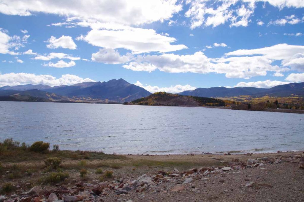
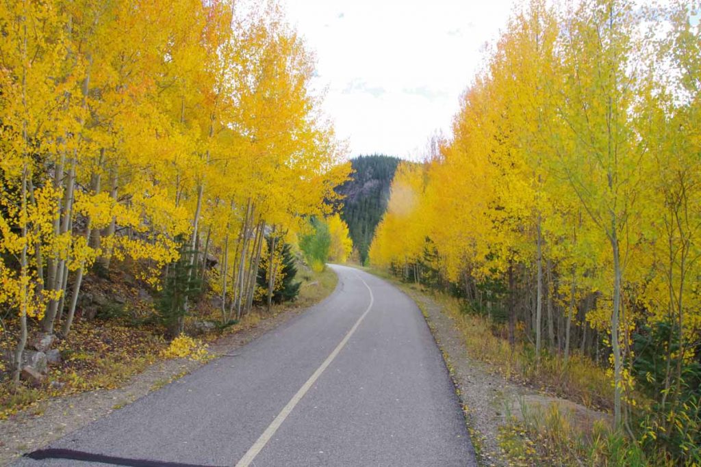
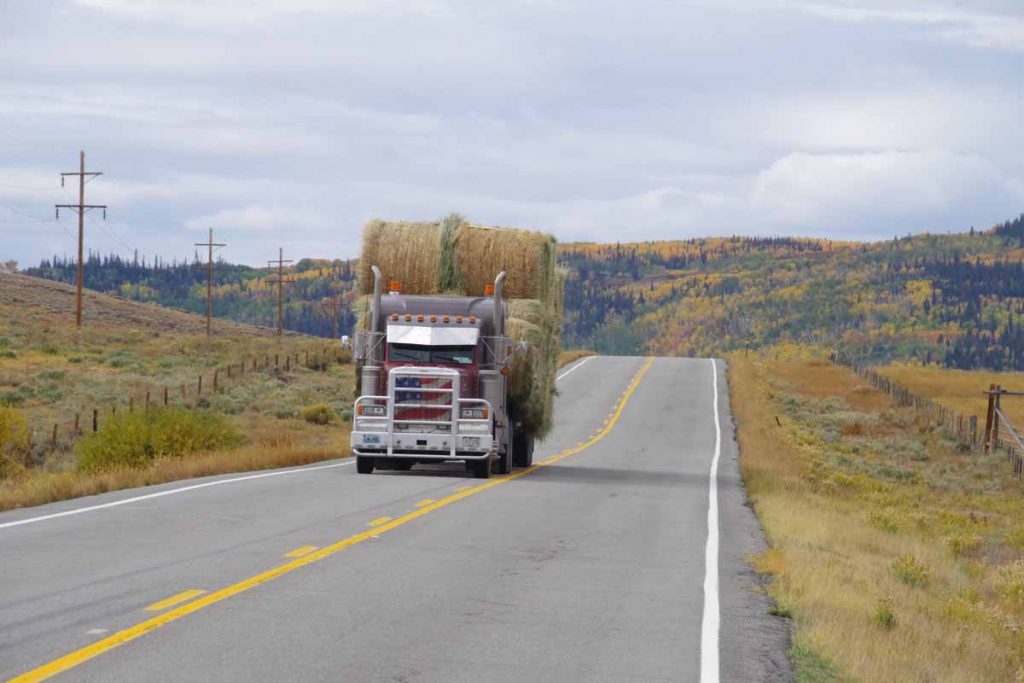
This past weekend I took an intermission to do an event ride named Pedal the Plains (PTP). The ride was 154 miles spread over three days: 24 on Friday, 59 on Saturday and 71 on Sunday.

Pedal the Plains was started in 2012, I believe as an offshoot of “Ride the Rockies” (RTR) ride which has now been going for 30 years. RTR is a week long supported ride of ~400 miles through the mountains and passes of Colorado. PTP was intended to bring a similar experience to the small towns on the eastern plains of Colorado. This results in several interesting comparisons and contrasts:

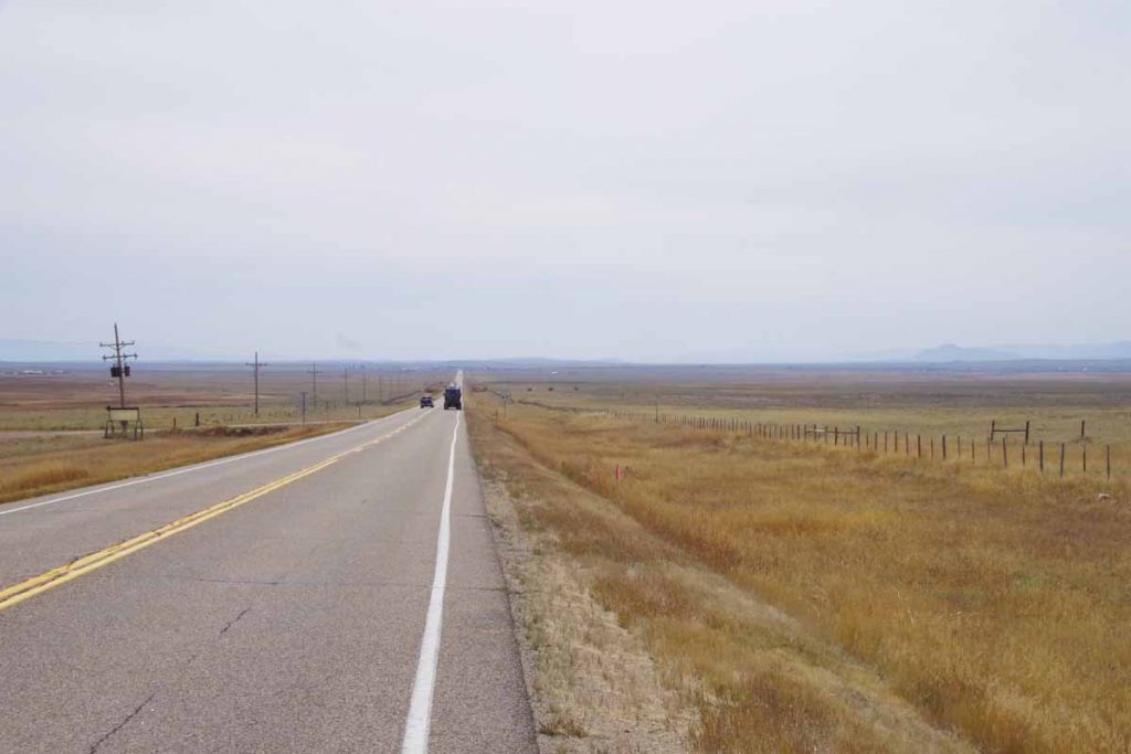
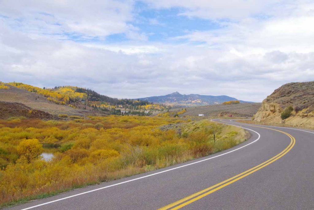
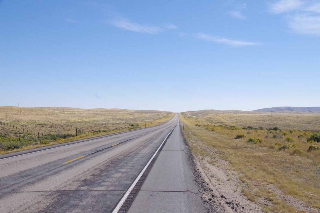
  • RTR is a more strenuous ride, particularly in terms of climbing as each day one might climb several thousand feet over a pass to get to the next town. In contrast, the Great Plains are relatively flat. The distances on the ride are not necessarily shorter (Saturday has an optional century ride), but as long as the wind cooperates, it is easier riding.
  • Many of the mountain towns, particularly the resort towns get many visitors through the summer and winter months. As a result, having 2000 (RTR) cyclists come through town is business and not a huge deal since similar events happen fairly often through the year. There are exceptions as not every mountain town is a resort town but one gets polite service but not necessarily a sense this is special. In contrast, these small plains towns seem to have fewer big events (e.g. county fair, rodeo) and having 1000 (PTP) seems like a novelty and a big deal. One definitely gets a sense of hospitality as the town turns out to help take care of their visitors
  • PTP has taken an “education” slant. The aid stops are not just places to refuel on bananas and gatorade, but instead each day there are half a dozen educational themed stops. One learns about life on the plains, about energy, about local history and similar themes. As one cycles along, signs have been placed along the route with short educational factoids and tidbits. I think it started with an idea of “this is our chance to show those folks from Denver what it is like to live out here on the plains” and has grown from there.

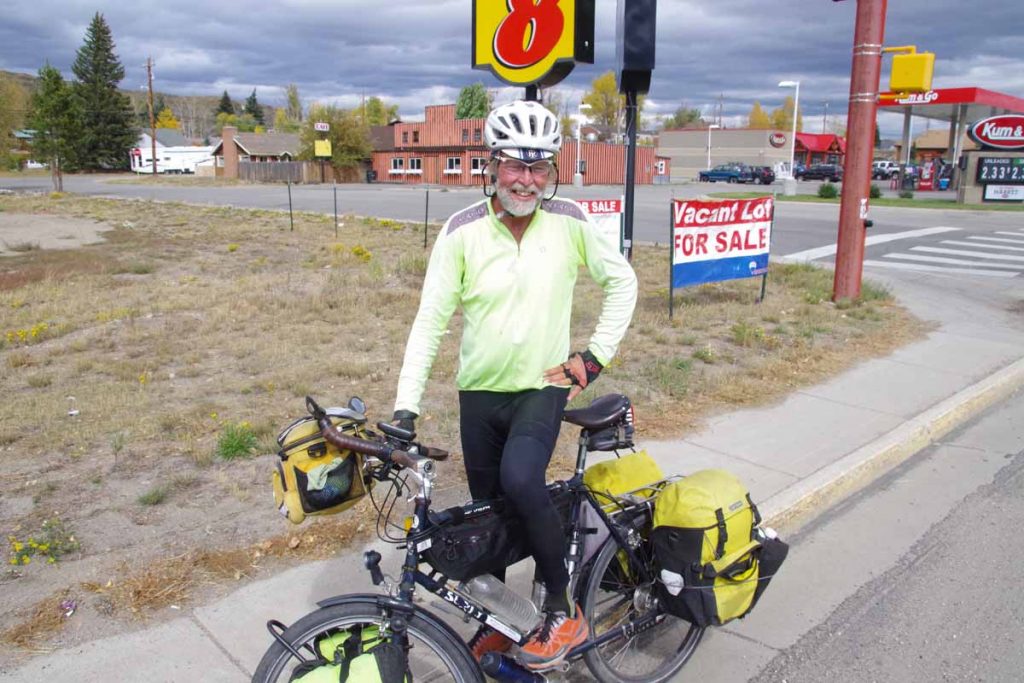
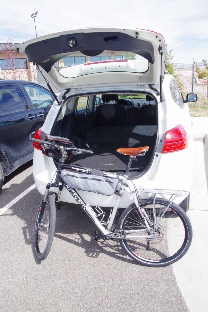
Overall, I’ve ridden all five of the PTP rides so far (2012-2016) and when my schedule started to line up, seemed like a good excuse to rent a car, get the bike serviced and then also ride a different bike on Pedal the Plains. I once again enjoyed my trip and will show a few photos below in the order I took them.
Day One
Today the schedule was an opening ceremony at 11am, followed by 24 miles riding from Ordway to Fowler. I drove down from my parents place early in the morning.
imgp3832
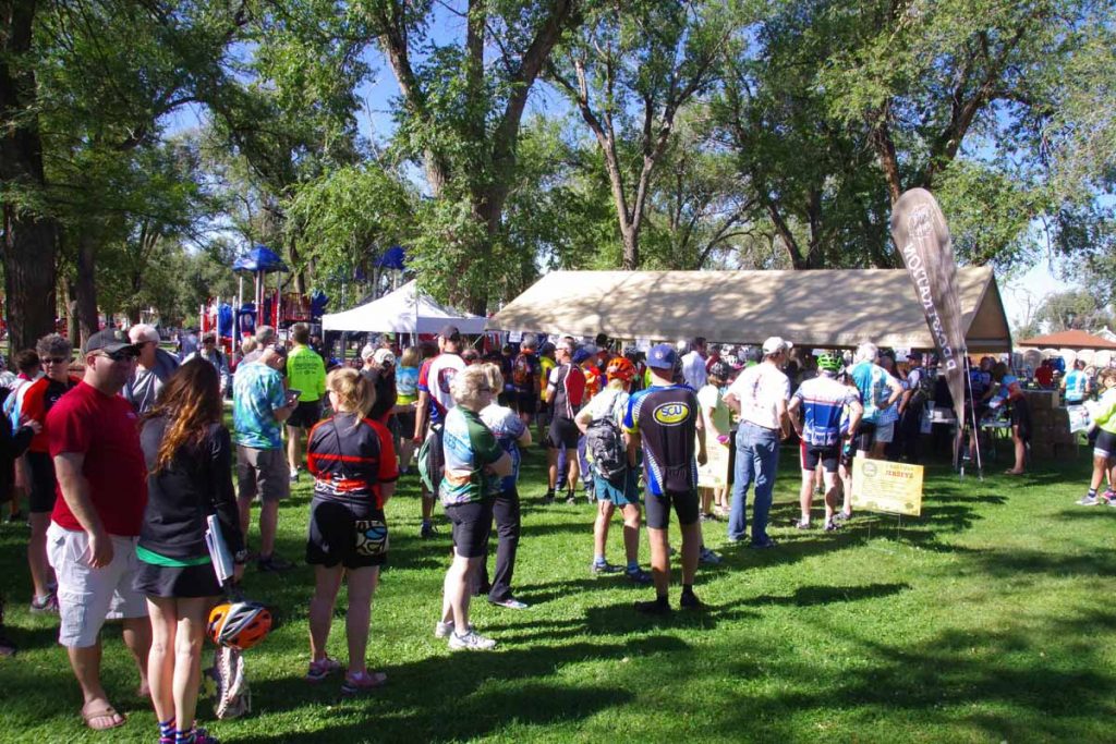
Lines for registration. We were told there were over 1000 participants this year who came from 18 different states. Though the vast majority of people I talked with were from Colorado.
imgp3842
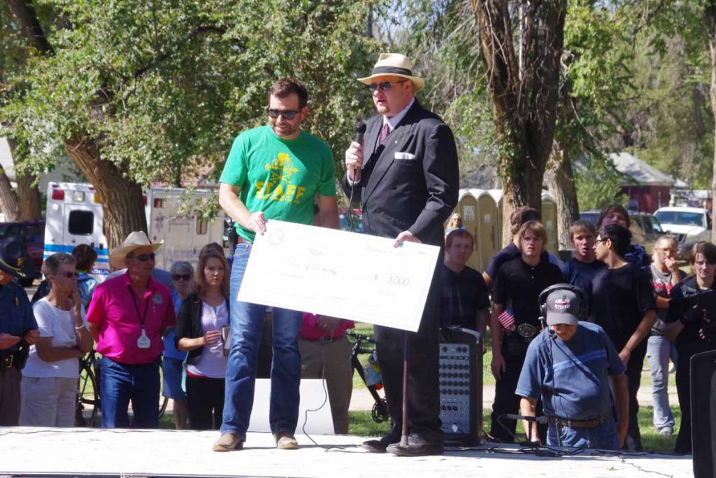
Chandler Smith, tour director presenting a check to the Mayor of Ordway.

The ride is organized by the Denver Post newspaper. The proceeds from the ride go to the Denver Post Community Foundation. That foundation distributes funds at least three different ways (a) each host town gets to pick a local charity to receive funds (b) there is a local art initiative where each town receives funds for a local art project (c) two youth oriented organizations: Future Farmers of America (FFA) and 4H both receive an overall grant. In return both organizations also help provide some volunteers at educational stops.
imgp3851
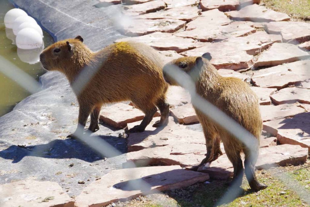
Our first educational stop was at local exotic animal park. Forget exactly what these critters were, but they also had wallabies and other rescue animals here.
imgp3852
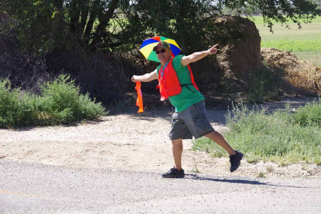
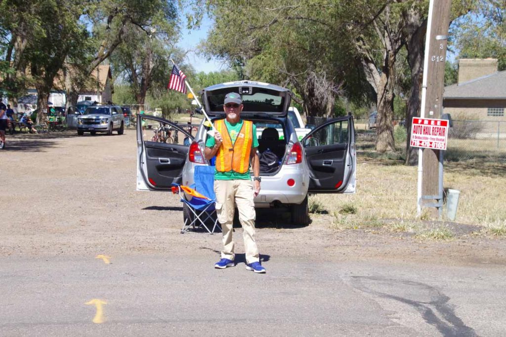
One of the volunteers helping to direct traffic. Overall both route markings and traffic direction was excellent. The busiest intersections had state highway patrol officers or local sheriffs and smaller intersections usually had volunteers such as this one.

For ride as a whole and not just routing, there seem to be several categories of volunteers:

  • Approximately 50 people such as this person volunteer in general and help out each day. Many of these seem to come back each year and so have built up knowledge of how to organize the event.
  • Governor Hinkenlooper took special interest in getting this event started and his office of local governmental outreach helps with organization as well as providing a number of volunteers.
  • Local communities take care of meals as well as volunteers in each town for everything from shuttles to entertainment, etc.
  • FFA and 4H clubs come out to help educate as well as provide volunteers.

imgp3857
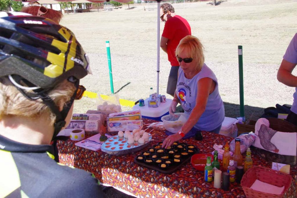
One of the educational stops. In this case, the Egg Growers association has a nice collection of hard boiled eggs on a stick. At end of each day the wheat growers had a truck with cookies and the Western Dairy Association had a truck with chocolate milk.
imgp3865
Educational stop coming into Fowler, this one at their local historical museum.
imgp3867
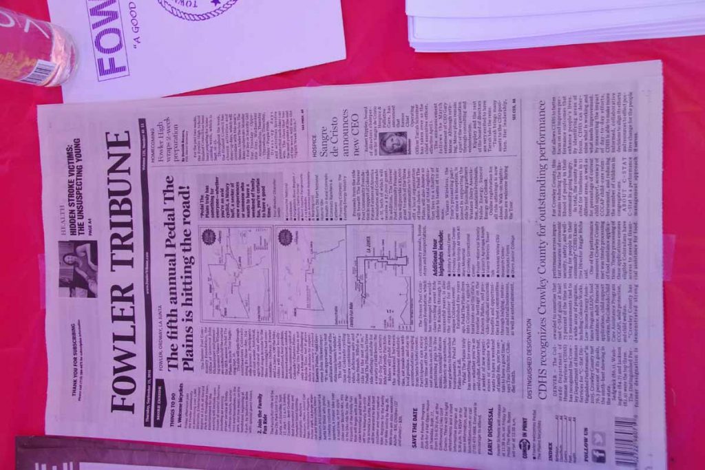
Example of newspaper stories from the Fowler Newspaper letting locals know of the coming event.
imgp3869
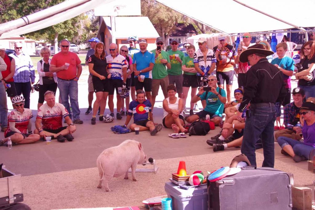
Reaching Fowler, there was local entertainment including this set of trained hogs.
imgp3871
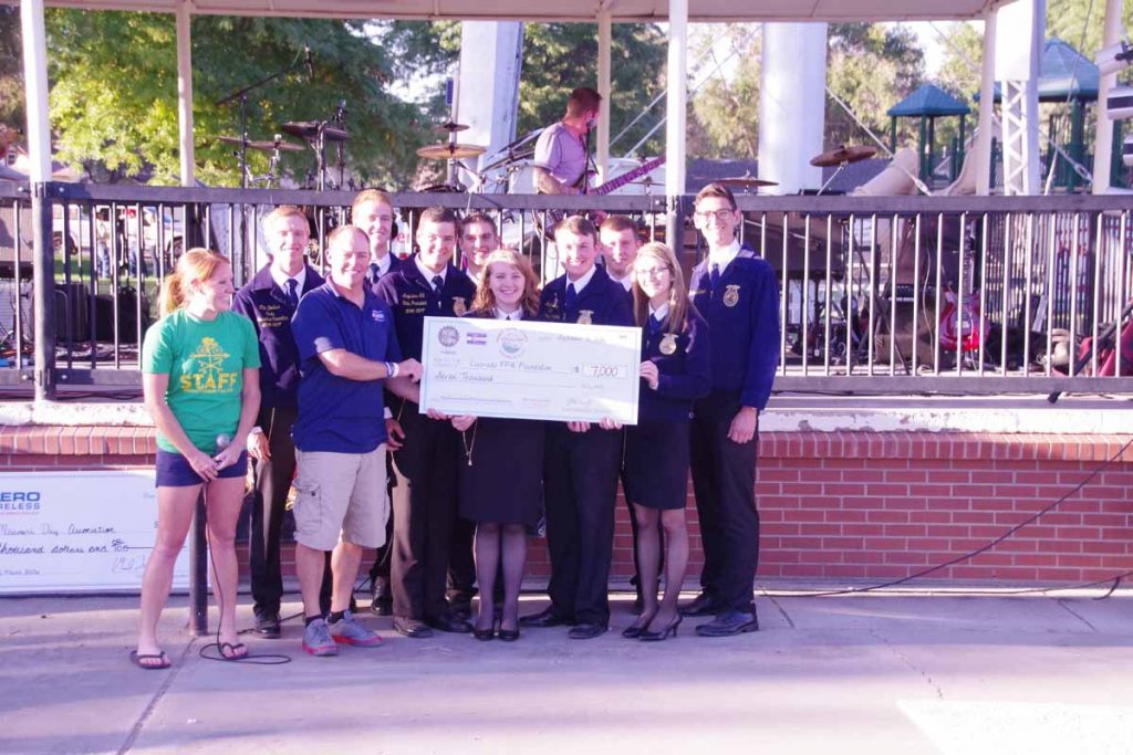
Evening check presentation ceremony. This time to the FFA.
imgp3866
Time to set up my tent in the local field. Overall a fairly easy ride of 24 miles but a lot of nice hospitality. For example, several Fowler churches opened their doors and invited in cyclists who came past. Inside could share cookies and cool water. Also nice chance to talk with locals.
Day Two
Second day the official route was 59 miles with six educational stops. There was an optional century ride and it was possible to register only for the century ride. There was also a five mile “family fun ride”.
imgp3878
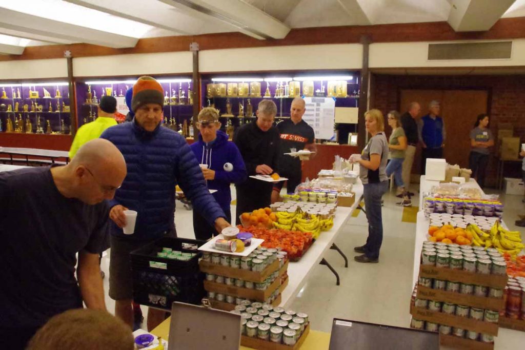
Breakfast served from 6:00am to 8:30am. Things started fairly early with a “rolling start” between 7am and 9am so likely not long after 9am the town would be quiet again.
imgp3883
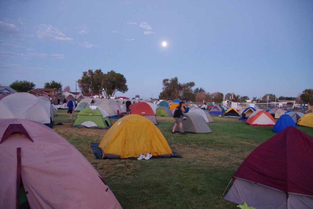
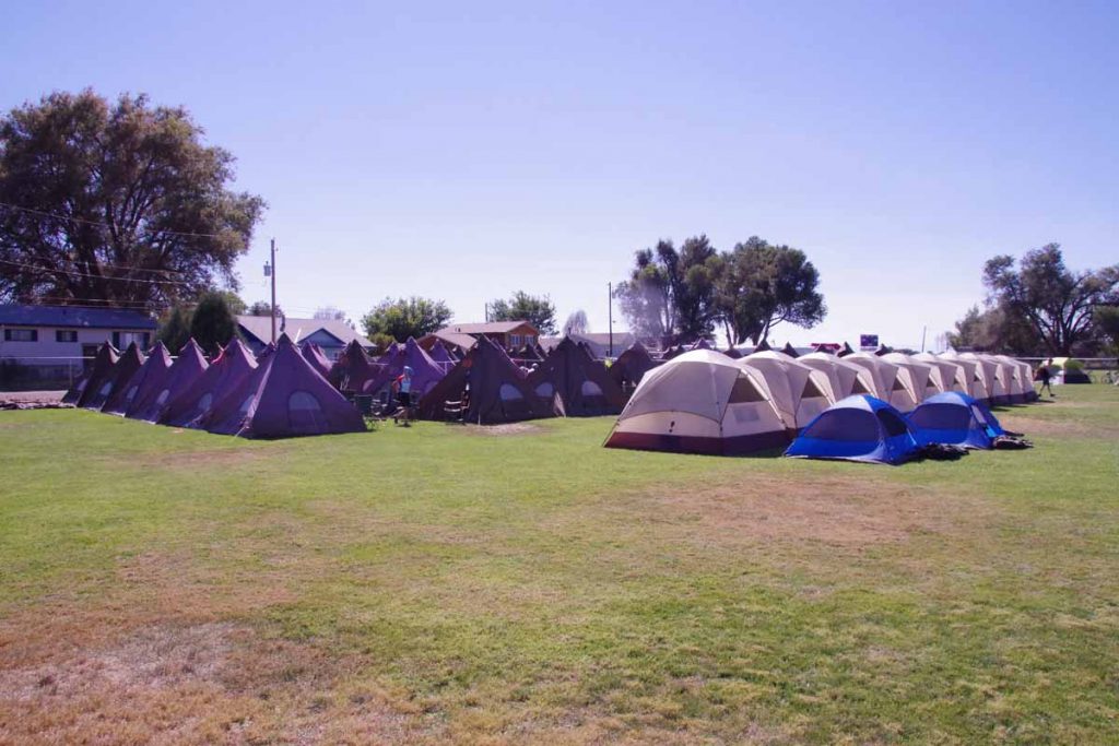
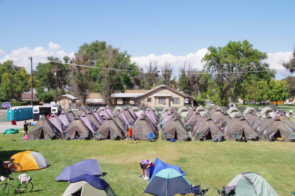
Our tent city under the moon. There were several different lodging options:

  • Outdoor camping in local ball field (shown above)
  • Indoor camping in the gym
  • Sherpa camping, e.g. sleep in a tent city, but set up by others
  • Lodging shuttles which ran went to local motels

I did the outdoor camping.
imgp3886
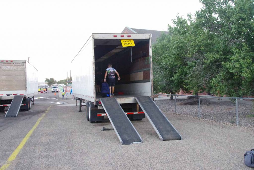
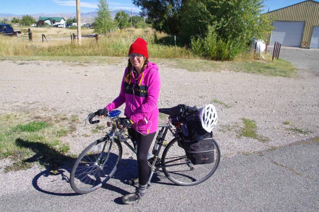
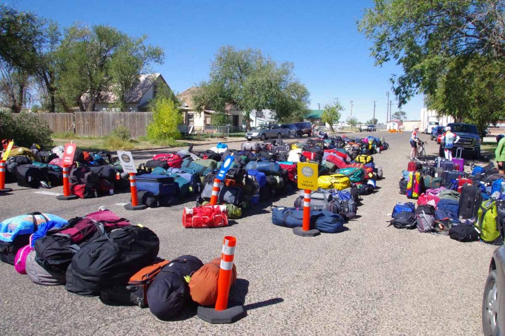
Once the luggage is packed it goes on the truck.
imgp3885
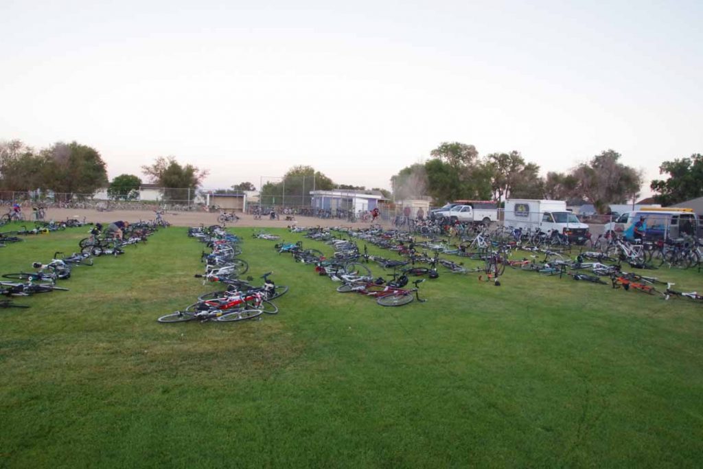
Time to pick up my bike from the “bike corral”. In this case it was a fenced off field with local volunteers checking stickers on the bike with our wrist straps to see that the numbers matched.

After that we were off and cycling.
imgp3892
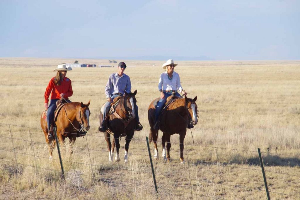
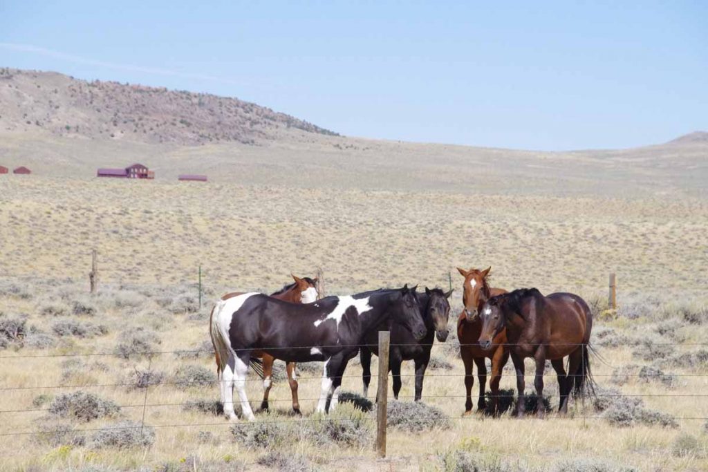
Local horse riders that we saw along the way (I think they specifically decided to do this to show the cyclists, but not 100% certain).
imgp3894
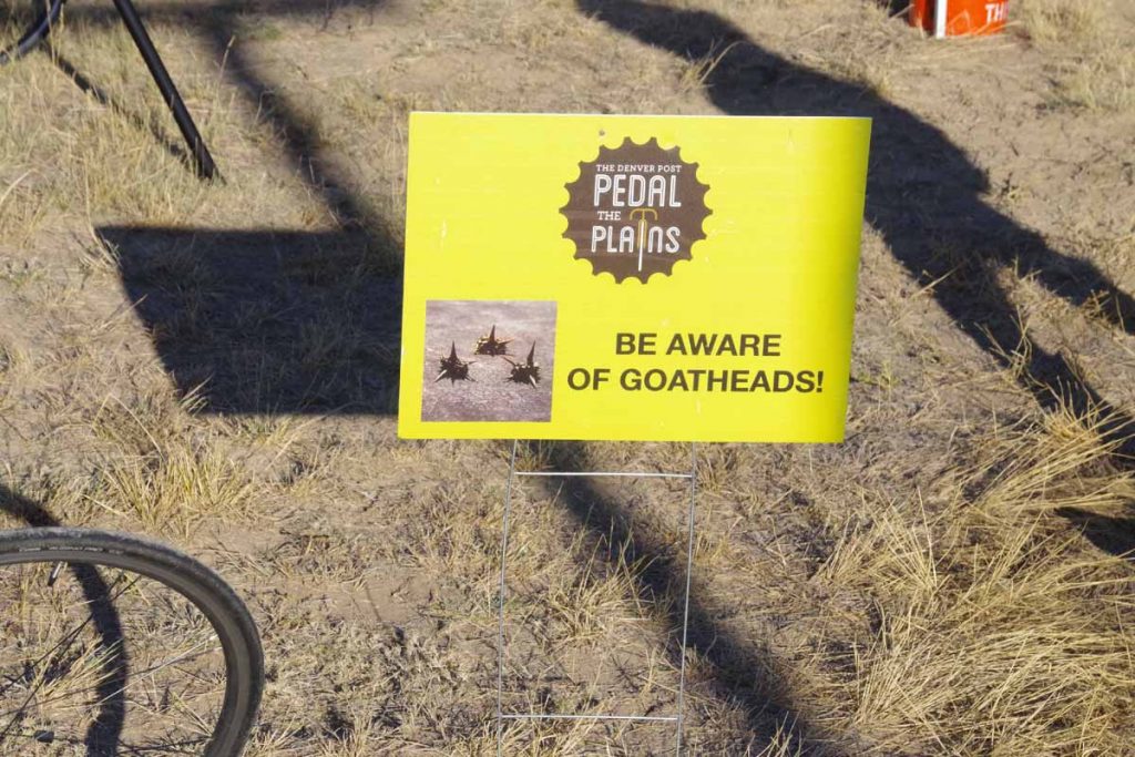
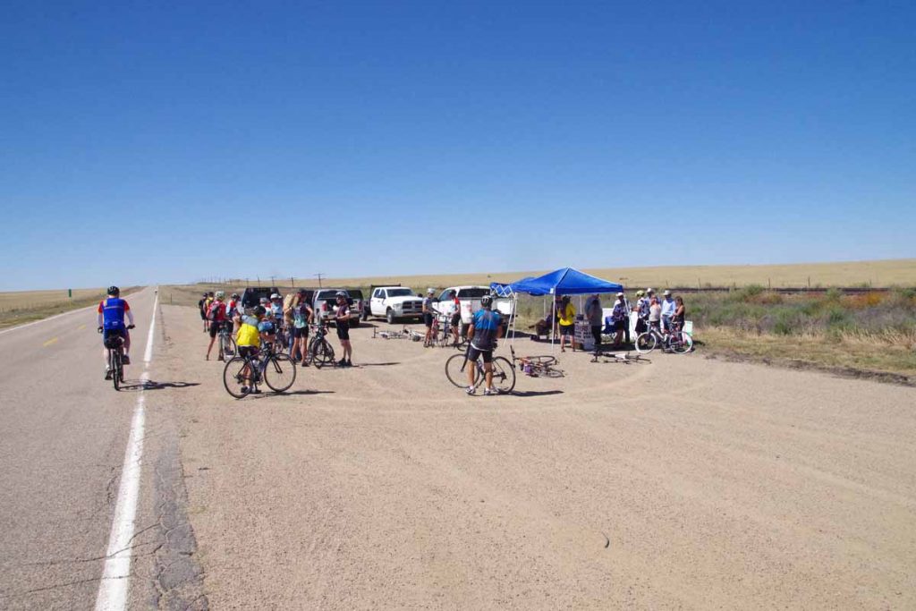
Rest stop warned us about goat head thorns.
imgp3898
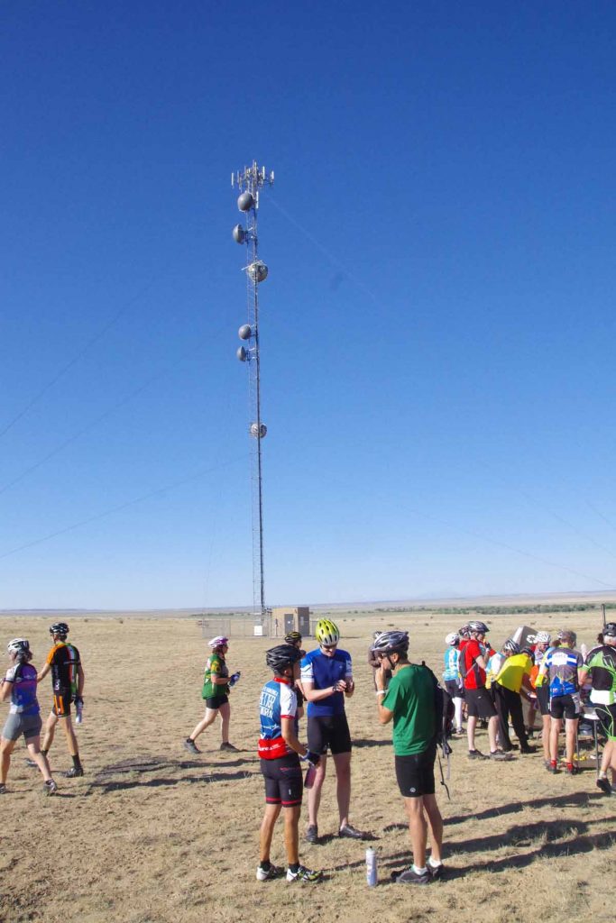
This rest stop was at a local cell phone tower. Viero Wireless, a carrier focused on the plains, was a sponsor and also did this educational stop.
imgp3902
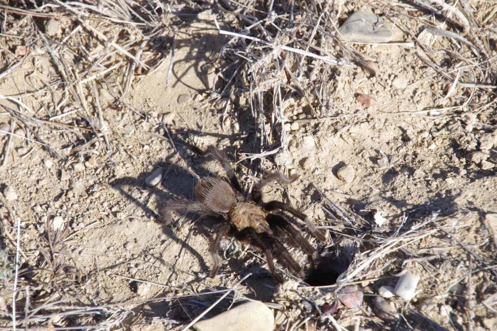
It was tarantula season and these guys were big.
imgp3905
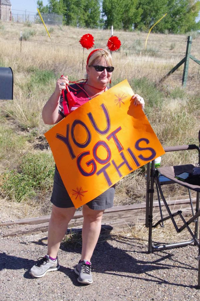
Local encouragement.
imgp3906
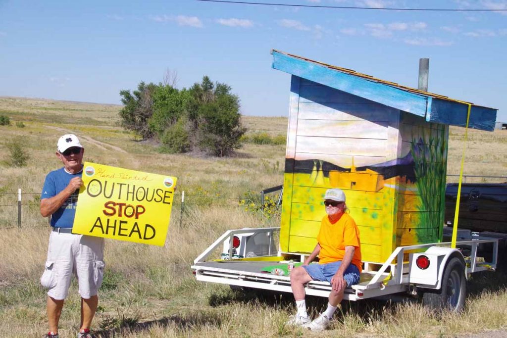
One of the art themes this year was this outhouse. They brought it out along the way as well.
imgp3913
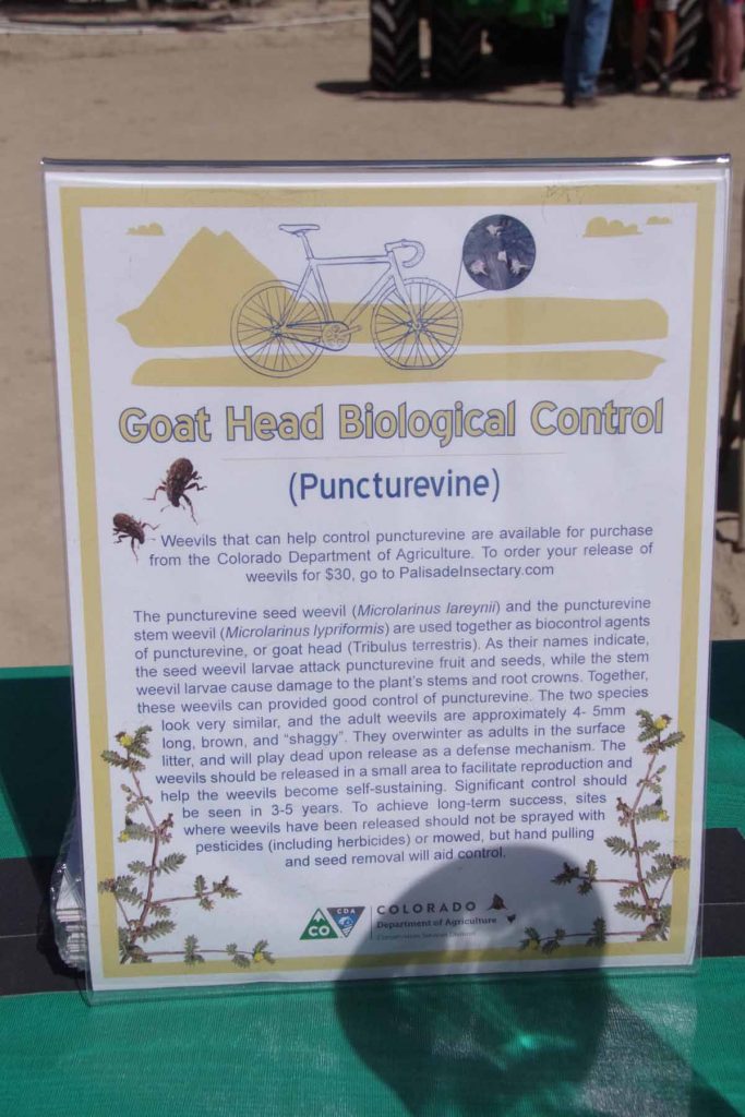
This educational stop had a description of weevils one could purchase that help eat and control goat head plants.
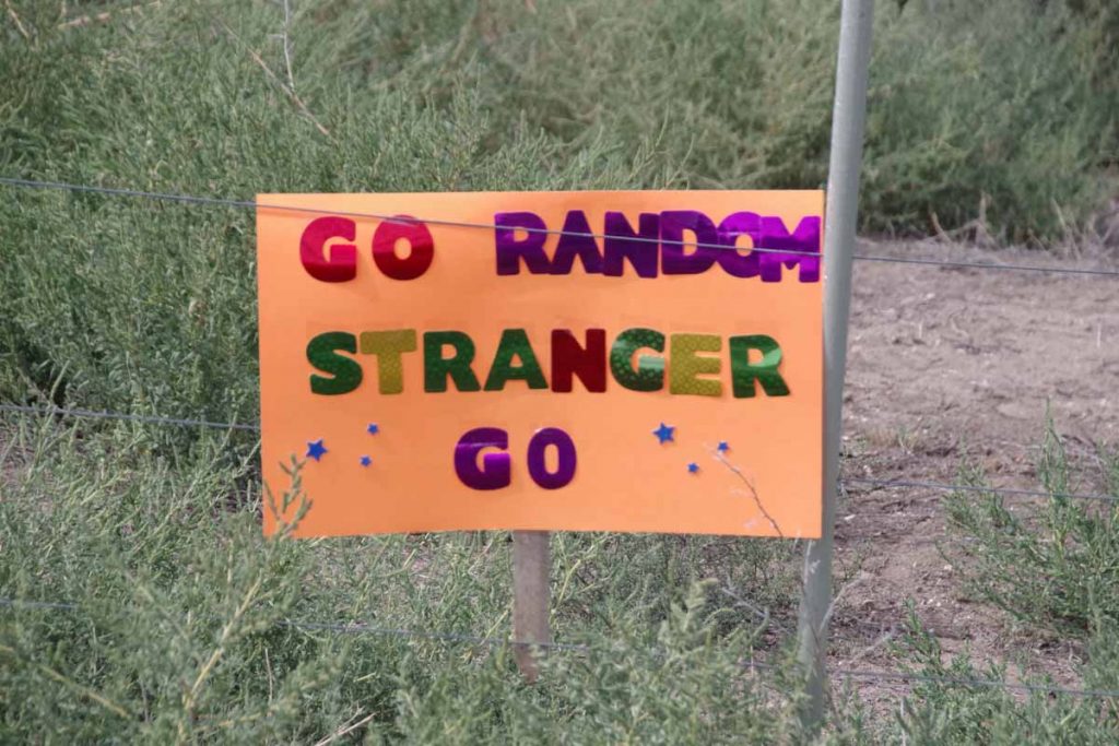
imgp3914
More encouragement.
imgp3917
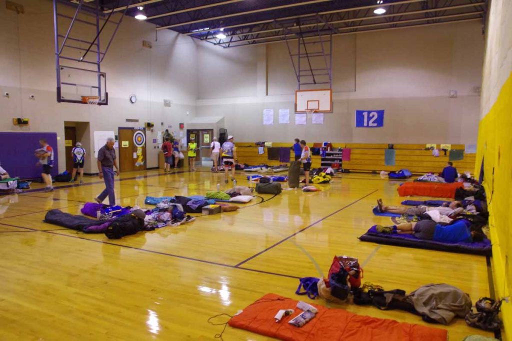
End of the day in La Junta, this time showing the indoor campers. The gym was split into “early risers” and “late sleepers” with different times the lights went on and off.
imgp3916
Our camping area.
imgp3919
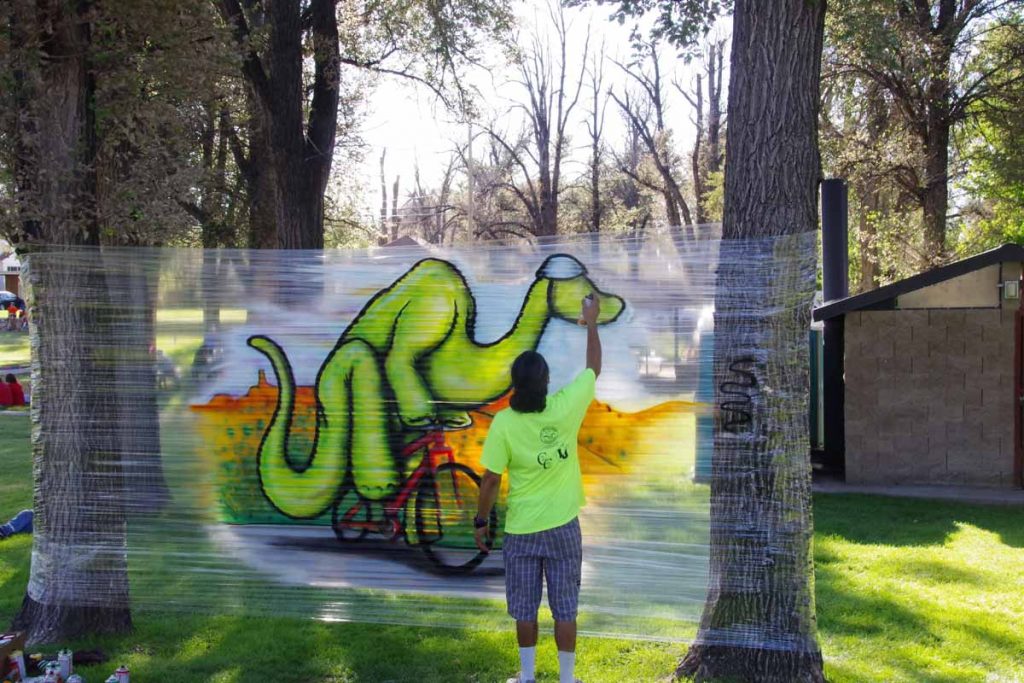
Artist finishing his work.

Day Three
Our third day cycling agenda was 71 miles.
aimgp3928
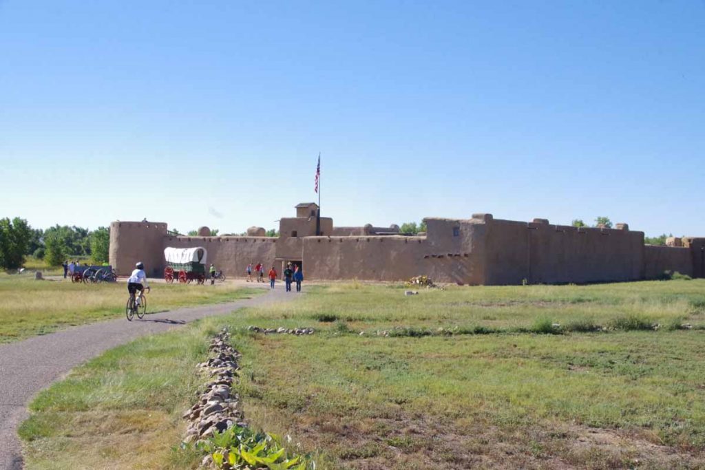
One of the educational stops was Bent’s Fort, a National Historic Site. It was rather interesting place to look around as well as learn the history.
imgp3929
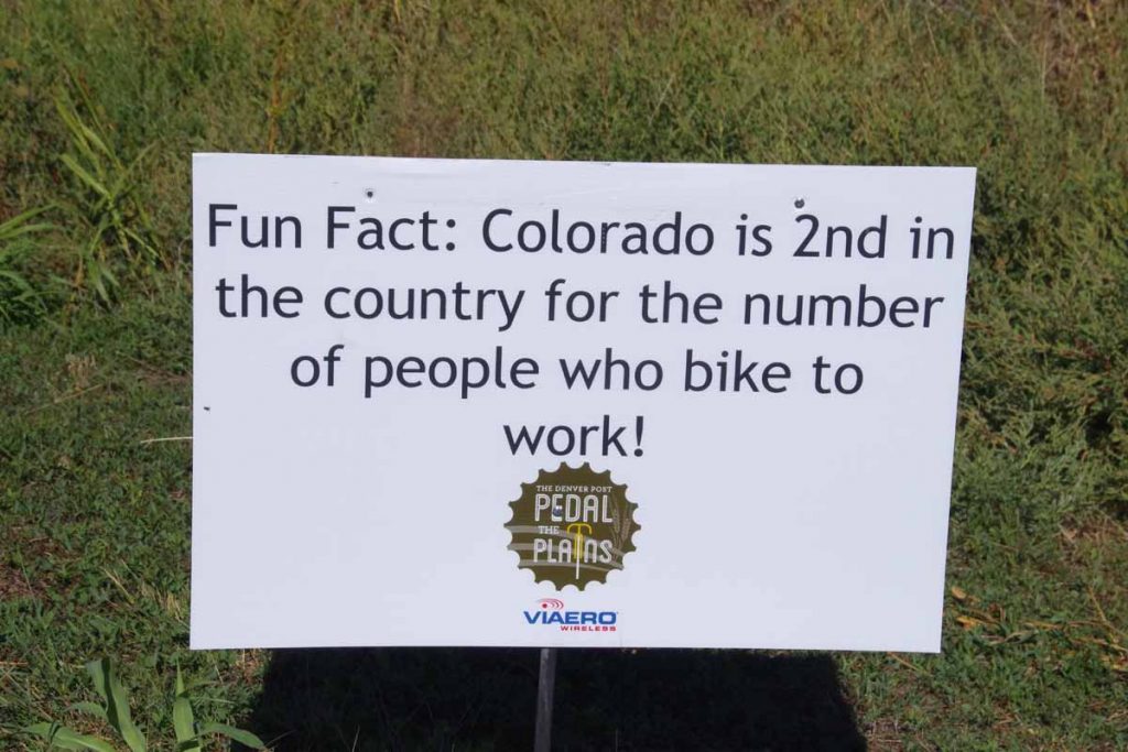
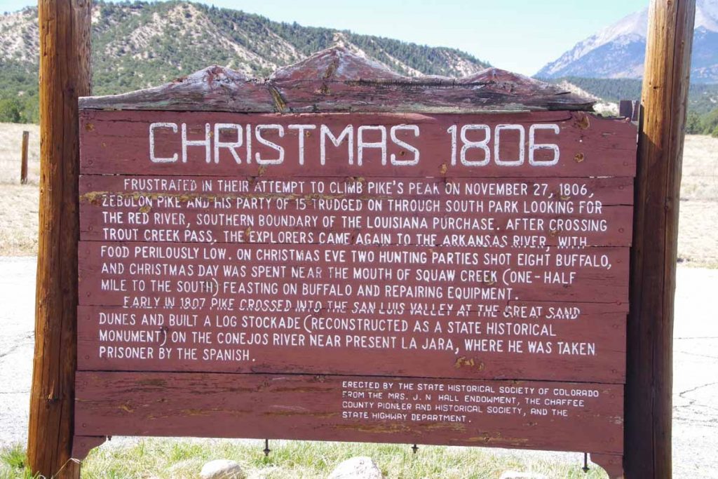
Example of educational signs that are placed along the way.
imgp3931
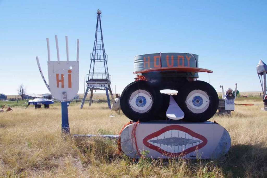
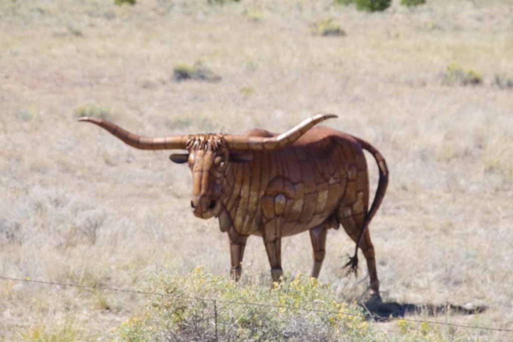
Not a formal stop, but this farm had someone pretty talented in creating this local display.
imgp3933
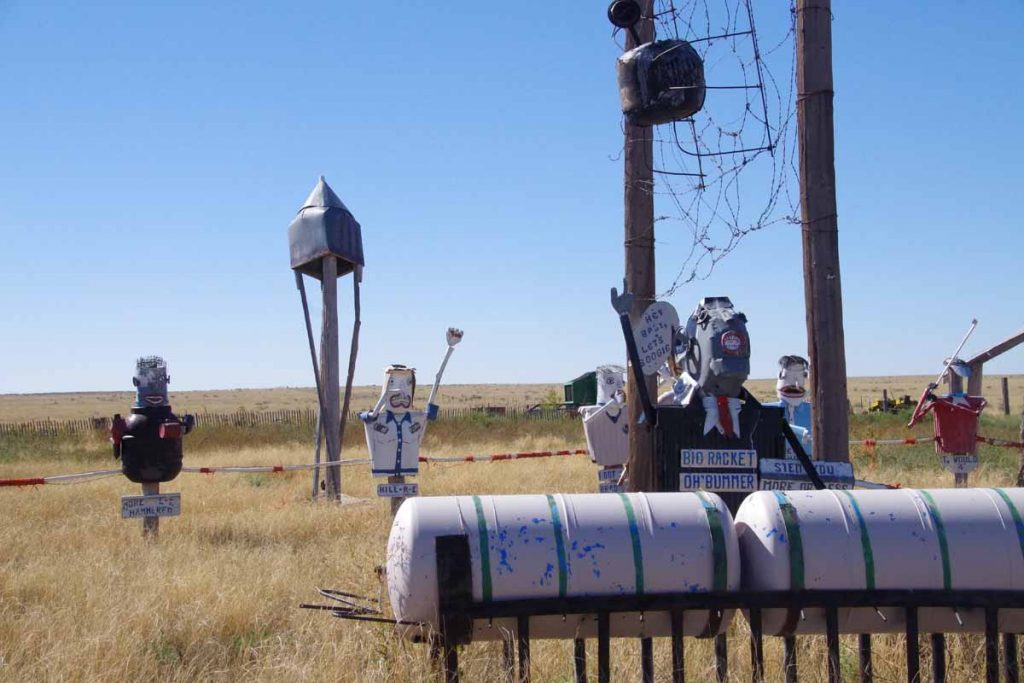
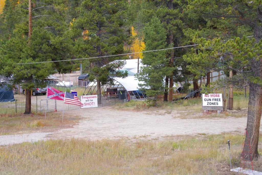
Some political themes to it as well.
imgp3937
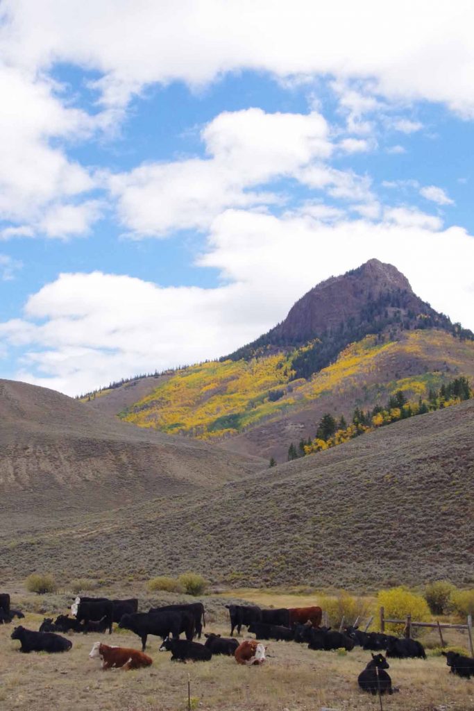
This educational stop was done by cattlemen’s association telling us about beef industry.
imgp3938
Another volunteer directing traffic.
imgp3943
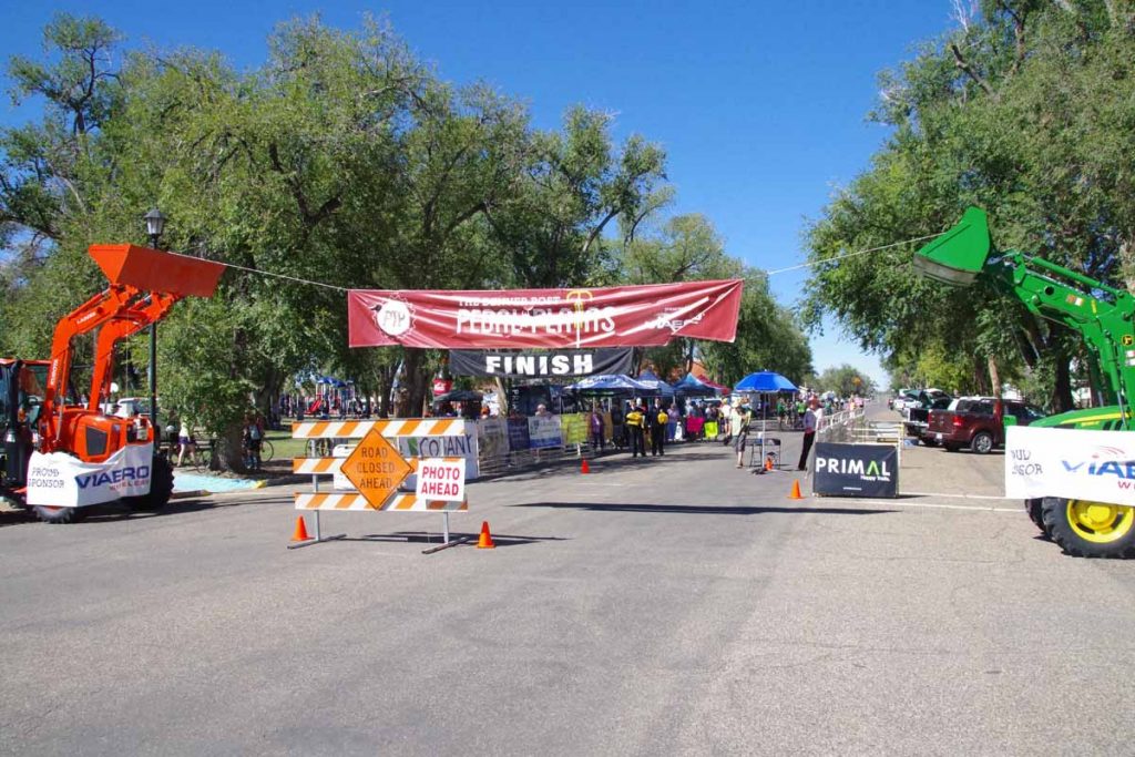
Finish line at end of the ride.
imgp3940
Time to pick up luggage from where it had been unloaded.

Overall, it was a fun ride and well organized. I still really enjoy coming through these little towns as well as nice hospitality. Also a nice little intermission from my overall journey which I will now go back and resume.

Posted in Colorado, USA | Tagged pedal the plains

Colorado visit and a few updates

A bicycle ride across the Americas Posted on 2016-09-15 by mev2016-09-18

I brought my bike to Lee’s Cyclery in Fort Collins and asked them to diagnose the hub failure as well as do regular tune up. I haven’t spoken in person yet, but did receive a voicemail that the inside of the hub was pretty dirty but nothing was broken, implying the hub got contaminated and then fouled up. They cleaned and re-lubed the hub and it works fine again. Feedback was to make sure to get more frequent service on the hub.

They are also doing a maintenance and replacing stretched chain and worn out cassette.

So plan after the intermission is to continue with the mountain bike and fixed hub. Will give a good test to make sure all is still OK and also take opportunity to get hub serviced before crossing into Mexico. On a different path, I’ve been in discussion with wheelbuilder if there might be a hub more easily serviced from the road but still pretty reliable – and there is also a possibility there.

In the meantime, plan is to drive tomorrow to Ordway, Colorado and do the “Pedal the Plains” ride in southeast Colorado. This is the 5th annual version of this three day ride. I’ve enjoyed doing this ride and have also done it the preceding four times the ride was held. I’ve got my touring bike here in Colorado and will use that bike for the weekend ride.
aimgp3830
Above is a photo of the Virginian Hotel in Medicine Bow. It is nicely restored 100+ year hotel and activity center for the town. I came to the hotel on Tuesday afternoon and asked if anyone was going to Laramie “today or tomorrow”. One of the staff was doing a grocery run (Medicine Bow has only small convenience store) on Wednesday morning and I was able to hitch a ride. I picked up my rental car, fetched the bike and now have used that for errands including going down to Pedal the Plains.

Posted in Colorado, USA

Medicine Bow

A bicycle ride across the Americas Posted on 2016-09-13 by mev2016-09-13

Today was example of how cycle touring doesn’t always go to plan, particularly with mechanical issues.

I had a simple plan worked out: (1) spend two days cycling ~120 miles from Rawlins to Laramie via Medicine Bow (2) rent a car for weekend to drive to Colorado and do the Pedal the Plains ride, visit family and get the bike serviced.

I had another hub go out on me today. Actually, I’ll still be able to do the other parts of the plans since I got a ride into Medicine Bow, a hotel room and a ride tomorrow morning to Laramie – but also need to sort through these hub issues.
imgp3819
Today started out normal enough. Rawlins is on a major transportation corridor with trail lines as well as I-80. Forecast called for headwinds early and decreasing through the day.
imgp3824
First seven miles went on back road via Sinclair. Sinclair is a very small town with a large oil refinery. They were rebuilding the main street but I was able to get along other roads. I stopped in at the truck stop before getting on I-80.
aimgp3825
This Fed-Ex truck had broken down and was getting a tow.
imgp3828
Next 14 miles were on the interstate. There was a broad shoulder and cycling was easy. The last few miles before my exit, there was road construction that routed both directions onto our half of the interstate. Fortunately, I was on the half with the wide shoulder as other direction would have been tougher.
imgp3829
At 21 miles was a shell station and much quieter roads. One or two miles were flatter and then good hill to climb. I was nearly at the top when had a louder clang. Somewhat surprisingly, then noticed that the hub was spinning freely both directions. The end failure was same as my earlier hub (spinning freely both ways) but symptoms before that were much different: on the previous hub it had been occasionally slipping for a while. This failure was much more sudden (haven’t opened things up but wondering if previous one was more pawls getting gunked up and this one was a spring breaking? – in any case more unexpected today.

While there isn’t much traffic on a road like this, there was a higher percentage of pickup trucks. It didn’t take long and I was able to flag one down. Kind folks who lived in Medicine Bow were driving there and gave me a lift the remaining 30 miles to the Virginian hotel in town. Here I had lunch as well as asked if anyone was going to Laramie today or tomorrow. I’ve arranged for a lift from one of the employees tomorrow morning. Plan is that I’ll go pick up the rental car I have reserved and then pick up the bike to bring it for service.

So I’m in Medicine Bow (as I planned), going to Laramie (as I planned), picking up a car (as I planned) and bringing the bike in to service (as I planned). However, rather unexpected was having the hub go on that hill earlier today. A google search of “phil woods hub failure” says I’m not the only one to have seen this issue – but will need to investigate a bit more before going to Latin America if there is a better alternative that can be more reliable.

Posted in USA, Wyoming | Tagged hub

Rawlins, Wyoming hospitality, Wyoming wind

A bicycle ride across the Americas Posted on 2016-09-12 by mev2016-09-12

Two days cycling brought me from Lander to Rawlins. Wyoming is often windy and on second day we had a front come through the might have increased that wind.
Day One
My description for the first day was “26-6-26”. This meant 26 miles of gently rolling hills, followed by a 6 mile climb, followed by 26 miles of mostly flat.
imgp3782
Riding started out well, here is an example of one of those rolling hills.
imgp3787
After 26 miles, I came to the base of the “Beaver Divide”. This was a steady climb that gained ~1100ft. By now, the wind was starting to pick up and during the climb there was some cross-wind as well as small bits of head wind. However, without too much trouble I slowly made my way to the top.
imgp3790
Here is the description of the Beaver Rim
imgp3791
Along with the view from the top. Tough to see in the distance, but believe Togwotee Pass is off there in the distance. By now the wind had definitely picked up and it was mostly a tailwind.
imgp3794
Six at 38 miles was a rest area. I ate my lunch items inside out of the wind. While I didn’t stop in (it was Sunday), there was also the Mormon Handcart historic site nearby.

From what I’ve read, (wikipedia), some of the Mormon pioneers made the journey to Utah pulling handcarts. At this location, two handcart companies encountered early snows and a number of people perished. Just cycling this route on smooth pavement, one definitely gets a sense of how difficult it must have been to have walked through this area pulling a cart.
imgp3799
The last 20 miles were open riding with a good tailwind.
imgp3801
The horses seem to congregate when there is wind.

This brought me to Jeffrey City. Jeffrey City had once been a booming uranium mining town with several thousand people. About 95% of the people left and one can see some abandoned buildings from the road.
aimgp3803
The Split Rock Cafe and Bar seems to be a center of what is left. I stopped in for a late lunch.
imgp3805
This community also has reputation of being very welcoming to cyclists. Sign above pointed to the Community Church a little ways away.
imgp3806
Both the church and the pottery building will let cyclists camp. Later in the evening I talked with the pottery dude. He had bought an old gas station some years ago for $5000 and now makes and sells pottery. He realizes he won’t see much pottery to cyclists, but still gives them cookies and has a spot on the Adventure Cycling maps offering behind his store as camping place.

He also pointed out to me that Jeffrey City had won a June Curry award from Adventure Cycling for being such a welcoming community after the local motel had shut down.
imgp3804
While the motel has reopened (and I stayed there), I definitely got a sense of welcome hanging out in the Split Rock cafe and talking with folks.
Day Two
The wind howled through the night as the front passed through. I knew it was shifting from SW (tailwind) to NE (headwind for 1st 23 miles) so somewhat concerned of how difficult the day might become. Fortunately, by 7am the wind had lessened. I had a breakfast at the Split Rock cafe and then set out into the wind.
imgp3807
It was much colder and there were some drops of rain. This made for slow steady slog.
imgp3809
After 15 miles I came past Split Rock.
imgp3808
Here is the description.

After 23 miles, I came to the Muddy Gap junction. The temperature had dropped to ~3C (37F) and last bits had some head wind. Fortunately, it warmed up significantly from here and the road also changed to have more tail wind as I went through muddy gap.
imgp3813
I crossed the continental divide to a region known as “Great Divide Basin”. There isn’t much precipitation or water in this basin and the water that is there evaporates rather than going to either Atlantic or Pacific.
imgp3814
Despite the sign, the Anna-lope cafe in Lamont was not open.
imgp3817
I have been following the “Transamerica Trail” which goes from Virginia to Oregon. However, the Great Divide Mountain bike route also rejoined here for last 15 miles into Rawlins. These cyclists had started August 8th in Banff and were doing the Great Divide.
imgp3818
Not much later, I crossed the continental divide and left the Great Divide basin. The last miles into Rawlins were fast as they were downhill and down wind. Yeah! Overall definitely had some strong winds the past two days and also good sense of hospitality at Jeffrey City.

Posted in USA, Wyoming | Tagged June Curry, wind

Lander, wide open spaces

A bicycle ride across the Americas Posted on 2016-09-10 by mev2016-09-10

Higher than average miles today (75 miles) but still an easy day as winds and elevation drop were favorable.
imgp3767
Today was a day with 45F (25C) temperature swing. Morning was cold 34F but mid-afternoon was over 80F. Flag flying above meant I started out with tailwinds! While they didn’t last much beyond the first 20 miles, the wind and elevation drop made for a fast and easy start.
imgp3769
At 12 miles I crossed over onto Wind River Indian Reservation where I would ride for the next 58 miles. This sandstone was just a few miles after entering the reservation. Other than the entry/exit signs and a few shops, I didn’t necessarily notice that much different about this reservation.
imgp3771
Parts of it were still agricultural and other parts were wide open lands or grazing land. At 25 miles was Burris which mostly seemed to consist of a house and a sign and 5 miles later some more ranches near Crowheart.
imgp3772
Met a cyclist who started in Tennessee, rode to New York City and was now heading west. We traded information about the road ahead. Also had a snack at the Crowheart store. By now the wind had shifted some, occasionally a cross-wind or even slight headwind but fortunately not very hard.
imgp3775
There was a rest area at 41 miles that had this description of the wind. Mentioned on the sign are bighorn sheep. There is a bighorn sheep museum in Debois, but unfortunately their fall hours yesterday closed at 4pm and I just missed them. Three miles later, the road split.
imgp3777
The next mile was a bit of a climb and then I was out in the wide open spaces.
aimgp3778
Fort Washakie seemed to be a bit more of a town and had another gas station convenience store to stop. By now the road thermometers were over 80F and also a bit more traffic on the road. Cycled the last 15 miles to Lander. Lander is a pretty big town: over 7000 residents and first traffic lights I’ve seen since entering Wyoming four days and 200+ miles ago.
imgp3780
There is a large bike shop here, Gannett Peak Sports that gives an ice cream bar to touring cyclists (thanks!) and also had a log book that you could sign. Added my entry along with the others. They definitely get some traffic through here. Otherwise got out the maps and looked for next few days. Approximately two days cycling to Rawlins and then some different choices.

Posted in USA, Wyoming | Tagged bike shop, plains

Post navigation

← Older posts
Newer posts →
©2025 - A bicycle ride across the Americas - Weaver Xtreme Theme
↑